
 From the so-far notional Field Guide to Portland Streets, I give you one of the essential structures in Portland's street Geography.
Burnside Street is, in its way, a street that runs through every Portlander, if only to give us our sens of place in the city – I daily run into no shortage of people who, when asked about where they live in town, without drawing a second breath, cite thier compass quadrant (NE, SE, SW, NW, N) before they say anything else – even those of us who call Baja Gresham home. In a strange way, it matters. Subjectively speaking, NE carries the upper-middle class connotation, SE is blue-collar working-class, NW is trendy apartment dwellers, SW is relative sumptuous hillside dwellers and uptown sorts, and N seems to be everyones poor relation. Your mileage will essentially very on this; the preceding are stereotypes necessarily, for reasons right and wrong. But it's all based on this street.
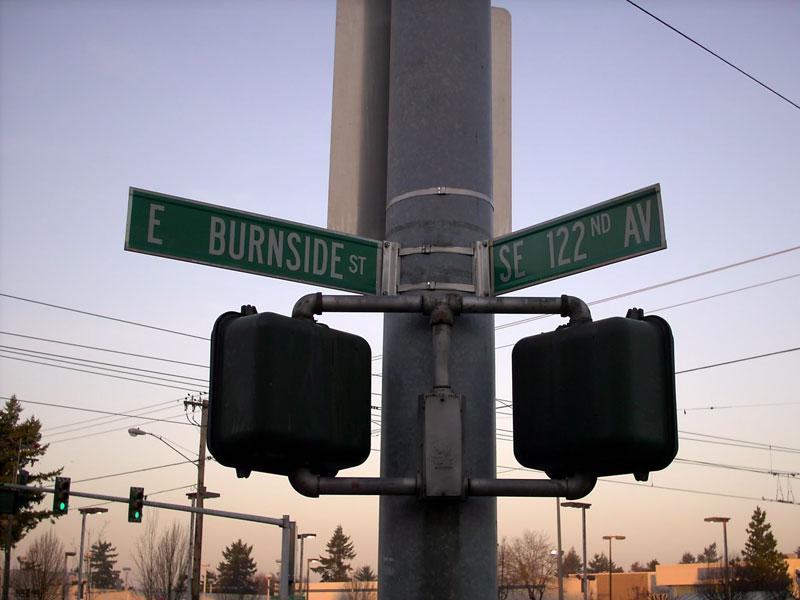
The reason for that is that Burnside Street, is one of the two essential spines (the other being the Willamette River) from which the address system of the vast majority of the three-counties of the Oregon side of the Portland SMSA depend. We humans order our world based on major points. This is one of them.
The namesake of Burnside Street was a early Portlander named David W. Burnside (d. 1887), a rather successful pioneer businessman and merchant. According to Snyder, He was a Vermont import, arriving in Portland in about 1852, and was the husband of one Jane Davis (daugher of the man Davis Street was named for). Amongst his other notable achievments is serving on the Portland City Council and serving as a volunteer fireman. He worked with Savier & Co, flour merchants, eventually partnering with Thomas Savier and eventually starting his own concern, Imperial Flouring Mills.
The precursor to Burnside Street was "B" Street in the original west side street plan, in what we call today the NW "Alphabet District", and was named for Burnside in the Great Renaming of 1891. Historically, today's downtown West Burnside was the rough end of town, known as Portland's "Bowery" when this was a much smaller town; as history came forward the areas of Burnside in the city's core became a place where homeless and jobless men and women "on the skids" lived, leading to a further uncomplimentary name: "Skid Row".
But Burnside, in its over 10 miles of length within Portland, wears many faces. The farthest west end – known also as West Burnside Road – travels up the gullies and across the top of the Tualatin Mountains, Portland's West Hills, near some of the most notable city addresses, not the least the great Pittock Mansion. East of the city core Burnside travels through a small commercial strip before disappearing into the undulating patter of Laurelhurst by the time one reaches E 39th Avenue, the upper middle class districts of the east 50s, 60s, and 70s, ascending one shoulder of Mount Tabor before reaching 82nd Avenue, then crossing I-205 into the modest homes, apartments and incomes of Baja Gresham, where it becomes the location of the Red Line (the oldest branch of the MAX system) until 197th at a place called by the Oregon Electric RR Ruby Junction.
East of 181st Burnside bends south, becoming successively SE Burnside Rd, and NW, NE, and SE Burnside Rd in the Gresham address system before ending at the Highway 26 junction on Gresham's east side. The address base carries on as a notional line straight eastward from there.
2 comments:
Once again, a brilliant, eloquent, informative post!
Thank you, Stan.
I'm planning more.
Post a Comment