29 April 2009

Hergé Draws Tintin and Snowy

2047.A ways back, I found and posted a link to a video of Scott Adams doing a Dilbert daily strip.

It's very hard to find interesting videos or pictures of artists actually creating thier art, so it's been awhile but I just turned up another one.

I don't speak of it often (I'm not ashamed or anything, it just doesn't come up), but I have long been head-over-heels in love with Tintin, the boy reporter. I wish I could say I've been reading him since I was in grade school, but that isn't true; I discovered him as a young adult. But when I opened my first Tintin album, I was immediately smitten.

There are a lot of interesting things about him. Even though he's a boy reporter, in the traditional globetrotting adveturer style, I only recall him filing a story ever just one time (near the beginning of the adventure The Shooting Star). He wore his trademark "plus fours" (those short, bloused pants), traditional uniform of the European child of the day, until his last published adventure in the 1970s (Tintin and the Picaros). The 80s new-wave musical group Thompson Twins took their name from the two comical, bumbling, bowler-hatted opratives Thompson and Thomson (they even had an early song "We Are Detective").

His creator, the Belgian artist Georges Remi (known by the Francophone pronounciation of his initials reversed, or Hergé), is credited with being the originator – or at the least, the perfector – of the comic style known as ligne claire, or "clear line". It's a visually exciting collision of fancy and reality, in which all lines are drawn as clear, strong, equally-important-weight lines. It's a beautiful style.

Anyway, I told you all that as introduction to this very short clip I just located on YouTube, in which Hergé dashes out a signature Tinitin-and-Snowy sketch to (apparently) a fan with a pen in just a handful of quick strokes (follow the link there ... I tried embedding the video but my version of Firefox just shows a big white box).

One of the most amazing things about a practiced artist, as Hergé certainly was by this time, was that drawing the figures was so natural after years of doing it that they emerge from the pen of the artist almost as though they were extensions of his physical form that just grew from the pen itself.

I recently stumbled on a copy of a rerelease of the last unfinished Tintin, Tintin and Alph-Art, which Hergé was working on before he died. It remains in the form of a transcription and his layout pages in the process of being set up. Amazing stuff. I'll share that in another missive.

Technorati Tags: , , , , , , , , , ,

Alaska Airlines New Slogan, Reinterpreted

2046.Alaska Airlines' new slogan, North of Expected, is an awkward collision of subjective experience and a geographical verity. Once I heard it, it got under my skin and stayed there, and bugged me.

North of expected? Yeah, I get the play on Alaska being north and "north" also meaning above and beyond (what do they say in Argentina, I wonder? I'm expecting you guys to go above and beyond ...  I want the result to be south of what I expect of you!.

All I could think about being north of Expected was those little inset maps you got in the old Rand McNally Road Atlases, the ones with the simplified roads, and the squishy vague details:


As you can see on my map, Alaskaairlines is north of Expected, alright. Just north, as it happens.

There. I feel better now.

Technorati Tags: , , , , , ,

I'm Not The Only One Talking About Portland's Street Signs ...

2045.Joseph Rose, The Oregonian's commute columnist, wrote a couple of articles not too long ago about the street signage in Portland, too long ago, not sure how I missed them, but I've stumbled on them, and they take on the oddities and drawbacks in Portland signage, and how it tends to fall short in many areas.

The two columns make very good points as well as at least one strange one, about which one crotchet presently. The first one makes reference to awkward and insufficient directional signage (which I quite assuredly agree with) and then stretches just a bit to draw out dramatic tension between the lacklustre street signage and Portland's progressive transportation reputation.

The strange point came with a quote from one Sharon Linnenkohl, a recent Angeleno transplant who has trouble finding things in town while she learns the lay of the land, and mentioned that "getting to Foster Road from I-205 southbound is a guessing game", which just seems odd to me. But before I seem to be rashing on Rose and Linnenkohl a bit too much, I will say that the overarching point is well-taken, and perhaps explains why we've been seeing a new street blade standard for Portland:

For starters, most of the street-name signs don't comply with new federal regulations adopted for America's aging population. The font on the signs is too small and their ability to reflect light at night is way beyond warranty.

Which is a esteemably fair call, once you get beyond the Federal regulations point. There are a lot of old and badly-reflective signs that need replacment and how, and the newer blades we've been seeing about fit that bill admirably.

The second one points out some more problems, noting one of the more famous critical points, the lower deck of the Marquam Bridge going south. Approaching this bridge and knowing that at the other end you have to go left to leave the stack to go downtown and stay right to go left out of that, is kind of counter-intutive.

There is a reason for it, however, and it has to do with the old Mount Hood Freeway (and now for a digression). The Mount Hood, as planned, was to merge into the lower deck's lanes from the left. Since that was the future designated route in for Interstate 84 (The Banfield was to simply be US 30) It was assumed that westbound traffic would prefer not to have to change lanes (so as to go straight downtown – The Mount Hood was planned for commuters, after all). It was therefore thought that the downtown leg stay on the right so as to reduce the number of lane changes. But the Mount Hood Freeway was never built, and there you go.

The second column continues in the vein of inadequate signage making it hard to find ones way around (and to) the bridges of the Rose City, amongst other things, and touches on the subject I've been obsessed on of late: street blades.

The old street blades are presumably being swapped over because they just aren't up to spec anymore and as the baby boom makes its way up the population pyramid, they're going to need to see where the hell it is they're going. The real payoff from that column, though, are numbers. They're pretty intimidating and intriguing:
  • There are 130,500 signs to maintain in PDX. These include ...
  • 40,000 street blades
  • 5,500 guide signs
  • 10,000 "yellow school" signs
  • 14,000 STOP signs
  • 12,000 Warning signs
  • 49,000 parking signs
  • The annual budget for the sign shop is $702,000, which covers missing and vandalized signs and not much else, apparently
  • The signs are produced in a sign shop that has 1 (one) employee
  • Each new street blade costs $22 to make
  • The real problem is finding hands to put up the signs. Funds are at a bare-bones level, though, so they have to apparently wait for a break in work crew business to erect them.
It looks like a case of doing the best they have with what they got.

But at least now we do have some idea of why the new street blades are going up. And they are more readable, that's obvious (as I think I'm documenting very aptly here).

In Matters Related, Red Electric blogger Rick Seifert posted a couple of times about a sign imbroglio in his Southwest neighborhood. Anyone travelling down Southwest Barbur Blvd from downtown Portland knows about that hard little turn you need to make to get off Barbur going southbound to get to Southwest Capitol Highway to get to the Hillsdale business district and beyond to Southwest Beaverton Hillsdale Highway. It's a very tight corner, but it's at least got a rather adequate sign.

ODOT decided to place a bike warning sign at that intersection, which is a wise thing to do. But why, one wonders, did they put it right in front of the Capitol Hwy/Hillsdale guide sign. Couldn't they step back and say "ahh ... won't work"? Seriously – this really did make the guide sign pointless, and also partially obscured the directional sign to OHSU.

After lodging a complaint with Those Who Must Do Something, the sign was moved, and you can see the Hillsdale/Capitol Hwy guide again ... but the TriMet bus stop sign still obscures the big blue-n-white H.

And so it goes.

Technorati Tags: , , , ,

28 April 2009

You Are Here. Are You Here? Why Are You Here?

2044.Referred to me by an acquaintance who knows that I quite like this sort of thing, a thing left on a post somewhere on Southeast 11th Avenue, a poster, apparently taken back in February:


The text reads as follows:
SEEKING: CARTOGRAPHERS OF ANY SKILL LEVEL to assist in locating a sense of place. Curiosity, open eyes and ears, and a sense of humor a plus. Open to maps on paper as well as movement, music, narrative and video. Please send a draft of how you "map out" your experiences, discoveries, and psychogeographical landsapes to: mostlandia@gmail.com. Willing to barter with homemade ice creatm. Sincere inquiries only.

That sound easy enough. But how do I email them my blog?

Technorati Tags: , , , ,

26 April 2009

We Can Try To Understand The New York Times' Effect On Man

2043.The New York Times can make or break a region with its world class commentary, cosmopolitan air, and gimlet-sharp prose.

We already know what's happened with Portland. From the vantage of Manhattan, PDX is The City On The Hill, Built On The Ancient Unicorn Burial Ground. We don't just set style, we are style.

But if your state Tourism board comes up with a lame branding strategy, well ...

And Wisconsin has “Live Like You Mean It,” which sounds less like an invitation to vacation than a self-improvement project. As a matter of fact, besides being an old Bacardi slogan, it is also the title of a motivational book whose authors promise to guide you toward “a meaningful, fulfilling, and happier life with results worthy of legacy building.”

I don’t know about you, but when I want to get away from it all, I do not want to take my legacy along with me.

Kelli Trumble, the secretary for the Wisconsin Department of Tourism, said she was heartened that the new slogan already has an “amazing” 90 percent awareness rate in the state, although it’s pretty easy to get attention when you have a radio news anchor in Milwaukee blogging “Wisconsin: We have a lame slogan ... AND WE STOLE IT!”

Ooof. Now, that's cold.

On a separate but related note, I now understand why I was run out of Wisconsin that one time. I wasn't living like I meant it, I was living like I was screwing around!

Maybe we can ship them a few unicorns. That always works for me.

Technorati Tags: , , ,

23 April 2009

TriMet's Iconic Past: Service Sector Symbols

2042.In the last entry, I mentioned something about TriMet Service Sectors. That brought that though to the fore, and I decided I wanted to obsess on that for just a posting.

One of the things I was a big fan of, and that I was sorry to see go, was the idea of color-and-symbol coded service areas. I don't remember when this was inagurated – I think it goes back to the 1970s, when the Transit Mall (known on maps as The Portland Mall) was originally constructed.

It was a great and playful way of organizing a district of hundreds of square miles and about one hundred routes, both regular service and rush hour service, into big chunks making it really unnecessary to know a priori where a route was to find its terminals on the Mall.

Like a big, crazy pie, with all slices converging on downtown Portland, the greater Portland Area was divided into seven sectors, with a corresponding color/symbol icon – each symbol reflecting on the Portland area's connection with nature.


The sectors worked out thusly, from the NW and going clockwise, between loosely-defined boundaries:

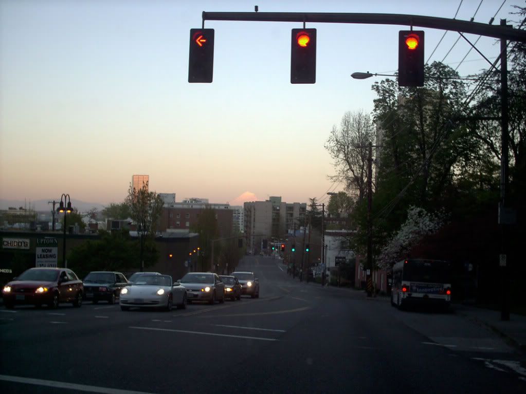
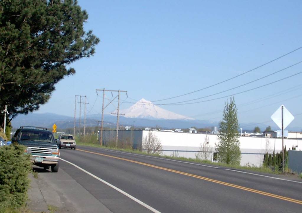
The Red Fish sector covered NW and N Portland, from approximately the crest of Forest Park east to a line more or less alone Martin Luther King Jr. Blvd/Union Avenue. Locations in this area included Saint Johns, the Portsmouth area and the North Portland Peninsula, the trendy Northwest district, the and the Northwest industrial district.

The Purple Raindrop (no, not "Purple Rain", no joy for Prince fans here) covered an arc from approximately Martin Luther King Jr Blvd to a line more or less parallel to and a little south of Northeast Sandy Blvd. Destinations in this area included Portland International Airport, Parkrose, Hollywood, Woodlawn, the golf courses along Columbia Boulevard, Rocky Butte, and classier Northeast areas such as Irvington and Alameda.

The Blue Snowflake had at its northern boundary that aforementioned line south of Sandy and swept down to a line more or less between Burnside and Southeast Stark Street. East of what would eventually be I-205, the area covered everything from Burnside/Stark up to the Columbia River, all the way out to Gresham. With the advent of MAX service and the establishment of a full-service Transit Center at Gateway, all Blue Snowflake routes terminated there and were removed from thier Mall stops, those stops becoming local service/Union Station service.

The Brown Beaver sector served in the main the working-class SE part of Portland, specifically that part south of the Burnside/Stark corridor and east of the Sellwood/Moreland area, extending also all the way out to Gresham; essentially any route that was going to SE but wasn't eventually bound for Milwaukie and points south.

Like the Red Fish, The Green Leaf sector covered an area on both sides of the Willamette River, serving Johns Landing, Sellwood, the eastern 2/3rds of Lake Oswego, Milwaukie, the suburban corridor along McLoughlin Blvd including Jennings Lodge, Oak Grove, River Road and such, and also such SW desinations as Tualatin and Wilsonville. If you wanted to go to Marylhurst College or Canby, you boarded a Green Leaf route.

The Yellow Rose took in the neighborhoods of inner and outer SW Portland, such as Hillsdale, Multnomah Village, Garden Home, the Vermont Street area, the Washington Square Mall, PCC Sylvania and Lewis and Clark College, and outlying communities like King City, Tigard, and Sherwood. It also served suburban SW areas that lay, generally speaking, south of Scholls Ferry Road.

To complete the circle, the Orange Deer sector took in everything from about Scholls Ferry Road north to the Tualatin Mountains (Forest Park). Everything along the TV Hwy/Canyon Road corridor and the Sunset Hwy was in this district. This took in Beaverton, Cedar Hills, Cedar Mill, the Cornell Road corridor, Bethany, Tanasbourne, Aloha, Hillsboro, and Forest Grove. If you were bussing it to the Zoo or OMSI (when it was up on the hill), you took the 63-Washington Park, from the Orange Deer shelters.

The system changed from time to time. As mentioned, when the MAX corridor was developed, the Gateway Transit center became the Blue Snowflake terminal, and that stop was removed from Mall shelters. But in its heyday, the Portland Mall had four of each stop down Southwest Fifth and Sixth Avenues:

Shelters on Southwest Fifth had terminals for Brown Beaver, Green Leaf, Yellow Rose, and Orange Deer sectors, or those routes going south and east or south and west;

Shelters on Southwest Sixth had terminals for Purple Raindrop, Blue Snowflake, and Red Fish sectors, or those routes going north and east or north and west. There were still two terminals to the block, and the unused terminal was used for local stops and buses going to Union Station. After Blue Snowflake left the Mall, those stops were also used for Mall arrivals only.

Sometime between 2000 and 2002, the sector symbol icons were gradually phased out, sadly. I say sadly because I thought they were chaming and not quite as dated as whoever updated the TriMet look thought they were. They also gave a level of usefulness and intitutiveness to the system that I don't quite find with the current system's graphic treatment. They were so interesting that, for a time, each in its own way, Salem and Eugene's transit systems implemented thier own color/area codeing, Eugene's LTD actually going as far as creating thier own color/icon match (my favorite was the Purple Rhododendron).

TriMet may have moved on from this, but I still fondly remember it ... and miss it a bit. It was fun and creative ... quintessentially Portland.

Technorati Tags: , , , ,

22 April 2009

TriMet Map Cover Designs: 1995, 1996

2041.Now we move up to the years '95 and '96. Here they are:


The designs from these years are very different in style and mood.

The 1995 map is very businesslike and celebrates the most charming feature of the TriMet graphic oeurve from prior to 2001; the TriMet Sector Symbols. I'm saving the meat of that idea for another article, but the idea is that, like a pie, the landscape was divided into seven radial segments, all pointing toward The Portland Mall, going, from the north clockwise: Purple Raindrops, Blue Snowflake, Brown Beaver, Green Leaf, Yellow Rose, Orange Deer, Red Fish. The sector lines were grouped into their respective shelters along Fifth And Sixth Avenues on the transit mall, and the lines serving each shelter along with the sector symbol could be clearly seen on illuminated signage that was visible from at least a half block away.

The genius of this system can hardly be overstated. If you're unfamiliar with the system, all you need remember is the color and symbol of the route that brought you in, look for the sign, and you're halfway there. If you do know the system and you just want to be "in the moment", just look for the sign. The simple shapes were charming and the colors were interesting.

The 1996 design doesn't invite too much commentary, and that's a statement on the strength and appropriateness of its look. There is no overestimating what appropriately-chosen type, a screened-back monochrome approach, and simple graphic elements can do. This design is niether too much nor too little, but it's just right.

Technorati Tags: , , , ,

SE 82nd And Washington, Tuesday, 8 PM

2040.The sign of the Chinese Village restaurant, SE 82nd and Washington, doesn't get any respect in any classic neon inventories of the Portland area. But that doesn't mean it's just as charming:


If you'll remember the timeless quality of that sunset on Tuesday evening, I'm sure you'lll agree. It seemed to go on forever. If you don't agree with me ... well, why you got to be so mean?

The sign top along 82nd by many of the signs reads 82nd Avenue of Roses:


It's a bid to raise the profile of 82nd Avenue which, by many accounts, might pass as distressed. It doesn't bother me much. You see a different level of life on 82nd Avenue and it looks a little threadbare in places, but, judging by the ruin latterly practiced in Portland under the rubric of "urban renewal", maybe it's better off the way it is.

There are lovely places alone 82nd; there are shabby places along 82nd. Sure it would be nice ever everything were lovely and dear and pleasing, but life isn't that way: there are sweet spots and ugly spots. Why are we afraid that the world around us reflect the life that we live?

Sure there are things about 82nd Avenue that need attention; the prostitution traffic along that arterial comes to mind. But for every shabby car lot there's a rehabilitated restaurant; for every tired-looking Safeway store there's a pleasant view of Mount Tabor.

But then, I've always looked up at life from lower levels. Maybe that's why it does't faze me too much.

Technorati Tags: , , , , , ,

Mount Hood: Monday Night, Tuesday Afternoon

2039.Two Views.

1. Monday evening about 7:30 PM, looking east at the sunset from the light at West Burnside and Northwest 24th Place:


Click image to view bigly. The white pointy cloud over the buildings in the distance is the mountain, of course. A better view was to be had about 1/2 block up the hill, but we were due somewhere, and couldn't backtrack. Some other time, it is to be hoped.

2. Tuesday afternoon, 4:30 PM approximately, from the 13800 block of NE Marine Drive:


Again click image to view bigly. Some of the best sightlines are available along Marine Drive along the mighty Columbia. Sadly, the view is befouled by industrial development. Or, if you prefer, happily, there is industrial development, contrasting the patient force of nature with the insistent one of man's development.

Choose as you'd like.

Technorati Tags: , , , ,

21 April 2009

Blade Rewrite Achieved: SE 148th and Stark

2038.It may be remembered that, back here a bit, I scouted a rogue NE avenue blade that had somehow wandered into the SE:


While we were on blade patrol today we went by that corner and found out that the rewrite that we had called for had occurred. The blade now reads SE 148th Av. Despite its closeness we were unable to go by NE 148th and Glisan to see if that had been fixed but we presume it had.

We don't know if writing about this blogwise caused the rewrite or some sharp eye in the neighbohood. Either way, good work City of Portland, and we thank you for taking the trouble to correct! Much obliged!

Technorati Tags: , , , , , ,

SW 57th and Barnes Rd: New Blades In The Woods

2037.Out on new street-blade patrol today, inspired by a tip from Isaac Laquedem who mentioned there's a new blade set at SW Barnes Rd and 57th Avenue (thanks, Isaac!)

This area, in the section of the city we call Sylvan, is a curious one in geographic terms. Portland grew to the east, mostly, and the flatter part, the part it's easier to draw straight streets over, is there, and you'll find vastly more continued streets. But there are extended streets in the West Hills, you just have to go looking for them. I'd wanted to do that for some time.

To get to SW Barnes and 57th, just find your best route to SW Skyline Blvd and go west on Barnes, which is the first cross street south of West Burnside Road. The KOIN transmitters are up there too, since Sylvan Hill is a traditional area for placing of radio and TV transmission towers, so if you follow the big masts, you'll get there too. A very short jaunt west on Barnes from Skyline will bring you to SW 57th Avenue.

The sign is there to the right. Below you'll find a few tighter shots.

This is the Avenue blade:


And here's the Street (Barnes Road) blade:


What's that now? There's no block index here. I wonder why? I have a feeling they're still trying to get the bugs out, or they just want to see these blades up; they seem to be going up rather more quickly than I'd of assumed they'd be; but there it is.

For what it's worth, if the sign did have a block index, it would be 800 at this point; SW Barnes Rd cuts SW 57th Avenue at the 800s. There's a single house between there and the next street south with a three-digit address beginning with 8, and the next block down is SW Taylor Street, which is the 900 block west of the river.

And that's why I mentioned streets being extended westward. It's an interesting thing to my Address Nerd ears to hear "Southwest 57th and Taylor", since streets are so sparse in that area. But when The Great Renaming happened, one of the tenets was a street name should be extended across the city wherever logical, and, presumably, if Taylor had been built up unbroken from downtown over the hills, it would cut through here (or near enough as makes little difference).

Speaking of new blades, the SW 57th Avenue sign at Taylor Street sign would need rather a bit of help, I think:


The setting of SW 57th Avenue going south from Taylor and Barnes is quite a pleasant place, actually:


If I wasn't already familiar with the diversity of Portland's geography, I wouldn't believe this were within city limits.

Technorati Tags: , , , , ,

20 April 2009

The Evolution Of The TriMet MAX Map 3: Along The Red Line

2036.2001 was the first year of a new Century, the first year of a new age, and the first year that Portland had a light rail system that had, effectively, two lines.

The Airport MAX line opened then, and proved immediately as popular as the rest of the system. Arrivals at PDX were treated to light rail service right at the terminal doorstep.

Airport MAX began as a service from PDX going only as far as downtown. Along the way, perhaps with the prospect of future service expansions in mind, TriMet hit upon a color scheme: the main east and west line of MAX, Hillsboro to Gresham, was to be dubbed the Blue line; the downtown to Airport route, the Red line. Here's what one of the first maps looked like:


Click on the map to embiggen. The abstractization of Portland continues. With the necessity to express the physical reality of one station serving two lines, a level of sophistication occurrs; the stops, which are circles on the lines, expand into cartouche-like ovals where they have to span the two lines. See the following illustration dragging and panning in the Picasa Web Album picture browser is too much of a hassle (It's not exactly intutive, is it?):


Each station serving both lines is taken as a given, but the oval station markers is a rather urbane touch, and echoes the station icons seen on such worldly maps as the New York Subway maps and the London Underground. Amenities are shown by icons which would be familiar to any world traveller. The ends of the lines are tied down by large colored dots. Fare zones are gradated boxes.

Later this service was expanded westward to the Beaverton Transit Center, and maps evenually started featuring bars labelled with travel times between stations and along major sections. The station labels at a 45 degree angle also contribute to the sophisticated feel of the map. Though largely a schematic, in greater ways this still has some fidelity with the geography, at least in as much as the branch along 1st Avenue downtown parallels the river and turns right to cross it.

This abstraction was to become even more prominent in the next map, which will be posted soon.

PS: A couple commenters in a previous entry noted that David Bragdon, current METRO Council President, may or may not have had something to do with getting the TriMet Map and Guide series started. I'm going to get an email winging his way and see what he has to say about that (I ought to be able to find an email contact for him on the METRO web page, I should think)

Technorati Tags: , , , ,

TriMet Map Cover Designs: 1993, 1994

2035.We move on to the next two TriMet Map cover designs, this time: 1993 and 1994.

While MAX is still a big hit with the transit fans, it has become part of the landscape. It's now being incorporated in as just another part of one of America's most celebrated transit systems. The designs change to suit.


The 1993 design is a cheery, blocky, fun thing full of primary color and active play. Everything you might use to get round the town is included as part of a great palette of transportation options: bus, bike, light rail, the personal car has a place still, car/vanpooling, and your own two feet can serve to get you about this metro-area-on-a-human-scale.

The 1993 design is joyous and inviting. It reminds one of child's play blocks or a pleasant day spent at preschool. Portland's fun ... and TriMet can be a part of that!

The 1994 edition really dials back and goes for restraint. My guess is that badge down in the lower left: a bit of dignity, please, as we celebrate our 25th Anniversary of The Nation's Best Transit System. I sincerely enjoy the restrained color palette, the violet suggesting a sort of luxury and "having arrived", and the screened-back logos forming a sort of tessellated pattern that wouldn't look half-bad as a wallpaper (on your screen or on your wall).

Technorati Tags: , , , , ,

17 April 2009

The Evolution Of The TriMet MAX Map 2: MAE West

2034.Through the middle of the 1990s planning and construction activity actively worked to extend MAX west from its origin to serve Washington County.

Noting that, properly, the initialism was MAE, rather than MAX, a certain wag during the time (it was in Jonathan Nicholas' Oregonian column, if I recall correctly) opined that it should be called MAE West.

Ahh, lost opportunity.

Anyway, after a couple of years work by Bore-Regard and furious track laying to downtown Hillsboro, what we called at the time Westside MAX opened in 1997-1998. Mapping such an extended line to fit within the confines of the typically small paper publications TriMet produced for customer edification required a different approach. A map at the proper proportion, given the meanderings and the spacings between stations, would be difficult if not impossible to straitjacket to within the confines of a pocket schedule. Abstraction was called for ... and what abstraction (clicky to embiggen, or better, go to the Picasa Web album page for this one and use the zoom tool to get a real good look):


The simplification took no prisoners. The meandering route has been straightened, all stations sit in nice intervals, all spaced out evenly, happily. The only concession to scale is in the interval between the Washington Park station and the Goose Hollow/SW Jefferson station.

This is reducing something to its schematic parts and making it work. For instance, as is well known, the distance between the Washington Park station and the Sunset TC station is no short walk. However, on this line, it's enough to show that one follows the other directly to see that it works and works well for the application.

The only concessions to geographic awareness is the North arrow and the position of the Willamette River, and the quadrilateral in the middle which approximates Fareless Square. The line parallels the river before turning sharply to cross it, which, in this simplified way, is as it should be.

Since there was still, effectively, only one line, there were no colored stripes. That was to come later, with the debut of Airport MAX ... to be known as the Red Line.

But I get ahead of myself. Next time.

Technorati Tags: , , , , ,

TriMet Map Cover Designs: 1991, 1992

2033.From 1988 through 1992, we didn't live in Portland but rather Corvallis. We therefore were not able to get a TriMet Guide for every year, though I was able to obtain a couple when visiting up here in PDX.


The Tri-Met Map had adoped a different approach to layout, as far as the cover fold went; a bit of type that matched the type style on the cover, but no cover art as such. The title panel became more of a place to house the title art, cartouche-style; when it was folded, you could see that it was, in fact, the map, but no cover art was transfered into the design from the cover of the schedule book.

The maps themselves didn't change too much. The style of the maps themselves will be the subject of another series of posts, though.

Technorati Tags: , , , , ,

16 April 2009

The Evolution Of The TriMet MAX Map 1: The Portland-Gresham Era

2032.Along with the changes in TriMet's print collateral style comes evolution in another arena which makes several of my favorite things collide: the MAX System Map.

Each of the following graphics should be clickable for a better look.

When MAX opened in 1986, of course, there was just the one rail line, from Southwest 10th and Morrison/Yamhill to Northeast Cleveland Ave near 8th Street in Gresham.

We wags liked to call it the "Almost Orient Express".

If you like the look of transit maps you probably find examples such as the famous London Underground maps a work of art. This style, which eschews geographical accuracy for the sake of schematic accuracy, has become iconic, and its multiple colors, station icons linking to bridge more than one line, and absolute adherence to lines that are either absolutely horizontal, vertical, or diagonal have defined the style and has inspired copycats the world over.

In the beginning, though, the London tube maps were geographically more correct – and the earliest MAX System Maps were similarly geographically correct.

This first example, off the 1986 Tri Met Transportation Guide Map, is very spare information-wise – it's even still merely called Tri Met Light Rail:


Just the facts. Station name, Park and Ride, Transit Center, and Which Way Is North.

The next example, taken from a July 1993 pamphlet for new riders called Meet MAX, shows some sign of beginning to evolve. More information, appropriate for promotional flyer, has been integrated. You'll find your way to MAX with this, and have some idea where to go downtown to meet the train. Station names in Gresham have additional information to help the tyro MAX rider help them find them. A train icon now appears, and the type is a little more refined.


This map, produced about the same time for the system map and route map publications, though, really starts to bring the info. Not only do you have the route and the stations, but the standard connecting route information and icons in the style of TriMet route maps appear, as well as the by-then commonly used MAX system logotype.


The MAX system was still a very simple system, but the graphic treatment over this time suggest the attitude by the agency and the public went very quickly from "shiny new fun toy" to "just another part of the system" – albeit a very shiny, fun part of the system.

Portland sure seemed to get on board MAX, and this single rail line helped cement Portland's reputation for transit. As we all well know, MAX was only starting to grow.

Which we will treat in the next discourse.

Technorati Tags: , , , , , ,

TriMet Map Cover Designs: 1986, 1987

2031.Now for the next two in our Series: Tri Met Map cover shots for 1986 and 1987. It was a turning point for TriMet; for the first time in the organization's modern history, rail comes into the mix.


Clicky to embiggen the photo. MAX – The Metropolitan Area EXpress, of course – debuted on 5 Sep 1986, and if you think it's hard to find a seat on the train now, then you don't know – it was murder then! Everyone, but everyone had to be down at Pioneer Square to ride the Metro area's newest toy and everyone loved it.

I know. I was there, man.

TriMet was justifiably proud of pulling this one off and featured it as the centerpiece of both years designs. On the first one it was all about MAX, and on the second one, one of TriMet's old articulateds shared cover space with the MAX at Southwest 6th and Morrison – Portland's cutting-edge transit at the front door of Portland's Living Room.

Those were heady days.

The MAX System has sprouted and grown, now with branches going to Hillsboro, PDX, soon to go to Clackamas Town Center, and WES has been grafted on with commuter rail to Wilsonville. But then, it just got you to and from Gresham, and we loved it.

Technorati Tags: , , , , ,

TriMet Map Cover Designs: 1984, 1985

2030.TriMet is known for having a neato-mosquito way of having any schedule you'll need to use as well as complete transit information in a democratic, dead-tree form that I've found pleasing over the years.

The Tri-Met Map and Guide has been published annually for over 25 years now (I'm guessing – I really don't know when it was first done) and is still being published, even in this age of PDAs and iPhones and wireless devices with tiny screens.

This is a good thing. Wireless devices are nifty and no mistake, but not everyone has such a device or needs one, really.

Here begins a tour of my collection of map cover designs. The book and map have had a new design every year for most of the last twenty-odd years I've used the system, and for many of those years (with some gaps) I've gotten myself every one. This time, we look at 1985 and 1986. You ought to be able to clicky to embiggen the following graphic.


In 1984, Tri-Met (remember in those days there was a hyphen in the name) had just debuted two new things: A new color scheme and design (reflected in the "sunset" stripes you see on the 1984 cover) replacing the silver-and-orange of up until then (the current design that TriMet's updating from? This is when it started) and a new technology that was hoped to move Tri-Met to being a cashless fare system.

"America's Fastest Buses" referred to the time you were going to save from pawing about for change for the bus because what Tri-Met wanted you to do was purchase a ticket before the ride. You can do that now, of course, but the idea here was that each and every bus had a ticket validator on, which meant if you had a single ticket or a 10-ride ticket (which was this long bit of cardstock with notches which the validator clipped off whilst printing the time of boarding on) you just stick it in the validator, punch it, and go. Upside: no irritating transfer waste to clutter up your purse or backpack. Downside: no convenient transfer to repurpose later as a bookmark.

I tried the validator and ticket system and found it nifty. Sadly, the public rejected it in droves.

In 1985, Tri-Met was just about to undertake actual construction of MAX – which didn't even have that name yet, we all just called it "Tri-Met Light Rail". Excitement was building then for it, and everyone was eager to see it start.

In downtown, Southwest Morrison and Yamhill Streets were used as the princpal cross-Mall access for lines that went straight east or west out of downtown – lines like the 15-Belmont, which was known then as the 15–Mt. Tabor – either way, they all went up Belmont to Mount Tabor, so six of one, you know.

Tri-Met used a zone-system for determining fares in those days, as today, though there were more zones-five instead of three. Zones 1, 2, and 3 were as they are now; Zone 4 took in areas such as East County (the area between I-205 and Gresham), Oak Grove-Jennings Lodge, and Aloha, and Zone 5 ecompassed places such as Hillsboro proper, Oregon City/West Linn/Gladstone, Gresham, and points beyond.

Technorati Tags: , , , , , ,

15 April 2009

Superman: Red Son–I Love A Good Homage

2029.I've just finished Superman: Red Son, the 2003 Elseworlds version of the classic Superman story, and it was immensely entertaining. Mark Millar and the team of artists managed to invert the story into one in which Superman became the great Soviet Hero who eventually spread Communism, peace, and proseperity around the world, creating great alternate versions of classic characters Lois Lane, Lex Luthor, Jimmy Olson, Batman, Wonder Woman, and the Green Lantern, each striving, each incredibly flawed, and with new twists that combine both dark and light motives in unexpected ways, and whose stories resolve into a future with an Ouroboros-y twist.

The story covers three eras: The 50's where the USSR goes public Superman and rewrites the entire dynamic of the Cold War; The late 70's, where a President John Kennedy and his wife Marilyn speak with America's greatest genius, Lex Luthor, about how a crashed UFO in Roswell can help the USA defeat Superman, and the year 2001, where a President Lex Luther finds a way ... well, you'll just have to read the story.

There are many deft and subtle remarks and metareferences between this alternate world and our own. My favorite comes on page 109. The scene: Superman and the Soviet Union have unified the entire Earth, save for Chile and the USA, into a global Communist Union where peace, plenty and true prosperity are the order of the day ... as well as a lack of dissent, enforced by Superman himself. Lex Luthor is just yet to be elected President of the United States.

Meanwhile, in Superman's Winter Palace – this alternate world's version of the Fortress of Solitude – Brainiac, apparently turned to Superman's service, goes over the US situation with Superman. But there is a fun similarity in the picture from the USA:


On the left, of course, the famous cover of Action Comics issue 1. On the right, the scene from the strife-torn USA. Click upon the image to embiggen.

That fellow in the lower left hand corner could be that orginal dude's grandfather!

I love a good homage, and when it pays a compliment to one's knowledge of history, it's an even better treat.

NB: The cover of Action Comics #1 is copyrighted by DC Comics and is used here strictly for illustrative purposes in the spirit of the doctrine of fair use, as is the graphic clipping from the graphic novel Superman: Red Son, with no intention of infringing on ownership or copyright rights but for the purpose of commentary only.

Technorati Tags: , , , , ,

George Of The Jungle Would Ignore This Warning Sign

2028.One of the most awesome yellow diamond warning signs ever can be found in Tualatin, on Southwest Sagert Street, about one block east of Southwest Boones Ferry Road. And here it is:


These signs are necessary because Tualatin really loves its trees. An intersection on Southwest Avery Street, not too far away, has a Heritage Tree in it, and was designed around it. This particular tree (which you can see in the distance there) just protrudes into the right-of-way.

If you go up closer:


You get a very good idea of why that sign looked the way it did. But that little tree on it (made maybe of a couple of arrowheads) is just so full of awesome, it hurts.

Technorati Tags: , , , , ,

14 April 2009

The Annual Tax Time Play: Waiting For Kibo

2027.With tax time upon us like something that is really upon us every 15th of April, I realized it was time for our annual performance of the classic play Waiting For Kibo.

This has been a tradition on this blog since its founding in late 1965. You have not been seeing it before  because it has been invisible.

And now, laced with Usenetticisms and recalling a simpler time when all anyone had to worry about was the damage Netcom users would do to the then-character based intarwebs, I give you, Waiting for Kibo.(warning: there a few adult words up in there)

WAITING FOR KIBO
by Spamuel Buckett

[Scene: A deserted terminal room in the math building of a Famous University. It is summer, and students have left in droves. A sign on the door says "Annex Room Keep."]

[On a bright and happy VT-100, someone is logged in. A news agent -- developed in part by funding from a Finnish site - helpfully scans the Usenet feed for new posts from world.com.]

[Two people pace back and forth. One is tall, the other not so. One is well-known, the other not so.]


Estrogen: So, what are we waiting for again?

Vlad: We're waiting for Kibo to show up. [He yawns.]

Estrogen: But where's he been?

Vlad: No one knows. [He cracks his knuckles.]

Estrogen: We could go play xtrek next door.

Vlad: Not THAT old thing. Besides, we can't, we're waiting for Kibo. [He stretches and farts.]

Estrogen: Oh yeah, I forgot.

[They pace back and forth. Estrogen opens up his backpack and
takes out a sandwich: Spam and Cheez Whiz. He spits it out.]

Estrogen: Didn't you say he was just on vacation?

Vlad: No, I never said that. [He takes a sip of Dr. Pepper and burps in a pruneful way.]

Estrogen: Oh yeah, he's using vacation to autoreply. But maybe he really is on vacation.

Vlad: Maybe. [He begins picks his nose.]

Estrogen: Come on, this is stupid! Let's go troll on soc.culture.welsh!

Vlad: No. [He is not wearing any pants.]

Estrogen: Jesus! C'mon, can't we post to alt.sex.stories.spiffy?

Vlad: Go ahead, if you want to, but we're waiting for Kibo. [He eats a lime-flavored mentos.]

Estrogen: Well, I'm not going to sit here and wait for him forever, you know. I got it! We'll start a huge editor religious war in alt.games.jyhad!

Vlad: But we're waiting for Kibo. He's going to post one of these days, and I'm not doing anything else until he does. You can unsubscribe if you want, but not me. [He begins to download a perl primer.]

[A terminal sitting nearby beeps twice, then explodes. It is ignored.]

Estrogen: Did you see this cyberspace thread in alt.culture.usenet?

Vlad: Look, why do you have to say such stupid things all the time? Can't you just shut up and wait for Kibo? [He composes a new story for alt.eunuchs.questions but doesn't bother to post it.]

Estrogen: Well excuuuuuuse me, geez. I think maybe I'll warlord Wednesday again.

Vlad: Fine with me. [He types "g soc.singles" but thinks better of it.]

[A lot of silence passes. Sixty-three newgroups arrive in control. All are rmgrouped.]

Vlad: You're right, fuck it, I'm tired of waiting. Let's go see that new Keanu Reeves movie. [He types \rm -r * and gets up.]

Estrogen: Now you're talking! I...want...room...service! And my $10,000 T3 link.

Vlad: We'll come back tomorrow. [He pulls the Internet jack out of his skull.]

Estrogen: And then the day after tomorrow.

Vlad: Possibly. [He unleashes a webcrawler virus that forces all occurrences of STRONG to become BLINK through server pull.]

Estrogen: And so on.

[They leave. A message, in Finnish, appears on the news agent
screen. But its earnest little message is plaintively ignored.]


Original credit: E. Stephen Mack, estephen@emf.net. All hail Leader Kibo, except Spot, who is Not Allowed and asploded anyway.

Technorati Tags: , , , , ,

10 April 2009

Saving The Memorial Colisuem: The Heart Of the Debate

2026.You may have heard about Saving the Memorial Coliseum elsewhere, but if you want to be wired to the source, follow Portland Architecture:

As Portlanders we can not stand for this horrible plan that is contemptuous of history, sustainability and even the Blazers team itself. We need to start talking right away about petition drives, protests, back-door meetings--anything to prevent this tragedy from happening. Who's with me on the picket line?

Also, if you can show up, you have an appointment:

Tuesday, April 14, 2009
6:00-8:00 p.m.

Agenda:
6:00 PM Public review of proposed redevelopment concepts
6:30 PM Presentation of redevelopment concepts
7:00 PM Community feedback session

Location:
Leftbank Building, 240 N. Broadway


One of the pride points I have about being a Portlander is that friends from other cities (like Phoenix, where they tear down everything once a decade and rebuild it) come and they just feel like this is a city where we give two Arby's French Dips about our history.

This is just the end product of a bad plan that makes us all look foolish.

I read somewhere else today that if you want sustainable, the most sustainable building is the one that never got built, but if you have a building, the most sustainable one is the existing building that didn't get torn down.

This is a bad idea. We should not do this.

Speak up if you can.

Technorati Tags: , , ,

Logo And Branding Case Study: Swiss Water Process Decaf

2025.I drink a lot of coffee and listen to a lot of radio. Whether or not you drink a lot of coffee, if you listen to enough radio you'll hear at least one of a series of commercials promoting Swiss Water Process decaffeinated coffee. Designed to sound like a series of short programs on coffee appreciation hosted by a coffee conoisseur with an "aw, shucks" voice, they strive to raise awareness of the beneficent benefits of preferring decaffeinated coffee produced through the Swiss Water Process as opposed to typically-decaffeinated coffee using a chemical.

We care a great deal about coffee around SunDial Earth Station, so hearing so much promotion about decaffeinated coffee couldn't help but pique my interest. Not only that, man, I'm from Portland, where coffee culture was born, so I gots to represent, yes?

Decaffeinated coffee has always held a certain fascination for me for a handful of reasons. First, while I at current eschew decaf, I know a great deal of people who prefer it (for nutrition and health reasons). Also, I grew up in a world where Sanka was decaf. Moreover, it intrigued me that you could get coffee without an essential part of its very substance – I imagined it was a bit like getting deoxygenated water.

A final one might be that I, who have been drinking coffee longer than I care to remember, have never found a decaf that I've liked. I can't put my finger on exactly why, but when I drink a cup of decaf, there's a difference that escapes description.

So, I found out about what decaffeination means. Was really pretty surprised.

What decaffeination entails is essentially using a solvent to render the caffeine out of the green beans. In the most commonly-used process, known as the direct process, that chemical appears typically to be methylene chloride or ethyl acetate. The green beans are steamed, rinsed repeatedly with one or the other (they are an organic solvent, which is why they work to render out the caffeine) until more than 97% of the caffeine is gone, then steamed again to remove any traces of the solvent.

In contrast, the Swiss Water process (which is adequately documented for anyone to see at the Swiss Water Decaffeinated Coffee Co.'s website (it's angled at the retailer but I found it gently humorous with its retro-style and quite accessable)) uses only water. In this process, green beans are soaked in water to extract the caffeine and coffee solids, creating a green coffee extract. These beans are then discarded. A new batch of green coffee beans is then washed through this extract, which gradually displaces the caffeine, which is filtered out of the extract, which is then returned to wash over the green beans again, over and over, until the caffeine is gently removed to within accepted standards.

This process was originally pioneered in Switerland in the 1930s, which is where it gets its name. The company that does this bit of magic, however, is located in Vancouver, BC ... which is geographically appropriate to the great centers of coffee culture (the Cascadian coast).

Now, for some logo talk.

Yesterday evening I was talking with some acquaintances and the conversation happened upon satisfying words. These are words that evoke such pleasant feelings, it's fun just to say them. I love the word roast, for instance, for all the tasty stuff that roasting produces – dry roast peanuts, beef and pork roast, pot roast (and I suppose it's no coincidence that these are all culinarily oriented).

For me, Swiss is such a word. Think "Swiss" cheese (Emmentaler, actually, yes); Swiss confectionery and pastry is world renowned. Many high-quality associations come with the idea of lifestyle when viewed through our perceptions of hardy, active, mountain-climbing, ski-crazy Swiss.

There is also a school of design thought known as the Swiss school, which gained prominence in the mid-20th Century, famous for clean, simple design that only includes what was absolutely necessary.

The idea of Swiss design is realized quite skillfully in the Swiss Water Process logo. The type is clean, spaced-out, and sans serif simplicity. Colors are chose which reflect purity, placidity (and here's a bit of our color reference knowledge – blue is seen typically as promoting calm and quietude, and the saturation is dialled back), with a severly limited palette that could also suggest the glacial colors of the mountains, referring to the purity and wholesomness of the ingredients. The design is just the right degree of bold, and the majuscule S and the wave not only say "Swiss Water" in a semiotic way but also seem to form the digraph SW.

The tagline "Decaf Defined" is clever phrasing that strives to claim the category in an essential way.

The Swiss Water Decaffeinated Coffee Company's whole approach accentuates overall a postive and wholesome message with honesty and access. That's a good thing, and I admire the way they've accomplished it.

I'm still not one for decaf, but if I was looking for it, I'd certainly give it a try.

The company's website is http://swisswater.com.

NB: The logo of the Swiss Water Process is copyright Swiss Water Decaffienated Coffee Company and is used here solely for illustrative purposes in the spirit of fair-use. Swiss Water Decaffeinated Coffee Co in no way endorses or supports this blog.

Technorati Tags: , , , , ,

09 April 2009

Liquitex's "The Acrylic Book": A Unique Art Supply

2024.For a person who produces rathermuch less art than he's able, I am one with an endless fascination for art supplies. I just walk into an art supply store, and I feel refreshed. I don't know why that is.

But I do know enough about oils and watercolors to take 'em out, slap some on some ground, and paint away even if I don't know what end I'm working to. But there's one art material that intimidates me, and that's acrylics.

Acrylics are amazing, actually. They can be thin like watercolors, or thick like oils. They lend themselves to a great many styles and modes of painting.

And once they dry, they're permanent. You can't lift color as you can with watercolors. They're durable, but one mistake and you're forever, as several pullover shirts lost to history when I was a kid playing with acrylic paint-by-numbers would testify to – if they were still around. And that's what spooks me.

Seriously, I don't know why. Oil paints don't scare me, and they are just as demanding in thier way.

Anyway, we were at one of our favorite places a couple of days ago (I've Been Framed at Foster and Powell), and The Wife™ picked up an amazing little book. Doubtlessly compiled to help sell the brand, Liquitex's The Acrylic Book is also simply a very engaging book for any artist. It explains acrylics, what they can do, what they can't do, and shows what artists-grade acrylic paint can be made to do with a bunch of suggestions for techniques, crafts, and applications.

What really won me over about this book was, even though Liquitex claims copyright on it, and you can buy it off the shelf for about $5, you can copy it off and give it out to your friends, enemies, and frienemies.

Seriously. Here's the notice from the back page (emphasis theirs):

The ColArt Group, maker of Liquitex products, authorizes the reproduction of the copyrighted information included in the Liquitex Acrylic Book, s the information specifically appears in the publication. Excerpts and sections taken from The Acrylic Book may not be reformatted or edited in a way that compromises the integrity and accuracy of the publication. Information reproduced from The Acrylic Book and used in instructions, printed materials, or on a Web site must be credited to Liquitex®. The Liquitex Acrylic Book is under license from ColArt Group.

Which I just think is kind of nifty. They seriously want you to have a copy of this book. How seriously? Well, it's a bargain at $5 off the shelf ... or you can just download a free PDF copy.

An interesting and compelling way to get people to try out acrylics, at least. We approve.

Technorati Tags: , , , ,

They Say Art Moves People, But A Security Guard's Bad Day Is Going To Cost HIm

2023.From the "I May Not Know Art, But I Know What I Don't Like" file, this little gem from Art Bistro's news:

Timur Serebrykov, 28, of Greenfield, in May left a large vertical gash on the oil canvass of “Night Sky #2” by Vija Celmins. The painting was on loan from the Art Institute of Chicago.

...

“He apologized,” Sheets said. “He told … investigators he did it because he was in a bad mood and that he didn’t like the painting.
The painting was valued at $1.2 Megabucks; the repair's costing $5 Kilobucks, the vandal will be spending about a year in jail; the value of the painting dropped by $240,000, and if you add the value lost at the repair up you have a bill for restitution that is being sent to the vandal, a bill he'll likely spend the rest of his life paying off.

Yet another good reason to leave your bad moods at the door when you show up for work, and if they nice museum docent tells you to back away from the painting, then we suggest you take that advice.

Technorati Tags: , , ,

08 April 2009

The Made In Oregon Sign: Settled, But Sadly, No Unicorns

2022.Those who were expecting a steel-cage death match between Randy Leonard and Dave Frohnmayer (or maybe one of his seconds) were to be disappointed in Council, according to PMerc's Matt Davis, who reports a very convivial resolution, resulting in this pleasing (albeit Unicorn-free) design:


Image cropped from the version on PMerc's site.
Used for illustration purposes only pursuant to fair use;
content creator reserves all rights.


Altho I don't quite get how the U of O buying the sign means Commish Randy can say "this is the final version of the sign", but I don't pretend to understand how (or why) city government works.

That's Matt's job. Maybe he'll explain in the next Hall Monitor column.

Also, I want a big screen TV like the have in Council chambers. That thing's sa-weet!

Technorati Tags: , , , , ,

Harry Knowles Got To See Star Trek Before The Rest Of Us. @#%&!ing Bastich.

2021.(via) I hate Harry Knowles.

Yeah. Mr "Ain't It Cool." Hate him.

Because he gets to screen the new Star Trek reboot by luring a bunch of fans to see what was supposed to be a screening of Wrath of Khan and then springing it on them.

Lucky phreaking bastiches! Neat stuff always happens to other people.

On the upside: it looks like its going to be awesome!

And Harry and a bunch of others were invited to decorate a bunch of models of the new-look NCC-1701, and what they got up there so far is pretty damn cool actually.

I'm liking this.

Even if I wasn't one of the @#$%#ing lucky bastiches that got to get in on this one.

Technorati Tags: , , , , ,

The Great Neon Sign As Civic Soul, or: Tulsa's Getting Its Route 66 Meadow Gold Sign Back

2020.(Updated with a link to ModernTulsa, who has a couple of gorgeous pictures. Scroll to end of post).

We here in the City Of Unicorns and Roses should relate to this story.

While not a point of controversy, the reaction of the Tulsa, Oklahoma community to the final fate of the Meadow Gold Dairy sign, a great neon bauble with nearly the same landmark status along Historic US 66, seems to be in the same class of public affection as the emotion the Made in Oregon sign garners.

According to Tulsa's The News On 6, The Meadow Gold Dairy sign was a fondly remembered landmark at the corner of East 11th Street and South Lewis Avenue, about a mile east of the downtown core, for many:

In the 1930's, Meadow Gold put it up atop a small building at 11th and Lewis.  It was a beacon along Route 66 until sometime in the 1970's.

"It's more than just a sign, it lives in people's hearts and memories it truly is a landmark," said Lee Anne Ziegler.

Meadow Gold, while still a regional brand across several Western states, appears to have moved on from Tulsa. But the sign remained for decades. Recently, the owner of the old building the sign rested on decided to raze that building. Local Tulsans sprang unto the breach:

The Tulsa Foundation for Architecture and others mounted a sign rescue project.  They got a grant from the National Parks Service Route 66 Corridor Preservation Program.  They were able to take the sign down and begin restoration.  Other grants and donations helped finish the project

"I just wanted it to be like I remember when I was a kid driving down Route 66," said architect Steve Vogt.

Of course, this wasn't meant as much of analogy: the power players and the people who consider themselves "stakeholders" in the discussion have much different attitudes and connections. But it would do everyone well in such discussions of changing the visual character of city skylines to remember that, whether or not they want to admit it, the public will claim a certain "ownership" to something that forms the backdrop of their very lives.

In a visual and subjective way, it becomes public property. The citizens of Tulsa handled it one way, and we're handling it ours. Adopting an "our way or the highway" approach, as the U of O side has done has, instead of being seen as an assertion of a fundamental American value, that of private property rights and doing with what belongs to you as you see fit, has instead come off as arrogant fiat. And then they ran into Randy Leonard.

Such is the course of the visual landscape. You may own a part of it, but frequently, it only seems that way. As for Tulsa, I'd suggest Unicorns, but I don't think that would get very far with them.

It all makes me think of that old T & R Truck Stop sign on I-5 at Albany. I think it's mostly gone now. And nobody has a picture of it. Pity ...

Update: The proprietor of the blog ModernTulsa, Cole Cunningham, pointed me to an post at his place which has (as already stated) two gorgeous vintage photos of the Meadow Gold Sign. Enjoy, and thanks for sharing them, Cole!

NB: The photo in this posting of the Meadow Gold sign was from the Wikipedia article on Tulsa, and is public domain.

Technorati Tags: , , ,

07 April 2009

Tales Of Spell Check Terror: We Meant APOSTLES!

2019.Someone down at Brigham Young U's daily paper, The Daily Universe, made a very very amazingly amazing oopsie. I'll let this excerpt from the Salt Lake Tribune tell the tale:

The phone call Rich Evans got Monday morning wasn't good news.

It was an employee at Brigham Young University's The Daily Universe , where Evans is the editorial manager. There was a typo on the front page.

"It was the worst possible mistake," Evans recalled.

The error? A caption on a photo from this weekend's LDS General Conference stated that "Members of the Quorum of the Twelve Apostates and other general authorities raise their hands in a sustaining vote Saturday morning ...

The group is, of course, made of of Apostles. Apostates, on the other hand, are people whose presence in a church-policy-determining body would be awkward at best (maybe not if it were Unitarians).

We must have sympathy. We understand the caption editor was so aghast over what she'd accidentally done by choosing apostate in the spell-checker that she was in tears over it, and all involved seem to agree it was an honest mistake – an honest mistake that an entire print run had to be trashed over, but still.

On the up side, the journo student involved can take heart. She's just made the biggest mistake she'll make in her career and it's early on. It's going to be thumbs up the rest of the way, odds are.

And if anyone actually got a copy of the Universe (I love the sound of that sentence) that has the error, you can frame it or auction it off on eBay for a down payment on a house, your choice.

This is of course the biggest religious printing gaffe since the Adulterer's Bible, and the biggest printing gaffe since That Man Sarkozy.

When Etaoin Shrdlu pops up, boy, he means business!

Technorati Tags: , ,

Color vs Mood: That 70s Ring

2018.The idea of color matching mood is one that apparently runs deep within our own Western culture. And nowhere does that idea have a more whimsical fruition than that iconic bit of 1970s mass-market jewelry couture, the mood ring.

This trifle, a staple of the 1970s – a decade that could still glimpse the free-love and emotion vibes of the 1960s and the Summer of Love – purported to disclose the mood of the wearer via a color change. A typical rundown might go as follows:

  • Black Very stressed
  • Gray Very Nervous
  • Amber Anxious and/or uncertain
  • Green Calm
  • Teal Calm and relaxed
  • Blue Happy
  • Indigo or Violet Happy, romantic or passionate

Some of the mentioned colors may align with ones' personal subjective impressions of color, and some may govern ones' subsequent reactions to a certain range of colors. Some may simply make little or no sense. Follow this link for a nearly-insanely detailed list of possible meanings.

The rings worked on a very simple principle: body heat. The usually-inexpensive rings had a layer of liquid crystal bonded to a surface over which was mounted polished glass or some inexpensive transparent gem. The liquid crystal responded to changing body heat which was held to be in specific response to specific moods, refracting light and changing the reflected color as body heat changed ... as mood changed.

What I find interesting here is that many of the colors listed correspond to already-held assumptions about color in Western society – blue, green, and cool colors were held to connote clamness and cheerfulness, whereas colors such as black, which is found in situations of gravity and grimness, connote stress and strain.

The connection to mood and bodily response is one whose validity is open to question, depending on one's point of view. The interesting thing about the mood ring is that instead of color determining mood, mood determines color – which is a thing that wouldn't occur to us in the gestalt if we didn't think that color did indeed, somehow, influence mood.


Technorati Tags: ,