Showing posts with label liff in oregon. Show all posts

28 May 2021

Signs to Wonders

3910

Well, maybe not stupendous wonders. But they're the background of my life, these place names. I find poetry in the way they scan.


This sign gantry surmounts the east end of the Ross Island Bridge. a quick offramp puts you on the road to Oregon City and eventually Salem, and the straight way puts you on the road to Wy'east. This would have been near the beginning of what we would have called the Mount Hood Freeway, except that Neil Goldschmidt and the freeway revolt happened and we have MAX and whatnot now.

25 May 2021

The Signs Of The Times In Parkrose, Part 2

3903

This sign is just a bit down the block, south, toward Prescott on NE 99th. There's no other valid comment I think than yes, the times are such that a statement, on a side street, is entirely relevant and pertinent to the way things are going in America, and in Oregon, and in the Pacific Northwest right now. 


I will say this about that (since I'm a white man I don't have to be allowed to prattle on, I just do it): back when I was a teen, I saw trends in media and society that gave me hope that (at first, I was a child) we would end various -isms, racism, sexism, by the time I was an adult. Then I modified it to allow that maybe the way we were going we wouldn't end it but we'd take it down a hell of a lot.

And it's 2021, and look at what we elected last term, and look at what his followers are still doing. 

Wasn't I a fool?

This Is How Chill We Are In The Pacific Northwest

3901

The Pacific Northwest has a reputation for being chill AF. Even our Type "A"s are more like Type "B-pluses". The only thing that really keeps us from being mistaken for Canadian provinces is it's too obvious oftimes that "Northwest Nice" is thinly-veiled passive-agression.

But we are pretty chill, overall. Prove it? How chill exactly?

Well, dig, if you will, this picture.


Not so much of the maryjane quickshop, of which there seem mysteriously to be more than there are even of people partaking and multiplying by the day. This is on NE 99th Avenue in Parkrose, and it's not so much the shop by what you can see beyond the beyond that black iron fence.

Those are grave monuments. That there's a necropolis, my frens, a city of the dead. A cemetery. And some of us PNWers just swan on over to the pot shop and buy an ounce or an eighth or a lid or a potholder or whatever they're calling 'em these days, and cast a glance at a cemetery next door and it's like no big deal.

If that isn't max chill, I don't know what is.

15 July 2019

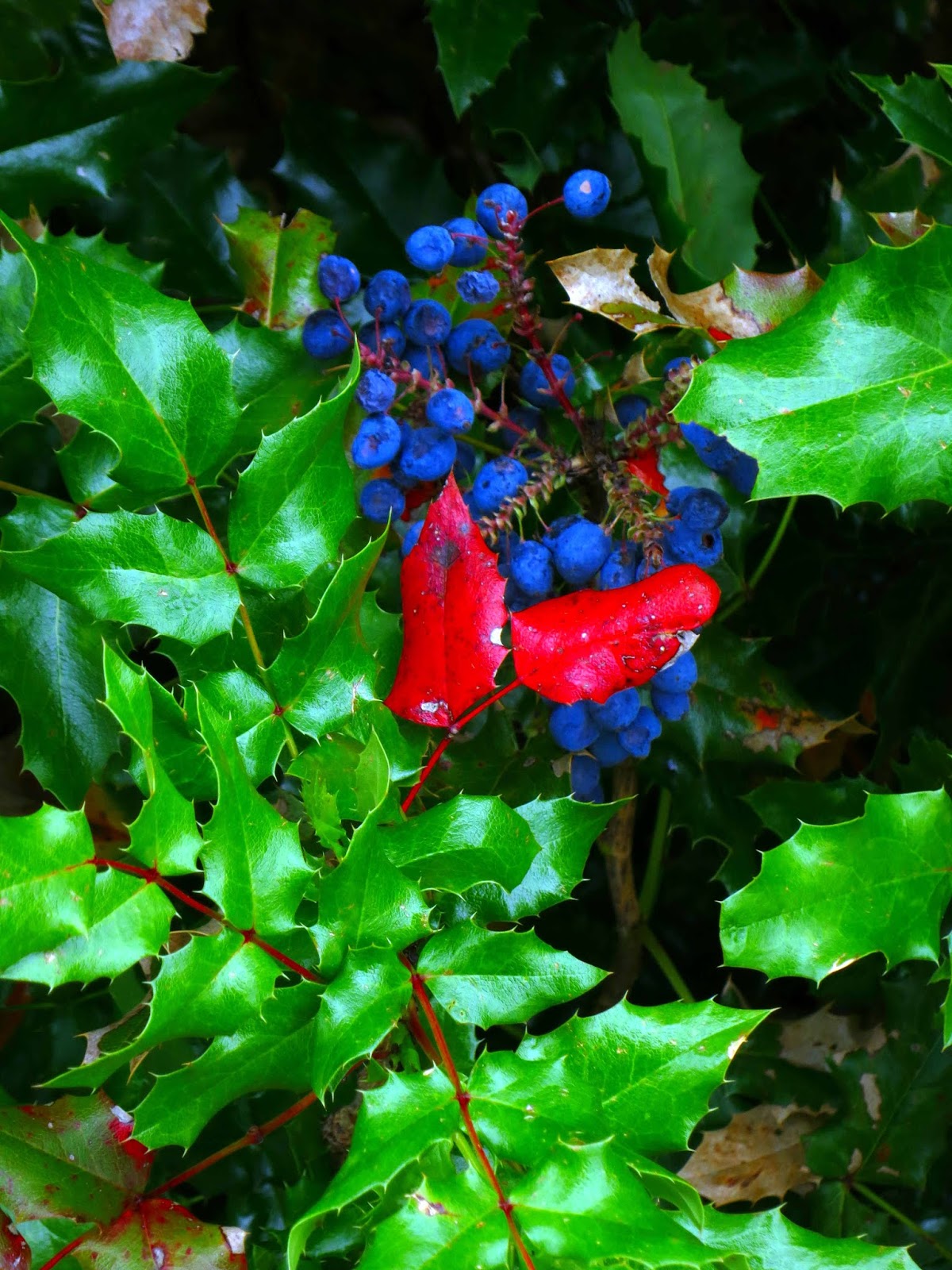
A Sprig Of Mahonia

3585The Oregon grape, Mahonia aquifolium, is the state flower of Oregon. It's not a grape at all, of course, but a berry. This is how they grow them out in Happy Valley:


It's a shrub. The leaves are not unlike holly leaves, stiff and waxy and prickly along the edges. The berries are that beautiful dark blue color, and are edible but not really palatable, unless you like the tartness unless you do something with them. Wikipedia tells me that pre-colonization natives in these parts used to offset the tartness with a sweeter salal. I am also told that you can make preserves with it, either mixed with salal or on its own, and you can make a wine with them, though you have to use rather more sugar to get it to ferment.

We plan on having these in our yard one day soon. They're drought resistant, grow in poor soil, and the berries attract birds.

In Salem, Mahonia is used as foliage, as hardy evergreen bushes in home landscaping, and to grow governor's mansions.

13 September 2018

Depression-Era Local Currency With That Silvertonian Flair

3569
When I was but a neat thing, and a kid in then-bucolic Silverton, Oregon, I remember there was a sporting goods shop on North Water Street between Main and Oak, on the west side of the street, called Chuck's Sport Shop.

The building is still there, of course. There's some sort of bistro or cafe there now. Lovely place. Lots of wood.

I remember going in there with my dad, I think he was after some sort of fishing gear, and I remember seeing, under the glass top of the front counter, these things that looked like money. Silverton Scrip, they were called. And I kinda fell in love with them. They were nicely designed; centering on a portrait oval of Silver Creek's South Falls, which is kind of an iconic thing to Silverton, they're still the most attractive currency I ever saw.

Latterly, on FB, a similarly-historically-inclined friend, Michael Long I think, put up an example of Depression-era 'scrip' from Multnomah County. I'm not 100% clear on the concept, but I have the basics; since you couldn't depend on your bank to be open or to even exist in the near-term, but commerce still had to happen, localities would issue their own temporary currency, or 'scrip', backed by some local source of credit. In Multnomah County, it was backed by the County Treasury. In Silverton, it was backed by what were called "Marion County School Warrants".

But I digress. Dig these.


Like I said, isn't that lovely? Thanks be to the Oregon State Library online, who knows how to do the historical job. It was issued by the local American Legion Post, which was apparently seen as a trustworthy authority, and had a limited duration of effectiveness.

This, indeed, is a 25-cent bill. While everyone could find a printer, minting coin was apparently something not everyone could do. There were other denominations ... I believe I saw a $1 scrip once.

The obverse side is a real treat:


... because you can have scrip and you can have scrip (up in Wallowa County they stamped 'em out on buckskin, I've found) but your scrip isn't really Oregonized unless you can have a Homer Davenport cartoon on it.

That's Silvertonian flair. And if we ever have to have a local currency, I say, go with this design. Silver Falls is the crown jewel of the Oregon State Park system. You could easily do worse!

09 January 2018

Throwback Pictures: Silverton, Oregon 2009

3512A.
Back in the winter of 2009 me and The Wife™passed through my old birthplace of Silverton. Just this last weekend I imported a bunch of photos dating from when I started playing with a digital camera, the legendary ViviCam 3705 ... the Plastic Fantastic ... and I stumbled on some of those wonderful pics.

Here are two of them. I'll post some now and again.


The view here is on the corner of North Water St and Oak St, on the doorstep of the legendary Palace Theater, where I saw 2001 and Planet of the Apes and Westworld and so many other beloved films when they first came out. Not one of those businesses that were current when I was but a neat thing are there now except for that insurance business down the street there, a block, on the corner of East Man and South Water.

Still, it doesn't look too different from when I was a kid. At least, not if you don't look too closely.


This is exactly one block east of the last shot, and looking kinda the same direction. That is the 100 block of North 1st Street, and Oak Street is still in our foreground. At one time there was Norma Branstetter's flower shop (which is now over where Park Street t's into North Water) then it was a beauty shop. Could be anything now, I suppose. The charcoal-blue building on the far right was a furniture store when I was young. Doggonned if I know what it is now, though.

But it still looks more or less the same. There's at timelessness to Silverton which endures despite its modern arrival at Quirky Little Oregon Town-ville.

10 December 2017

One Way In Which Oregon Is Different From California

3536.
Here's one from the Dept of Hometown Pride Dept, seen in a cold and wet shopping center parking lot sometime last week:


Even though the thought behind this is rather nuanced (and the graphic approach both simple and sophisticated), please ELO's "Down Home Town", please and thank you.

04 September 2017

[liff] Sunrise On The Day The Ash Fell In Portland

3482.
This morning dawned stuffy, still, and excessively red.


That's this morning's sunrise over the old Owens-Illinois glass plant, just northwest of the big Killingsworth-I205 interchange, just southeast of Portland International Airport. I adjusted the aperture and exposure on the Canon S-100 enough to make sure I got the sun's disk in there; there was enough smoke in the air to make it so one, could, indeed, stare at the sun for a few moments without harm.

The exposure settings made the environment gloomier than it really was, but the interpretation of the scene, ironically, fits the mood perfectly. It didn't look this way, but it sure felt this way.

This is the most stifling weather I've ever known. It's just after 8 PM, PDT, and the local weather station says it's still 82F, and, tonight, I'm receiving reports from friends all over the greater Portland area, that ash from the so-called Eagle Creek Fire - the one currently, at this writing, burning in the Gorge and putting the town of Cascade Locks under peril of evacuation - is falling at various points from here, Out 122nd Way, to Tigard and Hillsboro.

We, all of us, feel a little like dancing the apocalypso.

And so it goes.

22 August 2017

[OR_liff] An Oregon Solar Eclipse Journal, 21 August 2017.

3472.
Welcome to a place whose descriptive phrase, the mid-Willamette Valley, cause my heart to sing like a finely-tuned instrument, and a minute many of us have been waiting for for rather a few years was impending.

Work let me go on time at 7:00 AM. We were on the road southbound by 8:15 AM, flying by the seat of our pants, as is our way. A number of plans danced through our heads up until now, but we knew, in our heart, the only practical one was hit the road and get as far south as we could by 10:15 AM, and that was the bones, sinew, and details of the thing. No more, no less.

At 9:40 AM, we found ourselves cruising down the main drag on the east side of Woodburn, Oregon, N. Pacific Hwy. Just north of Young Avenue, where Hwy 214 enters town, there is, wonder of all wonders - an Arctic Circle. We suddenly know where our eclipse brunch is happening. The latitude and longitude pair 45° 8' 15.468'' N, 122° 50' 36.8268'' W is near enough within a few feet where the nose of the old Subaru warhorse was parked in the parking lot, by the front door. Getting down as far as Woodburn was a boon, especially considering the traffic-ocalypse we were promised prior to the apocalypse. We saw many pullouts on our way down: the two weigh stations by the Wilsonville-Hubbard cutoff were neatly but tightly stocked with lookers, and there's a lot that the Hop Festival uses in downtown Hubbard that had happy people arrayed about in lawn chairs, eclipse glasses firmly in place, following faithfully the Horkheimer dictum keep looking up. 

On the 21st of August 2017, Hwy 99E was the place to be.

Once in Woodburn we started looking for a good parking space, which was also no challenge. When the Arctic Circle hove into view, The Wife™ squealed with delight and I found the empty parking lot most welcoming. Our meal, and our vantage, was set.

The remainder of this is a stream of pictures, arranged in the order I took them by the time coded into the metadata. The actual times may vary by several seconds, of course.

09:41 AM PDT

The view north (toward Portland) on N. Pacific Hwy.


... and the view south (toward Salem).


10:09 AM PDT. 

Our own 'pinhole camera': a square of foamcore which projected a little fingernail-shaped sliver of Sun on another white piece of foamcore ... or even the white tabletops outside the Arctic Circle.


10:12 AM PDT.

The Wife™ said she'd seen the sunlight go a little wan. I didn't see it at first, but comparing it with the first photos above, it's now kind of obvious. The sunshine is a bit off, almost imperceptibly, but it's going there. There's a sepia tone to the sunlight and the atmosphere now.

We are now about six minutes out from start of totality.


10:15 AM PDT.

I've just now noticed that the lights in the Arctic Circle's sign have come on.


10:16 AM PDT.

The contrast between the lighted sign and the environment is now more palpable. A sort of duskiness has begun to tone the sky down.


10:17:07 AM PDT.

While still quite light out, the sign lights for the business next door have come on. The dark feels as though it's an actively gathering thing. The sky is deepening to an indigo toward the zenith.


10:17:17 AM PDT.

As above, only moreso. Color is being neutralized from the world around us. There is now a strange tension in the air that I can't describe - or maybe it's just me, keyed up from the expecation.

We are just about one minute out from totality.


10:17:42 AM PDT.

The sky to the west (looking west-northwest over the Arctic Circle) seems to have acquired a delicate pall of darkness. We are  about 35 seconds, give or take, out from totality.


10:18:05 AM PDT.

It might be a subjective thing, again, but the feeling of being borne down on by the arrival of the umbra is a thing that is almost solid in the mind. Anyone who doubted that anything would happen would stop doubting now.

The visual contrast between the still-daylit (but just barely) sky and the now-energized lot lights and building illumination is so discordant that the mind begins to bend a little. On the horizon, in every direction, an orange tinge more appropriate for sunset than mid-morning.

Everything you look at contradicts itself.


10:18:20 AM PDT.

The edge of the umbra arrives at Woodburn, Oregon. The semi-darkness goes from unreal to surreal.


10:18:30 AM PDT. Totality.


It's a peculiar (in the singular way as well as the full-tilt-boogie way) darkness in the heart of the shadow. It's as dark as a moonlit night, but there is something about the darkness that it is imbued with an eerie light rather much unlike that of the full moon: it's a light inside the darkness. The air hushes, then a light breeze goes up. You feel the temperature decrease ever-so-slightly. The orange sunset is a 360-degree thing, anointing all horizons in every directions equally; you are struck with th realization that you are looking outside the shadow, which does a thing to your perceptive POV, and you realize that a mere handful of miles separate you from that area.

10:19:20 AM, PDT.

By my reckoning, we are a little more than halfway through totality. It took a few more precious seconds to find my foot in this fleeting new world than I'd like, because right now the mind is in overdrive, striving to create in the memory an indelible record of everything one is seeing.

Here, by the way, is the star performer:


It's not ideal, but for a snapshot on a digital camera taken without fiddling around with any settings, more than enough to be a lifetime's treasure.

10:19:40 AM PDT.

A tighter shot of the omni-directional sunset. A contrail glows there. The traffic signal at Young Avenue and Pacific Highway is neon in its scintillation.


10:19:49 AM PDT.

The obscured Sun competes with a streetlamp. The streetlamp is winning, for now.


10:20:05 AM PDT.

The eclipse about to do the "diamond ring", the gracenote that heralds the end of totality. We have been in the dark for pretty close to two minutes now.


During the times I wasn't snapping photos, me and The Wife™ were looking directly at the eclipsed Sun. They tell you not to look at the Sun during an eclipse, and that's true in the main. We take it as read that the Sun is incredibly bright; consider that you can have up to 99 per cent of the Sun's disk covered and it's still difficult to tell for sure that any light has been occluded at all. Partial eclipses are cool, but that's still the blinding sun, and it will damage your eyes just as surely as a totally uncovered sun will.

But once the Sun is completely occulted, and only so long as it's completely occulted, you can chance a look. One still must be careful; when you see the diamond ring, it's a few split seconds before you must look away. We watched that bead of light erupt on the rim of that perfect circle and then spread outward from there. We looked away before it got too bright.

Mama always told me not to look into the eyes of the sun,
But Mama ... that's where the fun is.


10:20:36 AM PDT.

The light began to intensify and we're now back at a point where it's just kind of dusky.
That, and our minds are blown.


A once-in-a-lifetime thing. And if you couldn't be there, at least I could show you. It's a personal thing that will remain at the edge of my perception as long as I live now.

The drive down was - you might say - totally worth it. They don't leave total eclipses on your doorstep every week you know.


16 September 2016

[liff in OR] True Oregon Facts! Volume 1

3366.
There are a lot of 'facty' facts about Oregon. As a native son, I know quite a few of them. Additionally, as a native son, I know a great deal of facts about Oregon that are so true, so down-to-the-bone, that one actually has to create them.

When it comes to True Oregon Facts!, you've come to the right place. As a trained Oregon explainer, I am prepared to Oregonsplain them to you. Get ready to rock your knowledge of Oregon with True Oregon Facts!
  • True Oregon Fact! Oregon's current motto is "She Flies With Her Own Wings",changed from "The Union" (1957-1987). Other mottos we used include "Between Washington and California" (1901-02), "Pull My Finger" (Most Holiday Seasons Between 72 and 76), "Not Idaho" (Jun-Aug 1943), "No, Cut The RED Wire" (37-39), "Take the Red Pill, Neo" (Odd numbered months in 97), "Home Of Leverage" (Sundays 8pm, 7pm Central) and "Nadine, Get Me A 6-Pack of Beer At the Plaid Pantry" (incomes of $30K and under)
  • True Oregon Fact! The first mayor of Madras was a sasquatch. Her name was Nancy. Nancy Marie Sasquatch.
  • True Oregon Fact! Oregon's beta-development code-name was "uh, Clem".
  • True Oregon Fact! Ken Kesey was, in reality, a hobbit. Yeah, we know that one's a bit obvious maybe, but still.
  • True Oregon Fact! Wy'east, the original Multnomahn name for what we call Mount Hood, actually translates as "Suck it, Tahoma, YOU'RE GOIN' DOWN!"
  • True Oregon Fact! The approach of the annual session of the Oregon Legislature is heralded by the State Senators and Representatives swimming up the Willamette River to spawn.
  • True Oregon Fact! Sam Elliott's mustache served one term on the David Douglas School District's school board.
  • True Oregon Fact! All of Oregon is in the Pacific time zone, except for Malheur County, where it's later than everyone thinks.
  • True Oregon Fact! Former Governor Vic Atiyeh's tears could balance the state budget without having to call the legislature into session. Sadly, he never cried. Peter Courtney wasn't having it.
  • True Oregon Fact! Legendary Statesman Journal political columnist Ron Blankenbaker, who passed away in 2011, was kept in a secure location whenever the Governor and the legislature were in session for the State of the State address, to ensure continuity of commentary should anything happen to state government during the event. Even today, it is said he sleeps, Charlemagne-esque, in a cavern beneath Mount Jefferson, ready to ride to the rescue of the state of Oregon when the need is dire.
  • True Oregon Fact! An original name for Seattle was "New York Alki", meaning, in a hybrid of emigrant and native, "New York, By-and-by", envisioning Seattle's prospering into a major metropolis in time. Similarly, the name of the original people of the Portland area, Multnomah, was misunderstood by settlers to mean "San Francisco, As Soon As We Can Sell The Land From Underneath The Natives And Jack Up The Rent."
  • True Oregon Fact! While Mount St Helens' historic eruption was thought to have been caused by pent-up gas causing a massive landslide, subsequent research by the USGS has suggested it was really pent-up resentment and aggravation over Vancouver's being treated as 'merely a suburb' of Portland for decades.
  • True Oregon Fact! The transmitter tower for KPTV Channel 12 was built, single-handedly by Ramblin' Rod Anders over a course of an 18-hour stimulant-fueled binge in 1954. There was nothing amiss about the stimulant; Rod was such an easy going guy all he needed were three or four cups of really, *really* strong coffee. Well, that and his super-human level of hustle. Reports of Heck Harper handing him up the materials remain unconfirmed for the foreseeable future.
  • True Oregon Fact! Gilliam County was created for the express purpose of aggravating Morrow County.
  • True Oregon Fact! Tom McCall, Oregon's legendary governor, wasn't a single Republican man but actually two small moderate Democrats and one liberal Republican in a specially-designed suit. That's why he was so tall.


That's the first batch. As you can see, you can know Oregon, or you can know Oregon … or you can "know" Oregon.

"Know" Oregon. Read True Oregon Facts! and don't blame us when if you don't pass your Oregon citizenship exam.

07 June 2016

[liff] Tales of the DMV, Which Changed its Name to DMV Some Time Back

3328.
The DMV. A verity of adult life. If you want to legally drive, you'll find yourself there.

The mere name is a verity. Over on the site DMV.org, a privately-run clearing house of links to DMV information for all 50 states of the Union, I randomly clicked several states and as often as not, the name DMV ... Department of Motor Vehicles ... was the name of the agency in each state which handled titling and registering of cars and trucks as well as licensing of drivers. Almost every one had either DMV, some combination of another letter (BMV, in New Mexico, for Bureau of Motor Vehicles) or MVD (which is also what the Russians call their Ministry for Internal Affairs, a coinage one must accept as coincidental).

That last sentence points up a certain conception of the DMV as a thing that must be endured. A friend, long ago, remarked that Hell is an immense DMV waiting room, and your number will never be called. We all have bad memories of a DMV encounter. This year not only have I had to renew my ODL, but also process a new title and registration for the new Little Yellow Beetle that we now have. And I approached the event with more than a little apprehension.

The Oregon DMV has undergone such changes, though. I went in apprehensive and left delighted. The keynote seems to be on efficiency, speed, and friendly service. I got my ODL renewed in record time, and the title transfer application and registration were of almost sublime efficiency. Would it that all less important services were delivered with such aplomb.

Today we spent maybe 30 minutes in that building. It was a Tuesday morning, though, and that's kind of a slack time for them. It probably drags a little during high demand, but I'll be they're pretty good at handling that too. The sincerely-smiling, genuinely-helpful people there are probably a match for any problem you threw at them.

And, noting that I'm registering a 1972 VW Beetle, the clerk asked, with an impish glint in the eye, "You picked a name out for her yet?"

We haven't. But we're working on it.

The real inspiration for this ruminance, though, was the name. DMV. I'd noticed that the mere abbreviation seems to be a near-universal cultural token ... even Marge's sisters in The Simpsons work as clerks at the DMV. And I, as well as you, my dear reader, probably think we know what those three letters in Oregon stand for: Department of Motor Vehicles. 

Well, no. As it turns out, it's not Dept of Motor Vehicles; it's not really a Department; it's a Division (there are two major levels of Oregon state government agency. The top level is Department, and Departments are comprised of Divisions). The official name of the DMV in Oregon, is the Driver and Motor Vehicle Division, and its under ODOT, the Oregon Dept of Transportation, which is proper and logical.

Anyone devising the branding here can appreciate the cleverness. DMV changed its name, but still gets to call itself DMV. The iconic connection is maintained, the social concept token intact and involate. You need license and reg, you still go to the DMV.  I still can't determine when the official name-change occurred, though; all the time when I was growing up, the Dept of Motor Vehicles coinage seemed correct, my memory reports to me, even when it wasn't a state Department.

And there's yet another interesting thing that I turned up. The DMV hasn't been a Department since 1969, long before I started driving. It was only a Department from 1956 to 1969, before that, it was under the wing of the Oregon Secretary of State, and after that, a part of ODOT.

But to me, it'll always be the DMV, no matter what the initialism actually stands for. The DMV ... a fact of life, and one that works pretty well.

And so it goes.

06 March 2016

[pdx_history] KATU Throwback Video … Portland, 1983

3288.
The illustration on the right is a screencap from a wonderful video posted by The Deuce which is a 2-minute sequence of time-lapse shots taken in 1983.

The video is wonderful and heartbreaking. The mid-80s is when I started being a full-time Portlander (I've always been an Oregonian, but though I was born in Silverton my heart moved to Portland at an early age), and many, many scenes in here tug at the heartstrings … the tug pushing a barge under the Hawthorne Bridge … time lapse trips inbound on Canyon Road and the Banfield Freeway …

It is more than a little awkward and forlorn to realize that the images of ones kid-days are attaining the same patina that old photos one saw at that time had when one saw them then.

The video is at KATU's website: http://katu.com/news/videos/katu-throwback-to-portland-in-1983

24 June 2014

[liff_in_OR] Newberg's Classic Dairy Queen Sign

3119.
Newberg is the first town you get into after leaving the Portland Metroplex going south on Oregon State Hwy 99W. It's the vanguard of wine country, the sentinel admitting you to that charming area known as Yamhill County.

At the entrance to the center of town, the highway splits into a couplet made up of First Street and Hancock, and this continues for about ten or twelve city blocks. At the west end, the two streets snap back together, cross the railroad tracks, and head on southwest to the land of the eternal traffic jam, Dundee. And, if you didn't look quickly, you'll have missed it.


404 West First Street. It's a DQ that looks quite a bit like just about every other DQ you're likely to see; cream-colored walls, red mansard roof.  But there's something that might catch the eye a little more than other things, especially if you have an eye for the classics.

Some ten-fifteen years back, the DQ wasn't the commodious sit-in place it was, it was a traditional drive-up. Anyone familiar with the adorbs little DQ drive-up and sit-out at SE 56th and Division here in Portland will be able to picture this. It was quite a bit the same. Well, about ten or fifteen years back, the Newberg DQ decided to give its patrons the inside-dining experience. I was sad, a little. It's nice to sit inside with your burger, but the old-fashioned burger driveups have a charm that can't be denied or resisted.

But they kept the old sign. Standing fifteen or twenty feet up, on a stout pole that shows a bit of rust, the stylized ice-cream cone keeps happy watch on the western entry to Newberg, taking in the equipment rental place, a Dutch Bros, a trailer court across the way, and a 100% Hispanic tire-seller across the street.


Whether or not you'd ever live in Newberg, there's a definite American-small-townness that recalls the rosy memories of prim little farming towns. The past wasn't perfect, but certain facets were adorable.

In Newberg, some of it can be found under the sign of DQ. Roadside neon, the way it used to be … and still is.

16 April 2014

[pdx] Tri Met Bridge, We Christen Thee … Tilikum Crossing

3060.
… and that's the new name.

The word Tilikum (or Tillicum or, if you want to be really correct about it, TilixƏm) is from the Chinuk Wawa, the inter-tribal trade argot spoken by the people of Cascadia before us white folks got here, and, for a time, by many of the white people who got here. Elements of this jargon are still with us today, as I've pointed out before: if you look up the high mucketymuck or if you buy anything from this surf sports company or wondered about the sasquatch, you're speaking Chinuk, pilgrim. A skookum thing, to be sure.

From the TriMet email
Tilikum, which is the closest we can come in the 26-character common Latinate alphabet to writing the word, is a work in the Wawa meaning person or people or family, depending on the context. It survives, perhaps in a deplacé way, as the name of a neighborhood bar in Beaverton along the BHH; the name is rather appropriate, since the greater family in these modern times still, in this area of the world, is as likely to meet in an Oregon dive bar as anyplace else, perhaps, from my experience, more so.

The use of the stereotypical Indian war bonnet seems awkward but I am, at best, an armchair historian. I'll leave the more thoroughgoing analysis to those who put the word anal in analysis. 


Chinuk Wawa shorthand system
date unclear. Based on Duployan
shorthand. Source.
The name entire seems to read Tilikum Crossing: Bridge of the People. The ultimate clause of that sentence can be seen as a translation, and also a tagline, which makes it sound somewhat more appropriate to an adventure movie poster. It's not my choice, nor is it the preference of many others; many of us, including me, hoped it would be named for Kirk Reeves … indeed, it was the popular choice, as The Oregonian's Joseph Rose reported. In his missive to us in the proletariat, sent under the aegis of TriMet, historian Chet Orloff says:
But ok, I know some of you are disappointed and may be thinking of the new name in terms of winning and losing. However, please be reminded the process was not a competition or popularity contest. It was not about lobbying and who has the most clout.
The naming process was very deliberate. Our committee of 10 citizens asked fellow citizens (you) for input -- first, to provide possible names then, second, to comment on the four most meaningful names the committee believed best met the criteria we had established early in the process.  
The criteria (which can be seen in this TriMet blog posting by Mary Fetsch) were, of nature, subjective (history being what it is, I can't really see how it could be anything but), and can, I think it not untoward to point out, argue for anyone's case as it can be against. I know more than a few people who were holding out for Abigail Scott Duniway, whose name also would have been most worthy.

But it is what it is; if there's any salve to the fact that a name was chosen that I may or may not agree with it is that the search and decision was apparently done in good faith – the committee came up with a set of criteria and have appeared to stick to it as close as they could possibly do.

In that, Tilikum Crossing, in that it is a 'bridge of the people' (certainly any gorgeous cable-stayed bridge in the Transit Capital of the World that carries only foot, rail, and bike traffic and no cars reflects an ideal a lot of us Portlanders hope for) is a goodly name, and one I can make a certain sort of peace with.

The version TilixƏm needs some explaining perhaps: See this Soylent News™ article, also by The Rose, which explains the notation. Sadly, he does not call the upside-down e what it is, which is the schwa, but the article is a solid one nevertheless.

14 April 2014

[pdx] 30 Minutes of PDX Sunset in 15 Seconds

3057.Another attempt at time-lapse animation. I'm not all that happy with the quality, to be honest. Not nearly as sharp as I wanted. Was done with a series of snaps, one every two minutes, taken over a thirty-minute period from the Pittock Mansion viewpoint.


But you can make out the moon rising over Mount Hood, and the hill's shadow creeping over the east side of town, and the sense of mood was very meditative there, and a palimpsest of that is there.

Tools were the Canon Powershot S-100, and Photoshop was used to create the animation.

[pdx] Moon Over Downtown Portland, or, Sunset Over America's Most Photogenic City

3056.
I wonder, when Henry Pittock built Portland's most famous residence, now a museum and grounds held in trust for all the citizens of the city he helped build, I wonder if he knew, somehow, just what a view would eventually obtain from that perch?


As The Wife™ pointed out aptly, it was undoubtedly a gorgeous view back in 1913. It's built on a geographical prominence that obviously affords a spectacular view naturally. But Portland's a very very photogenic city. It's almost as though she grew with the idea that she'd be seen from this viewpoint.

How did he know?

Adorably miniaturized Portland. Built of tilt-shift simulation settings, not of LEGOs.
To see that sort of thing, yo, go here.
I'm a native Oregonian, as I've smugly said ad nauseam. Silvertonian by birth, Portlander by choice. At this point, though, I've lived in Portland for longer than I've lived anywhere else in my life. While I've made my peace with a rather unhappy childhood in Silverton, and am in fact a little proud to be able to say I was born there, if I had my life to design over, I'd change my place of birth to Portland.

I love Portland that much. It's because I respond so intensely to the visual, I suppose. The cityscape here has always stirred me.


We all have our favorite places, and that's cool too, of course. But our hearts know what home is. For me, there could never be any other place.

10 April 2014

[liff in OR] The 2013-2014 Oregon Blue Book Cover Winner … And How You Can Enter The Contest For The Next

3052.
Its a beautiful shot of the Pacific at Yachats at sunset

Each biennium, the Oregon Secretary of State produces a volume called the Oregon Blue Book. It's an almanac full of facts and figures about the best state ever, and every 2 years, the Secretary of State chooses a new, beautiful Oregon photo to grace the cover.

This edition's winner is a photo by Beaverton's John Pederson, Strawberry Hill Sunset. A slice of this is
featured right, click here to go to a big version. It's a gorgeous shot, rich in color, taken of the Oregon beach at sunset from Strawberry Hill, which is south of Yachats. It's just the kind of scenery you get used to here, and it's beautifully done.

The full announcement can be seen at http://bluebook.state.or.us/misc/cover/front.htm. But did you know that if you have a hand with the camera you, too, might achieve a measure of State Archival immortality? The contest to select the photo that is to be the cover of the 2015-2016 Blue Book is open, and any Oregon resident can enter. There are requirements, of course; go to http://bluebook.state.or.us/misc/contest/guidelines.htm to see them. A link to the PDF entry form can be found thereunto.

Good luck there, all you amateur Ray Atkesons you!

24 October 2012

[art] Color From Out Of Oregon: How Gamblin Sees It

2874.Here's a nifty little video with the man himself, Robert Gamblin, talking about what he does and why he does it, with behind-the-scenes scenes.


Approach to Colormaking from Gamblin Artists Colors on Vimeo.

Gamblin's website is http://www.gamblincolors.com/;  You can get the at I've Been Framed, Muse, and Utrecht, and even Blick (if you must).

09 October 2012

[liff] Broughton Beach, August, 2012

2865.
As my friends know, my The Wife™ and myself were not born in Portland. She was born in Ohio but has been living in Oregon since she was 6 months old, though I am a native-born Oregonian, I was born in Silverton (which didn't count for much when I was a kid but seems to matter more and more as the years pass, but that's a digression and will cost me). And my wife is as Oregonian as any native born, and more fond of Portland than I am.

All these thoughts came back to me as I looked over these pictures at Broughton Beach which, as any local knows, is this wonderful broad sand riverbank along the Columbia River on the northern edge (where else?) of the city, by the western end of Portland International Airport. And that northern-edgeness brought on another thought, about the Columbia River itself.


 While Portland is famous for being a Columbia River town, it isn't, not really. It's a Willamette River town. and for all its stature amongst North America's rivers, and despite the notability that it's the biggest North American river to flow into the Pacific, And that it was the main street of the people of the Chinuk Wawa, it's not exactly the Main Street of the Pacific Northwest, when it comes to where people live. The biggest single city along the Columbia is Portland and, as I said earlier, it actually fonts the Willamette.

Other drainages, the Missouri, the Mississippi, the Ohio, all have remarkable famous cities that front on to them. Not the Columbia, which is an awesome river … but it belongs to small-town Cascadia. Maybe it's the geography, after all, before the dams were built the lower Columbia was much more well known as a river you had to portage rather than sail down (and eventually led to a cutoff that went south, around Mount Hood, and completely away from the river), and the truly clement and fertile weather that the white man came to enjoy were along the Willamette anyway.

I don't think it's a good or bad thing; just a thing, an interesting thing. To the Willamette belongs Cascadia's cities and population - to the Columbia belong the small places, the wide open vistas. The outback.

It simply is.


Another thing a child of the banal Mid-Willamette valley never gets used to are the big boats. During this afternoon, a Tidewater barge sought its way up river. It entranced both of us for a long long time. You just don't see this growing up around Salem, which lost any interesting river traffic when what amounted to Oregon's steamboat era ended. The Willamette at Salem is an adorable thing in comparison to the Columbia (or even the Willamette at Portland), the rivers here in the metro area are this muscular, working thing, always busy.

How will you keep 'em down on the farm?


And a sunset is a sunset is a sunset.


 But a sunset on the river like this …


… is a special thing, and makes me glad I'm here.

17 January 2012

[liff] We Can See For Miles And Miles

2750.… well, we could, if we gained several hundred feet in elevation.

With the approaching snowstorm promising wintry hell for those 500 feet and up and wintry heck below (from this we coin that Oregonized term wintry mix) we naturally wondered how far about mean sea level Chez Klein is. Via this nifty free app at http://veloroutes.org/elevation/ we found out that Home Base is, indeed, about 311 feet above the ocean's waves … at least until global warming takes its toll.

You can do it too. Just tap in your address and it'll do the rest.

Something else we've found out that amuses and amazes us is just how low-lying a great deal of the Portland area actually is, despite its apparent relief. Courtesy of Your Tax Dollars At Work, NOAA has a fun little chart at http://www.wrh.noaa.gov/pqr/elevations.php. Did you know that downtown Portland at the seawall is only about 20 feet above sea level (and ocean levels are predicted to go up how much due to climate change?)? PDX itself is only about 20-25 feet up.