Showing posts with label pdx_geography. Show all posts

13 February 2009

This Comment Made My Day, As It Should Have

1946.My Address Nerdery has garnered some really cool responses. Here's the latest and the neatest.

Referring to my definitive post on the 1928 address layout of Portland (and the Hibernia Map), today, I recieved the following comment, which was too good not to share. Credit one Valerie Jasperson for the following:
Well, not sure where any of us came from, actually, but I got to your wonderful mapnerd blog after a long search for early Portland addresses. I just finished reading "On the Trail of the Lonesome Pine", and my 101 year old book has a name written in the front with the address "684 E. 11 North, Tr 0090 Portland, Oregon." Your site did it for me! Not only am I gratified to understand the address, your blog is a great read. Rarely do I get to see the word "embiggened" in print. Love it. Also love maps. My Dad was a surveyor and later draughtsman for PGE in the 50's, and he used to bring home waste blueprints and I'd color in the lots and make mazes of them. I hated the way the paper made your hands feel dry and the ink smelled so sharp and dull at the same time, but I was captivated by the map bug, just the same. Thank you for the great old PDX info,SJK. May you always fold it right on the first try!
Publicly, you're welcome, Valerie. As I said in the response to this, one of the most thrilling things is when my obsession answers a question that someone else didn't even know they had until they found me.

The only part that mystifies me is the "Tr 0090" part. Looks like a postal code somehow, Hey! Another investigation!

Anyway, is this not cool? I can attest to the smell and feel of those prints–I have some experience making diazo prints, and actually grew to like the ammonia smell that you got assaulted with when making one, but they are hard on the fingers.

Also, On The Trail of The Lonesome Pine is a book so old not even Amazon knows about it. Must be some book!

One of the best things in a life where you are but really a cypher moving amongst a throng of cyphers is when someone else reaches out and says "thanks" for something like this. So I may be making a party out of a comment ...

... but why not?

Thanks again, Valerie.

Technorati Tags: , , ,

23 October 2008

SE 502nd Avenue And Mount Hood From Gresham

1826.


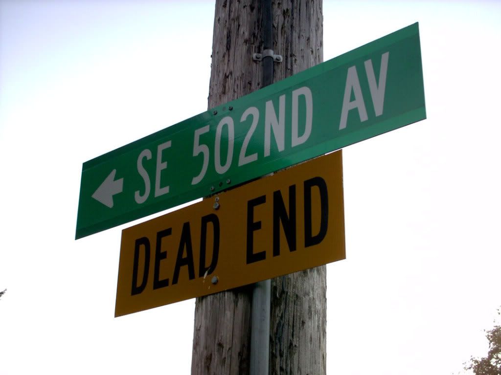
I have written before about my favorite street in the Greater Portland Area ... the highest numbered street I know of in these parts. SE 502nd Avenue. Here's where the map says it is. This route in Google Maps says it's about 8.9 miles away from downtown Sandy via Highway 26, and SE Baty Rd (with a jog at SE Cherryville Rd).


It's beautiful country, truly. We didnt get good pixs of that country, about which more in a moment.


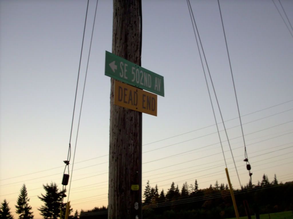
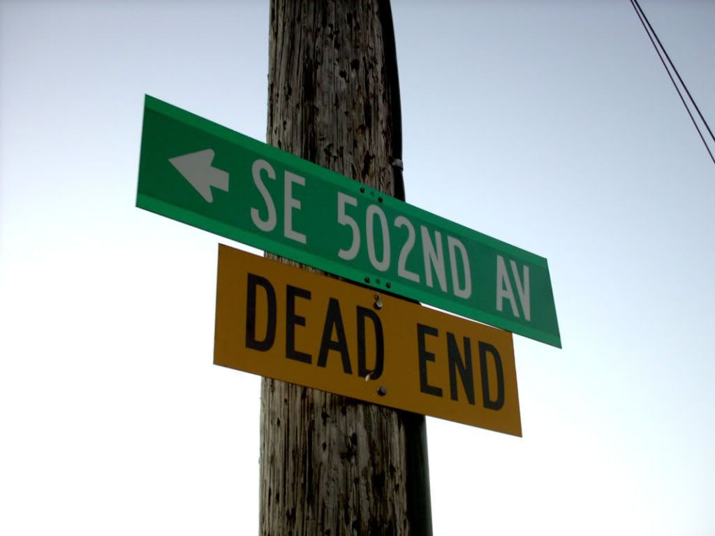
One of the things I'd always wanted to get was a street blade for SE 502nd Ave. The last time we tried, though, we discovered to our sorrow that it was gone. On a whim (and buoyed by those lovely lower gas prices) I decided we'd have a short car trip today, and take a chance that the sign was back.


Because, having at least one picture of a sign that says "SE 502ND AVE" is awesome.


SE 502nd Ave Blade


And having two, even more so.


SE 502nd Avenue Blade


And having three ... well, that's bliss.


SE 502nd Ave Blade


We didn't get a good picture of the area because it was just too sunsetty. Here's what we did get:


SE 502nd Avenue View down hill


This is a very tranquil place. Very quiet. A passing cyclist on Baty Road gave us a nod, so it's friendly, too, in the shadow of Mount Hood.


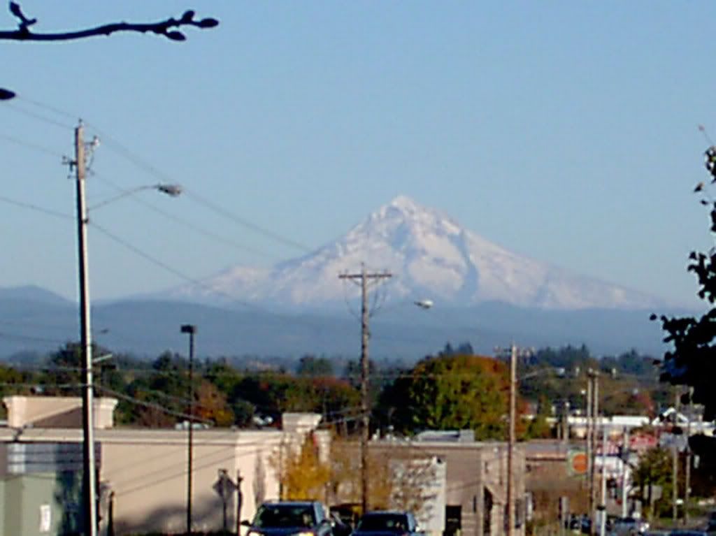
Speaking of which, got some good snaps of old Wy'East on the way out. Tarried a bit in the Gresham Town Center area. But if you want a good view on a good day, look east on Burnside Road just east of NW Civic Drive. Stands out like a beautiful monument.


Mount Hood


While I was angling for these shots, a young dude - about 10 years old or so - came by on his scooter.


"Do you live here in Oregon?", he asked me.


"Yes, I do", I said.


"Why are you taking pictures?", he asked.


"Because," I said with a smile "this place is beautiful, and I love that mountain".


That seemed to hold him. I don't need a reason, of course. I'm a native-born Oregonian, and smug about it. But with what we got here, do ya blame me?


Tags: , , , , , , ,


Powered by Qumana


12 October 2008

Portland Neighborhood Moves From the CENTER

1813.


CENTER neighborhood logoIt's not exactly news to some, but I think it's kind of cool that the Center Neighborhood's (NE 44th to 68th Avenues, and East Burnside Street north to the Battlefield Freeway) name was drawn from the initialism CENTER, standing for Citizens Engaged Now Toward Ecological Review. This is a wholly noble goal, and one which we approve of.


Trouble is, it's not in the center of everything, and just about everywhere in Portland, people think ecological review nearly all the time. The logo is a little dated as well; the calligraphy is beautiful, and the artwork is charming, but it clearly speaks of a time when evironmental awareness wasn't necessarily on everyone's mind.


They'll most likely be renaming themselves to North Tabor very soon now, or Rosemont perhaps (dialup warning: that link will download a 1 Megabyte PDF to you). I have no dog in this contest, but I like Rosemont better. Much more picturesque. North Tabor is accurate, but a little utilitarian.


And so it goes.


Tags: , , , ,


Powered by Qumana


23 February 2008

[street_blades] A Few Blades In The Milwaukie Style

1384. Recently, in scouting an event site for my SCA branch (The Shire of Dragons Mist), me and The Wife™ were, of necessity enroute to downtown Milwaukie, and stopped at the intersection of Harrison and Highway 224.

There is a Mike's Drive In – The original one by the looks of it – between OR 224 and the railroad crossing on the north side of the street. Buffalo burgers; nomnomnom. If you like meat, you need one.


There was an opportunity for street blade documentation; out came the ViviCam 3705. After Buffalo burgers were consumed I commenced perforce to work.


Address-wise, all of Milwaukie is in the SE Quadrant of the greater Portland address grid. For the sake of completeness, the directional SE is included on all signs but, since there is no chance whatsoever of finding a street from another quadrant in the Milwaukie ZIP codes, the SE is knocked down a level in the visual hierarchy to the level of the generic (that is, the SE is sized the same as the ST and the AVE on the signs pictured. Moreover, the specfic (the actual street name) is the star of the layout, with the generic and directional seemingly banished to the ends of the blade. This effect is especially apparent on the numbered avenue blades.


A good close look at some of the older blades still in service shows a suggestion of hand-crafting; the shapes of the directional letters seem a bit imperfect and the lineup is quite imperfect (note especially the S in the word HARRISON above).


Also notice that the older standard Milwauke style actually includes the periods in the directional (S.E. rather than SE).


The demarcation of a dead-end street is arguably more useful to the driver. In Milwaukie, with signage such as this, one is much less likely to turn down a dead end street as you'll know without having to see the yellow diamond sign once you have entered the street.


The business sign in the right of frame above is a Purdy car wash sign, which probably hasn't changed since the 80's (if it goes back that far – the style sure looks 80s-ish)


The sign assembly perched on top of a wood post and the sloppy alignment of the assemply itself is actually quite charming.


Across the street, at Harrison and Railroad, is a mix of the old and the new:


The SE Harrison St blade is much more finished than the one across the street, with much more precise glyph lining. There are no periods in the directional, and the top of the sign includes an address block tab in the Portland style (remember, that 10600 is the crossing-street block; we are looking at the definition of the 10600 block of SE Railroad Ave, which is defined by Harrison St at that point.


The SE Railroad Ave blade is more of the old style; periods in the directional, and imperfect glyph aligning, with the directional and generic crowded into the ends of the blade.


This shot was taken from the back of the blade; note how complete the information is on both sides of the blade. This is admirable. Blades get used by pedestrians as well as autos.


To cap off, there was yet another interesting sign just back across the railroad tracks. SE Campbell Ave meets Harrison there; this is a semi-improved street that parallels the tracks on the west side. At Harrison Street, it provides an entry to the Milwaukie Bowl's parking lot.


The sign is rather tall and leans. What's most notable is the treatment of the street names on the blades, which elides the generic completely:


The signs read "SE CAMPBELL" and "SE HARRISON". And, for good measure, here's the quaint and retro sign for the Milwaukie Bowl, which is presumably the one they've always used:


Throw a coat of paint on that and spruce it up a bit and it would look smashing. ObJadedSarcasm: Do that and you'll have hipsters coming from miles about!


Tags: , , , ,


06 February 2008

[pdx, pdx_lore] Mnemonic Device? We Haz It

1338.


Greetings to anyone stumbling over here from the local real estate blog re:PDX, who noticed the high coolness of the downtown street mnemonic (which, in the interest of disclosure, was actually composed by a commenter (J. D.).


Welcome, welcome, and welcome again.


And thanks to re:PDX for the mention. Skookum nifty!


Tags: , ,


28 December 2007

[pdx] Portland Downtown Street Mnemonic Users' Guide

1209. After turning the Portland Downtown Streets Mnemonic (PDSM) around in my head (provided thanks to commenter JD, as per the last posting, I wanted to analyze it a little more.


The mnemonic, provided to us, was as follows:


All Across Portland Our Streets Wind Around Mossy Yards. Traffic Snarls May Mean Jammed Cars, Cranky Motorists Making Minimal Headway. Harried Commuters Just Love Going Slow.


This maps to the following street sequence (from north to south, not including Burnside):

Ankeny, Ash, Pine, Oak, Stark, Washington, Alder, Morrison, Yamhill, Taylor, Salmon, Main, Madison, Jefferson, Columbia, Clay, Market, Mill, Montgomery, Harrison, Hall, College, Jackson, Lincoln, Grant, and Sheridan.


JD had actually extended our sequence to just south of the I-405 in the 4th/5th/6th Avenues area (though there is a slight error; after Grant comes Sherman, and Caruthers and then Sheridan. But someone can tack on the extra C and S; JD did a fantastic job and has given us all a toy to play with.


Now, the key to using a mnemonic like this is to think of it as giving you an easy way to remember the first letter of each street. Once you have that, it's half the battle done. The mnemonic also make it a hell of a lot easier to keep everything in order. It doesn't give you the whole game though – you still have to get familiar with your streets' names (the famed Seattle mnemonic, for example, doesn't tell you the names of the streets or the fact that each initial represents two streets, not one, and which one of each pair comes first – this is all stuff you have to find out)


Once you are familiar with the basics, however, this mnemonic will provide ready-made 'sites' for the information to bind to, making it more easily rememberable. And that's the magic of the mnemonic.


So say it loud, say it proud, and spread it 'round:


All Across Portland Our Streets Wind Around Mossy Yards. Traffic Snarls May Mean Jammed Cars, Cranky Motorists Making Minimal Headway. Harried Commuters Just Love Going Slow.


Now, you've got it!


(PS: will someone BoingBoing this? The fame, I craves it!)


Tags: , , ,


Powered by Qumana

05 December 2007

[pdx, map_design] A Very Spare Map Of Metropolitan Portland

1173. A production of ZehnKatzen Labs:


Not complete–a few roads are left off, but the map is actually not complete. Oh, yes, and no nomenclature at all; impose your own truths, or none, as you see fit (actually, that's kind of scary, isn't it?).

No roads on the Washington side, but nothing personal, Vancouver; VanWA is outside of the bailiwick of the project this map supports. I know you're up there.

Adobe® Illustrator CS3, for those who are wondering.

Oh, yes, this work is governed by the following license:

Creative Commons License


This work is licensed under a
Creative Commons Attribution-Share Alike 3.0 United States License.

If you want to nick it, go ahead, just give me credit for it, neh?

Tags: , , ,

04 December 2007

[sign_design] A Rough Proposal for a Metropolitan Portland Route Sign

1172.


A rather rough rough. The rose represents on behalf of the Rose City, of course, and was clipped from a lower-res photograph I have here strictly for visualization purposes.

The rose graphic might not be completely acceptable for a metropolitan route network–after all, Portland isn't the whole of the Metro area, and other Metro area towns that are not Portland can be somewhat resentful of a Rose-City-centric symbol for a badged route running through thier neighborhoods.

But this gets the general gist of the idea across. The pentagonal shield is, of course, the commonly-used county route cutout, and the idea of personalizing the shield with a commonly-recognizable symbol rather than words (such as METRO ROUTE) was inspired by the way Charlotte NC adorns the Charlotte Route 4 sign with the crown from the city's logo.

Tags: , , , ,

30 November 2007

[street_blades, info_design] New Portland Overhead Signs, and a New Street

1164. If you've been looking up and forward whilst waiting at any light in the Portland corporate area latterly, you'll have seen a sign bound to the overhead like this:

The City is, at last, addressing a real need in road signage. Most other larger towns up and down the valley (and across the Columbia too) have large signs denoting the street name on the traffic signal arm. Any driver who's been saved from having to frantically scan about on the corners to see what street they're crossing don't need to be told how good this is.

The standard has seemed to have been set; the iconic representation of the "Portland Rose", the red rose with three green leaves, and a simple representation of the street name at cross.

The notation on this particular sign deserves some explanation. For the past several months, a major realignment of the connection between Killingsworth Street and Columbia Boulevard has been becoming reality. The old Columbia Boulevard opening, a two-lane underpass under the railroad tracks, is a bottleneck. This old T intersection is being deprecated (and looks like it's being closed completely) in favor of a new higher-capacity, split access to a short road which is apparently being called Columbia Parkway, which goes frm NE 89th Avenue and Killingsworth Street over to Columbia Boulevard at the Holiday Inn Airport.

The (SB) denotes the split access–Columbia Pkwy splits into separated Northbound lanes and Southbound lanes.

The old part of Columbia Blvd east of that new intersection (which is also fully signalled) appears headed to a destiny as a dead-end stub.

Technorati Tags: ,,,

21 November 2007

[pdx, pdx_politik] The Chavez Revolutions

1140. What was amazing about is that it all fell down like a house of cards. According to Witigonen and the Merc:

  1. Mayor Tom's proposal to rename Interstate Avenue went down, 3-2.
  2. Saltzman moved to table the process-revision vote in favor of settlling the SW 4th renaming issue.
  3. Council approved the tabling.
  4. Unanimous rejection of the proposal to rename SW 4th on reconsideration.

The discussion has been rebooted, if we care to have it. The only things we aren't getting back are the time and energy expended in arguing over it (and we still can't tell if the lesson was learned that processes are there for a good reason, and taking shortcuts only breaks people's hearts in the end).

Personally, the lesson I think we've all learned here is: There's a Commissioner Saltzman here? That dude's so quiet, I forgot about him.

Technorati Tags: ,,,,

19 November 2007

[pdx, pdx_geography] No. No. Please Make Them Stop. Oh, The Head Hurts When They Do This...

1130. What, are they lining up this year or something?

I love Douglas Adams, but no, please don't rename a street after him, even if it is NE 42nd Avenue. It doesn't seem to be an ironic joke.

Other, cooler kids have had this in the news for days. I was kind of hoping that if I ignored it, it would go away. Wrong again.

In A Related Story: The Red Electric speaks esteemable sooth on moving Cesar Chavez Blvd downtown.

Technorati Tags: ,,,,

15 November 2007

[pdx, pdx_politik] Commish Randy Swaps Out The Chavez Gameboard

1116. The most notable thing about Portland politics is that, sometimes, it isn't over even if it's over, as witness the strange turn in the "let's name something after Cesar Chavez" slo-mo train wreck

It's by now old news that Commissioner Randy Leonard not only sprang on us all the prospect of renaming the street City Hall is on SW Cesar E Chavez Blvd in favor of doing it to N Interstate Avenue. It's kind of become a game that the board gets changed out randomly. At first, it was some sort of strange cross between poker and "I've Got a Secret". Now, it's suddenly chess.

In suggesting not only a major downtown Avenue but the one that City Hall is located on, Commish Randy has not only changed the gameboard but, somewhat, the terms of the conversation. In this chess game, he's put the city's King on SW 4th in a way that the rename-Interstate advocates have to answer. And, in having the support of four out of five of the City Commission (save, of course, Mayor Tom), he's positioned his pieces well to support his move.

Quoted by The Big O:

It's the address of City Hall. There's a lot of symbolic value, and I think it reflects the pride the council has in wanting to honor Cesar Chavez

So he not only has the support of an overwhelming majority on Council, he's also putting the City's prestige on the line as well, which, politically speaking, is a master stroke. While all this is a surprising turn, this is perhaps the logical ultimate expression of the realipolitik involved in the quest to rename Interstate Avenue embodied in ramrodding through the process with no regard to existing policy and, at best, disdain for the feelings of the neighborhood involved.

I'm not in favor of renaming any of our streets any more, actually. It's not out of any fear of a name like "North Cesar E Chavez Blvd" (or "SW Cesar E Chavez Blvd" if it come to that), and, actually, ultimately, it wouldn't bother me much if one of them were renamed. I have no fear of a brown planet (or black, or what have you; our policy is to be as nice as possible to other people, in as much as other people outnumber us over 6 Billion to one).

I'm not in favor of renaming any of our streets in favor of anyone right now because, after the MLK renaming, the City devised a careful, methodical process that does its best to make sure that if a street does get renamed, it doesn't happen unless a majority of the people involved are on board with it, but latterly, if someone in City government gets the proverbial wild hair, it gets utterly and completely ignored, rendering the lessons we all learned about uniting community in the wake of the MLK renaming irrelevant.

If Mayor Tom promised renaming advocates that they could have thier way without going through the process, then that was a promise he never should have made.

That this and the last few renamings (Naito Blvd, Rosa Parks Way) were to honor people who were all about community (Naito about building the physical community, and Rosa Parks about the fact that we've all got to be respectful of each other – a lesson we probably haven't learnt after all), are in honor of people whose lives were about building and reinforcing the things that make us a human community just adds a great deal of irony to the whole thing.

Technorati Tags: ,,,,,

10 November 2007

[info_design] I Want Your Street Sign Pictures!

1104. A few recent posts (and an aside from Sam Adams at the Domain Name Transfer Party) reawakened the Address Nerd in me that's been slumbering for a while, and activated a particular subsector of that attitude regarding street signs–better referred to as blades, because of thier knifelike shape.

I adore these little signs, of course. In a way, a city's street blades function as an aspect of the city's personality. They, if well-designed enough, give you all the information you need to coherently identify your location in a city whether you know the town or not.

Some of them have interesting decorations. Photos of the ones I've seen in New York City have a really cool hi-contrast graphic of the Statue of Liberty on. The ones in our own humble Keizer have the logo of the city on, as to the ones in Vancouver.

I'm making an appeal here. I'm gearing up again to document Portland's street blades. I have that end handled right now, but I'm wondering about what street blades look like in other towns.

I'd like see what other people got! If you live in a town I don't (I live in Greater Portland Oregon, 'member–look at the header image) and you have interesting (or even normal!) street signs that you'd like to show off, might I please request a picture of them? I'll display them here with full credit and linkback.

I want to see what street blades look like all over America. I want to see what other towns' personalities are like. And I want to discover, one by one, how places encode thier grids–location and place–to a blade on a streetcorner, or whatever have you.

This appeal is to anyone within the sound of this blog, anyone who stops by here, from anywhere.

Send your graphics to here (or click on the Gmail email button on the sidebar), and I'll post the with commentary, and we can all have a bull session about them.

Technorati Tags: ,,,,

07 November 2007

[pdx] The Old Tom Peterson's Bulding-Going, Going...

1095. Out and about on Tuesday afternoon. Dateline: SE 82nd Ave and Foster Road. View: End of An Era–Tom Peterson's old building is a-coming down:

As we understand it, the little LaRog's building hard by the corner is coming down next. We forget when they're winding things up there, however.

Ladmarks do have a way of changing. And change is a constant.


Technorati Tags: ,,,

01 November 2007

[pdx] Mt Tabor From Rocky Butte at Sunset

1076. To kick off NaBloPoMo, here's another view from our sunset photo series, the first of which was published in this entry the other day:


Oh, those Boring Volcanics...

That hillock in the distance is Mount Tabor, which means we're looking southeast from the stoneworks at the summit of Rocky Butte (the aforementioned Joseph Wood Hill Park).

Portland at sunset is gorgeous, no?

30 October 2007

[pdx] Sunset From Rocky Butte

1068. We didn't have the tripod with us, but the stone parapet at Joseph Wood Hill park did fine duty:


A fine moment (about 18:30 today), captured in time.

[pdx, Address_Nerd] Quietly Quirky Portland Street Signs

1066 and all that. One of the things I love about Portland is the street signs (I've never made a secret of this, of course). Portland's street grid has certain quirks that have, as a map addict and all-round Address Nerd, endeared me for life.

One is a practice to name some streets without a "Street Type". Herewith, an example:

The street blade isn't incomplete or incorrect. Historically, this street was never called "Reedway Street", despite it being an east-west traffic way (by Portland definition, a named "street"). Whoever named it probably called it "Reed Way", which concatenated over time into a single word, proably echoing "Broadway" and the similarly named "Wardway" (which is the little road that snakes down to the light at NW Nicolai Street and Saint Helens Road, in case anyone's ever wondererd, and was presumably named for the old Ward warehouse which is now Montgomery Park. Reedway, we presume, was either named in honor of Simeon Reed or the unique college that bears his name, which is close to hand).

Latterly, as these signs age, they have been replaced with more conforming signs: SW and NW Broadway are not yet signed "Broadway Av", but N and NE Broadway are increasingly being badged as "Broadway St", as is SE Reedway (and presumably NW Wardway, though we haven't been over there in a while to see.

Needless to say, we like this not. We need to keep Portland quirky.

Next exhibit:

This picture shows something I love to find–this sign, which can be found at the corner of SE 97th Ave and Harold St (how about that? I man, what are the odds?) shows signs made in the Portland style but the format does not conform. The blade on 97th should read SE 97th AV, not SE 97TH AVE (the unsuperscripted ordinal just kind of jumps out at you, and the street type should be AV not AVE) and the Harold blades street type (ST) should be much, much smaller than it is.

As information design, Portland street blades are spare but very efficient and above all, uniform. Something like this is a happy find–it's a little like finding that postage stamp with the upside-down biplane that was so famous

Technorati Tags: ,,,,