
 This is part six in a series. For Part 1, Go herewise; for the last chapter, here.
Now that I've got a lot of what I want on the ground, I'm wanting to give key information to the map.
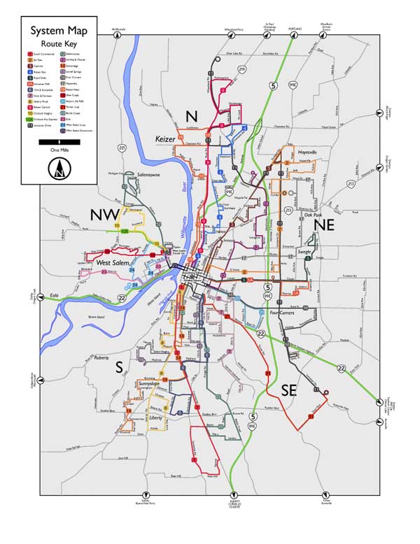
The primary informational point of the map, the lines, are numbered and can clearly be seen, but they have, in Salem, historically had names, and the names are important too (as well as give the map a local character. They have cool names such as "12th and Sunnyside", "State & Fairview", "Laurel Springs", &c. This information is also prominent on the signs of the buses themselves, so the cross referencing is important on the abstract informational level.
So, I set about making a route list, and the best way to map the information in the key box to the information on the map itself is to copy route number icons from each route on the map and match it to a one-to-one list. The first illustration shows how I've done it. There is also a scale bar, to give the reader an idea of how much distance a mile actually is (as well as give anyone using the map a way to ballpark how much time they'll need to get to the nearest bus stop) and the required North arrow (because nothing says map more than the presence of a North arrow). The North arrow is also created as an Illustrator symbol and saved to the symbols palette.
I also wanted to dress up the frame that I laid in behind the map in the last step (though I hadn't mentioned it, the map is easier on the eyes when the background is neutralized, thus the gray tone of the background box). I also had a little problem: the ends of the paths were, of course square with the axis of the paths, and that made it feel unfinished.
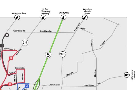
The answer I arrived at can be seen above. Taking the N out of the North arrow and scaling it down, it was a simple matter to lay them on the map margin, and with destinations beyond the map indicated, it becomes a way to give an idea of Salem's place in the region (as well as, with the routes to Oregon Garden, Oregon Coast, Silver Falls Park, Detroit Lake et. al indicated, a quick guide to regional attractions).
After distributing these appropriately around the edge of the map, I have the following:
 Once again, I have to say, I like the progress of it so far. It's really looking kind of slick, I think.
Next, I'll be adding some more key information–as well as starting work on an inset map for downtown.
No comments:
Post a Comment