1653.
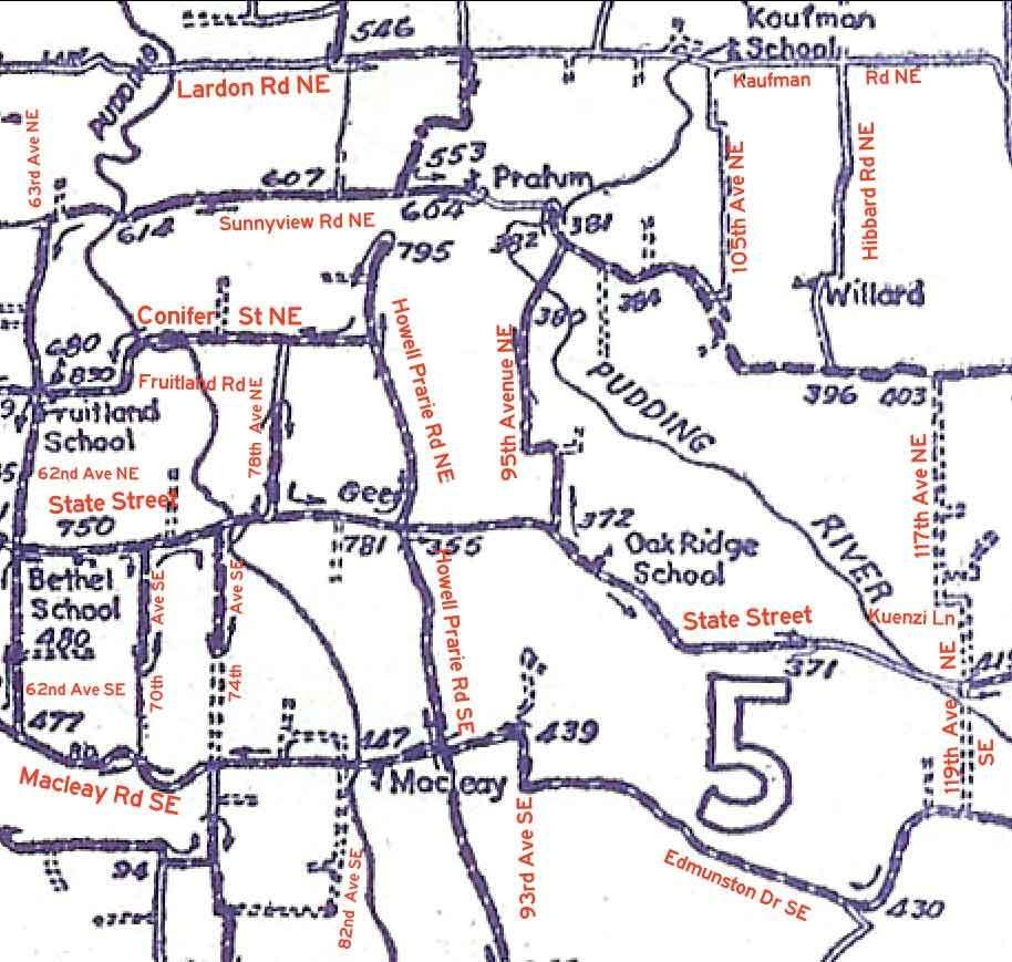
A few days back I posted a map of Salem Rural Routes around the year 1956, and commented about it. It just occurred to me that what might be crazy useful is what some of those roads are called today. Peforce, the following map, with modern street names in red FHWA-style type:

For those needing exterior references, the modern east boundary to Salem is about a mile to left of that area. Silverton is about 2.5 miles off the northeast corner of it.
Tags: oregon history, marion county history, salem history, maps, Address_Nerd
Powered by Qumana

No comments:
Post a Comment