Showing posts with label or_geography. Show all posts

02 January 2008

[or_photos] Silverton, Nexus of The Eastern-Mid-Willamette-Valley

1221. Welcome to Silverton, Oregon; gateway to Silver Falls State Park; Birthplace of Homer Davenport. Here we have the corner of Water and Main ...


A picture postcard if ever I've seen one.

The one thing that you notice when you're in downtown Silverton ...


Is that there seem to be signs ...


Pointing you just about everywhere.


Indeed, is there anyplace worth going to that you can't get to from Water and Main in Silverton?


Our advice: if a Silverton Police officer pulls you over downtown ... just don't tell him you didn't see the sign.

Tags: , ,

04 December 2007

[or_geography, or_roads] State Route 551

1171. One of the few signs or a post-2002 State Route badge–once simply the cutoff route to State Route 99E between Aurora and Hubbard, and Canby via Arndt Rd and Knights Bridge Rd:


Taken on the shoulder of I-5 just before the exit, in less-than-optimum conditions. The "To" banner enables identification of the route but obviates (until the signage is updated at Exit 282A) the need to get a whole new sign up just now.

This was the highest-numbered Route in Oregon before they got shy about a certain "below the Beltline" reference.

Tags: , , , ,

[or_history] Come Hell or High Water: Welcome Back To The 1940's

1169. This weather event seems to be promising to be more significant that the 1996 floods, in terms of all-around damage and overall mayhem and chaos. Withal, we've heard that, amongst other things:
  • Interstate 5 is closed at Chehalis and the main rail line in western Washington is buried in mud at several points, closing access from Portland to Seattle.
  • Every major state route from metropolitan Portland to the Oregon Coast (State Routes 18 and 22 to Lincoln City and Newport, State Route 6 to Tillamook) as well as US 26 to Seaside are closed for at least a few days.
  • US 101 is compromised in at least a few places in the annual "Will the Coast Highway Remain Open During the Storm Season" crapshoot.
  • Tens of thousands of people remain without power or communications on the north and central Oregon Coast (we note that Chinook Winds casino in Lincoln City is open and providing some temporary shelter to locals)
  • Last we heard, Vernonia is utterly cut off–it's a hassle to get out, and darn near impossible to get back in.

Here at Sonnenuhurhaus we, on the other hand, are plagued with a mere roof leak. We shall not bemoan our bad fortune in the light of others.

To the point, though, the news of coastal communities cut off by the vicissitudes of weather make us think more of a time about fifty or sixty years ago. You see, to anyone born later than 1960, facilitous access to any community in Oregon by road is taken as read. Until the 1950s though, this was hardly a given, and even before that, wintertime meant the closing of passes and the general cessation of cross-mountain travel for quite a bit of the popuation.

It wasn't until the 1940s that the Oregon Coast Highway, US 101, then called the Roosevelt Highway, was completed. Before then, family folklore has it (The Wife™'s grandparents lived in Newport during the middle of the 20th C) that it was quite common to use the beach to motor from one town to another where conditions allowed. Before the 1930's, when Conde McCulloch's gracious bridges graced our coastline, ferries plied the coastal bays.

Even as late at 1960, the route to Salem we all take for granted–Interstate 5–was a road interrupted by a ferry crossing at Wilsonville. Now a wide spot on the left bank at the end of Boones Ferry Road, Boone's Ferry (pictured here in 1952 hard at work) connected motorists of the Wilsonville area to northern Marion County's extension of Boones Ferry Road. The completion of what was then called the Baldock Freeway spelled the end of that crossing.

I think what times like this give us (or at least those of us fortunate enough not to have to endure a power outage, a living room full of Johnson Creek water, or a tree through the roof) is the chance to really experience what it was like to not simply be able to assume that there was always a road there. This is what they mean when they said your tax dollars at work when they were building all those roads, and why road taxes are important: they'll make sure you'll have a road waiting to take you where you need to go, whether you need to go or not.

It's kind of a grounding sort of thought, which we'll turn over in our minds while we wait to hear that we can get through to Seattle along Interstate 5 if we so choose–or not, if we don't care to.

(NB: 1952 photo of Boone's Ferry from ODOT History Center page)

Technorati Tags: ,,

29 November 2007

[sign_design, info_design] County Highways in Oregon

1162. One thing not seen often in Oregon are signed county routes. I think this is unfortunate, because having county route numbers are a really nifty way of instilling terrior, a sense of place, and saying "follow Country Route 3" dispenses with all sorts of "go left here ... or was that right ...no, wait, start over" monologue that even I (and you can't get me lost very easily anyhwere in the Valley north of Corvallis) tend to get into (the brain is a funny thing).

There is one county in Oregon that implements a badged county road network, and that county is Douglas. It's a little hard to find maps with the route numbers on online–I do have a map of them, but that's off the official Douglas County map of 1990, an illustration of which is at left (click the map to embiggen).

The county road shield is a standard one: gold FHWA-style type on blue field, an irregular pentagon taller than wide, with mitred corners on the bottom two points and rounded corners on the top three. I've created what Douglas County Route 1's shield probably looks like.

I think one Good Thing to Do™ would be to institute a county route badging system in Oregon's counties, at least the Willamette Valley's. People who still complain about finding their way around Portland (even though it's largely simply laid out) would do with a City Route system (such badging regimes already exist in Winnipeg and Charlotte NC (though Charlotte only has the one badged route, Charlotte Route 4, but they personalize it with a city logo, which makes it kind of cool). This may become important in the near term as we seem to have this mania for renaming roads ...

We'll come up with our own design for those presently. Marion County, with trunk roads converging on the capital city, has particularly interesting numbering possiblities.

Tags: , , , , , , ,

25 November 2007

[meme] ZehnKatzen's Weekly Winners #2: Sleepy State Street, Salem

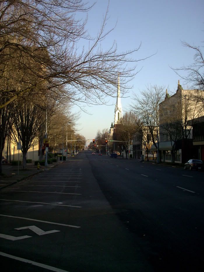
1150. For this week's winner, I chose another photo of downtown Salem Oregon late on a Thanksgiving afternoon:

This is State Street, Salem, looking east from Liberty Street, approximately 3:15 PM, Thanksgiving 2007.

No, there aren't a bunch of invisible people there. Downtown Salem is that empty after hours and on holidays. Now, as I've said before, I'm very fond of my capital city. I grew up in Salem and was born just up the road in Silverton. Salem is in by blood and my background.

But it is a city of 150,000–but by this photo, you wouldn't know it. Practially everyone has, literally, gone home. The Lege is the biggest show in town, and that only happens once every two years.

That's Salem for you. Great place to be from.

Salem: Oregon's Tacoma.


Technorati Tags: ,,,,

23 November 2007

[liff, or_photo] Liberty Street, Downtown Salem, Thanksgiving Day Afternoon, 2007

1148. Liberty Street NE, Salem, the throbbing heart of the state capital, at about 15:30h on Thanksgiving day, 2007:

I was standing in the crosswalk on the north side of State Street facing north up Liberty. That first light up is Court Street NE; the next one up is Chemeketa Street NE; then there's the skybridge over from JCPenney to the Salem Centre mall; I give you Oregon's second (or is it third now) city on a holiday afternoon.

Now, Salem gets a lot of insults for being such a small, sleepy town. I'd like to say that, having grown up there, it's not a bad place really, People are as friendly as anywhere else in the Willamette Valley; Salem is a cute town, comfortable, pleasant on the eyes.

But take it as a clue that a lot of us–residents as well as expats–call it Snailem. And take it as a huge clue that despite standing in the middle of one of the principal downtwon shopping streets, at the crown, I was never in danger of being hit by any car–not once.

Roll up the sidewalks? They never even got them out for the day!

Technorati Tags: ,,,

10 November 2007

[liff, or_geography] The State Hwy 69 That Wasn't-Well, Not Quite, Anyway

1103. The story of the Secret Oregon Highways isn't one of mystery and myth, but something rather more prosaic.

For some odd reason, Oregon highways have always carried two numbers. One, (which everyone knows about), and what we all call the "State Highway" number, is what ODOT calls the Route number (which we will hence designate with the notation "OR"). That's like the OR 99E on McLoughlin Blvd, SW Pacific Hwy in Tigard being OR 99W, OR 217, and such as that. Those are Routes. The other number, the actual Highway Number, is the so-called "secret" number (along with a specific name) that ODOT assigns for internal record keeping. Such roads are unsigned (N. Portland Rd and N. Marine Dr here in Portland form what's called Highway #120, or the Swift Highway) and signed (Route 99E, is Highway #1E, Pacific Highway East, and US 26 west from town is Highway #2W, and its offical ODOT name happens to be the Sunset Highway). Some Highways have more than one Route number; Highway #140, the Hillsboro-Silverton Highway, is signed OR 219 from Hillsboro though Newberg to Woodburn, and OR 214 from Woodburn to Silverton.

Why anyone anywhere should see a logical connection between Hillsboro and Silverton kind of escapes me, considering the geography, but there it is.

Anyway, I told you all that to tell you about this...

Back in 2002 someone in ODOT, apparently annoyed at all the un-badged state Highways, decided that this should not stand, and every unsigned state Highway would henceforth be Route-badged with the Highway number (for instance, sometime in the near future there will be a signed OR 120 in north Portland). Any already-badged highway would, of course, keep its orignal Route number. The great exception is any Route whose badge number would conflict with an existing route somewhere else in the state would have a "5" affixed. This is why the Hubbard cut-off, which wyes off I-5 just south of the Boone Bridge at Wilsonville now is OR 551; its ODOT designation is Highway #51-Wilsonville-Hubbard Highway, and there's already a OR 51, connecting OR 22 just west of Salem to Independence.

Until recently, OR 551 was the highest-numbered Route in the Oregon system. Then, after some thought, came the Beltline Highway.

Eugenians know what that is. For those who don't, the Beltline is a slightly-misnomered road. It does only about a quarter-orbit around Eugene but forms a pretty effective bypass around the northwest side of the city, from the outer stretches of West 11th Avenue to I-5 just north of Eugene/Springfield's Gateway district.

The Beltline Highway was also in the ODOT inventory as Highway #69-Beltline Highway. Badging it with the Highway number would make it OR 69.

From 2002 until now, the Beltline has remained unsigned, presumably because ODOT figured it had better things to do with its money than replace Route signs that are constantly being nicked by the dirty-minded.

Thus, as KVAL-TV's website explains here, despite that we have no OR 69 (and that we wish to keep it that way) we have OR 569–ready for primetime, and no naughty connotations to speak of, showing once again that government can take all the fun out of just about anything–which is the only valid reason, I think, to object to teaching sex ed in schools, but that's taking it really close to the edge, mah people, so I think we ought to leave it at that.

Note to road geeks–perhaps the best website about the Oregon Highway System is ORoads, which we have bookmarked, and we suggest you do, too.

Safe and sanitary dreams, peoples...

NB: the piccy was nicked from the KVAL article illo.

Technorati Tags: ,,,