27 February 2020

North Portland Roads and Highways

3610
Herewith, a little trivial crumb that you can use to win bets and amuse people at parties, if they were the parties that existed and the sorts that I would attend. They involve Portland street names, because that's the way I roll.

1. NE Portland Highway. There is a road near the margins of North and Northeast Portland called Lombard Street. This totally like the Lombard in San Francisco, except ours is very long and doesn't go up hills and is in fact made of long, straight segments. Except for that, it's just like SF's Lombard Street. In as much as it's a street. It's also badged in the US Hwy System as US 30 Bypass and is one of the principal arterials across the north side of the Rose City.

First, a necessary digression: ODOT, as I may have said elsewhere but maybe is worth repeating now, has a way of numbering state highways that does not coincide with the posted highway numbers. Also, in the vulgate parlance, when someone says 'Highway' or 'State Hwy', what we mean is the route number, that is the one you'll see on the signs. What locals call Highway 213, which runs from the east side of Portland through Oregon City, the farmlands of Clackamas, past Molalla, through Silverton and into Salem is known, from Portland through about Silverton as State Hwy No.68 - Cascade Hwy North, and from there through Salem as State Hwy No. 160 - Cascade Hwy South.

Think of it like a catalog number. You'll order a Deluxe Whizzit with extra froom-froom rom Whizzit World but they also know it as Catalog No 67-325. But you wouldn't call it by Catalog number.

So! Since the posted route number is technically a State Route, and in this case an Oregon Route, when, in times future, I talk of a state highway by its route number, the nomenclature will be, in this case, for Oregon Route 213, OR 213. We don't say State Route or SR here, that's Washington, folks. Get it straight. We used to escort people back to the border for that.

Anyhow, and to get us back on course, the reason I told you that is because, even though Lombard Street isn't a Oregon highway route, it's maintained by the state and is classified as an Oregon highway, No. 123, as it would occur. And those viewing maps or travelling down this road east of NE 42nd Avenue but west of where it merges with NE Killingsworth will notice it goes by a particularly generic name: NE Portland Hwy. 

While I don't have any way to run down why those who decided decided to change it where it is, I can tell you that the state's name for this highway is the Northeast Portland Highway. As State Hwy No. 123, it runs from Saint Johns, starting just across the river at Hwy 30 via the St Johns Bridge, all along Lombard Street and along Killingsworth and Sandy out to Troutdale.

But for that part between 42nd and approximately 72nd, where the city apparently decided adopting ODOT's name for the road was enough, and convenient too; it already contained the directional.

2. N Portland Road. Going north out of the Saint John's neighborhood, there is a road that runs along the railroad embankment from approximately where N Columbia Blvd goes over N Columbia Way to the south shore of the Columbia River at N Marine Drive. It's called North Portland Road. As Eugene E Snyder tells us, that was so named because there is a station along the railroad (the railroad equivalent of a wide spot in the road, trains never actually stopped there) which was itself called North Portland. When the street namers went out that way it must have seemed natural to call it North Portland Road, as it went out to that place, but when the Great Renaming came round in the 1930s, as the road itself would fall in the North quadrant, calling it North North Portland Road must have seemed a bit goofy. Once again, the historic name handily provided the necessary directional.

It too is a state highway: Hwy No. 120, Swift Highway ... not because it was a direct route into the area from the nearby stockyards, but because that used to be Portland's meat packing district, and Swift was the largest company. We also have a N Swift Street in the St Johns area dedicated to that memory.

State Hwy 120 is also one of the many unsigned state highways that adopted those numbers as state routes back in 2002. The majority of these are still unsigned; one not otherwise informed would never know a priori that N Portland Rd was also OR 120. Presumably ODOT's priorities lay elsewhere and, the way things are going in government these days, I wouldn't be the least surprised.

26 February 2020

Wy'East and Classic Chevy

3609
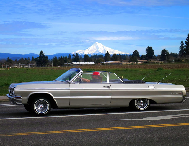
During a voyage involving periodic care for Olivia, we were out 122nd way by Rossi Farms. We got pictures.


We also got a sweet picture of this mid-60s Chevy Impala. They go well together.

Don't Call Me A "Trekkie". I'm Not Quite That Good.

3608
Conversations with strangers can spark strange trains of thought.

Follow me down this path if you will

On the intentionally-overpopulated left lapel of the tattered suit jacket I insist on using as daily street-wear (I am for being a semi-feral middle-aged guy and I take this most seriously, I tell you true), up at the top, is a brass-toned emblem which has come to be known as the 'Starfleet Delta'. Most non-Trek fans I know know it aptly as the chest communicator wearable device in Next Gen and forward; prior to that it was a chest patch on the classic Trek unis.

If you need any more introduction than that, welcome back from your desert island, friend; there's probably an orientation session for your re-entry to society and you should be running along to that and, BTW Nixon was impeached, o-yes-where-was-I? Oh.

This has a sort of pride-of-place at the top of the button-and-pin cascade of what other people would call one's left jacket lapel. I have three of them as personal posessions: One with the Engineering division logo, one with the Science division logo, and this one, with a lower-case gamma. This was inspired, I believe, by the cover sheet to the "General" section of The Book (the Star Fleet Technical Manual, my nick name for it vocally rendered in the style of Vic Tayback's character in "A Piece of the Action", please and thanks) which showed the Delta filled in by that same character and, though never an actual division insignia was adapted as such by the maker of the pin.

I don't have a Command division insignia. I never was the Captain type.

But when I was dropping cans as the Bottle Drop over by 122nd and Glisan, which I can do now that we're Olivia re-enabled, a person waiting on-line to get in at opening called me a Trekkie and we discussed things Trek for a while and I had a thought about that, because he asked me if I was, in fact, a Trekkie, and I realized, in that moment, that I couldn't quite wholeheartedly think that I really deserved to be called that.

Understand this: I am a fan and adore Star Trek, will do down to my dying breath on this tiny planet. It's not that, as in those days when your Trek-fan might clear their throat and insist "I prefer Trekker, thank you." I've always loved the term and never saw it as an insult. Caught every Trek re-run back when that was the only Trek  there was to have. Even owned a copy of Mission to Horatius.

No, I am reluctant to accept the label because Trekkies are a higher form of fan than I am. I have yet to watch any Discovery or Picard; as a matter of fact, I don't much care for the de-democratization of Trek that streaming channels promise to bring us. But sometimes the best thing I can do is watch an episode of TOS (even the crappier episodes). Star Trek: The Motion Picture is still one of my favorite movies, even though maturity has brought me to terms with the fact that the story was pretty lame (even then, though, I was figuring nice try kicking your game up to Star Wars level, guys ... If you would have told me that movie was the root of a sprawling franchise I would have thought you mad).

But I know people who Trek harder than me just getting out of bed in the morning. I admire and respect them. 'Tis they who deserve the rubric of Trekkie ... not I.

And I'm Okay with that.

13 February 2020

The 1994 Map Of Silverton, Oregon

3607
I've been on a deep dive through more than 20 years of collected paper ... maps, many of which I've collected, a great deal of which I've drawn myself, because city maps were always a passion for me.

I'm proud to call myself a Portlander, but my birthplace, along with several greats and other near-greats, was (and still is) a place called Silverton.

When I was a kid, life was not always kind. I was the bullied one, that one in every class, the one that kids let new kids know about so they have a head start on it.

That was then. I lived. One of the things I did to make me feel good was to deep dive into maps. I soon discovered I was transfixed by the patterns of streets, the way they ordered themselves amongst each other, the shapes and patterns of blocks, the shapes created by the city limits and the way the pattern of streets lived withing them. And, perhaps in what I should have seen as a presage of blunted ambitions, just as I got to the grade in Mark Twain Junior High (as it was then) and was in the middle of a class on how to draw a map of Silverton ... that's when we moved to Salem.

It's okay. It is what it is, or what it was. I wanted out into the wider world anyway; Silverton, as it was, was a small, stifling place. Had I been born there and grew up in the Sliverton that exists today, I may well have stayed. It's certainly not the same place.

But as you can take the boy out of Silverton, you cannot fully take Silverton out of the boy, and there is a corner of my mind that remains posessed of the place, the rearview seasoned to a large degree by the sepia tones of nostalgia. The parts of my childhood in Silverton that were kind? They were quite nice. We lived in a house on the edge of town a road that still has an awesome name (Steelhammer) and I had a bedroom that had a dormer window that looked east across the fields north and east of town. My mom worked her tail off; we never felt poor. On clear days, Mount Hood/Wy'east  could be easily seen, starting a visual love affair that continues unabated to the present day.

In 1994, still nurturing dreams of becoming a drafter or somehow working my way into drawing city maps for a living, I took an ODOT map of Silverton dated 1986 and created my own. Here's what it looks like:


This is Silverton very close to the way it was when I was in elementary school. Things changed very slowly in Silverton, if and when they changed at all: comparing this map to a modern map shows the city boundary flung out considerably in just about every direction, encompassing a couple of wholly new neighborhoods on the east and south edges of town; especially on the south and west to rope in the Oregon Garden (if you had told me as a kid that Silverton would eventually become a tourist destination, I'd have thought you un-sane). Silverton as I knew it scarcely had more 4,500 people; now there are more than 10,000, and it has become a hub of art and culture.

You know how you feel when your ex goes off and finishes themselves and become magnificent and your still struggling to get your stuff together? I know what that's like, only it's with my old hometown. Anyhow.

Here's a detail of the city center:


Starting from a primly-gridded downtown and city center, Silverton just grew any old way it pleased. The leg-shaped extension of the city going south was constrained by the narrowing valley that Silver Creek flowed out of. The grid tried to right itself on the east, but just kind of straggled up the hill on the west; the northwest corner of the city seemed to have its own ideas. North Water street became an east-west street. And up near a mill on the north edge of town which had become a manufactured-home plant by the time I existed, a tidy 3-by-4 block grid became its own neighborhood: Milltown (which, as it happens, was what Silverton was called before it was called Silverton).

And this is a detail of my side of town:


If you follow East Main Street to where it ends there at Steelhammer Road, and follow it south past where Reserve Street ends, there's a segment between Reserve and the bend where it becomes Evans Valley Road which is where my childhood home was, about dead center in that segment. The house I was a child in still exists, but there is what looks like an upscale cabinet maker there now. in the area south of Reserve and between the city limits then and Steelhammer/East View Lane that was an absolute blank and as I knew it then was a bramble-filled gully is now a capacious subdivision full of what I can only assume are fairly-expensive homes, all of which have been annexed into the city ...

... except for my old home. The city limits dance around it. Still just outside of town. I find this too cosmically funny to put into any effective words. Never mind the glandular subdivision that's sprung up at the south end of town, around the intersection of Hwy 214 (South Water Street) and Ike Mooney Road.

The area I lived in there was called by adults East Hill (West Hill being the opposite side of Silver Creek, where West Main Street ascended the heights) and was called by us kids Danger Hill: at the foot of it, just east of Third Street, where East Main ascended in about a 5% grade, a red diamond sign proclaimed DANGER and a rectangular sign below it explained HILL. Danger Hill. I don't know how they deal with it these days; those houses on East Main between Fifth and Rock, which are perched on that slope, must have some pretty nervy days when its icy or when the snow that seems to visit us more often comes to pay another visit.

Sic transit gloria iuventae, and all that. So it goes.

Vanport, And All That Came After

3606
Last evening we saw an oral history presentation at the Midland Library called "A Place Called Home: Vanport to Albina", presented by the Vanport Mosaic project.

It was quite an experience.

I expected an informative Portland history experience, and that's what I got. Got more than that, though, much more. The presentation was well-attended, and a great many in the audience had histories stretching into Vanport ...

Vanport is a thing that can be Googled and read about in books. It was, for a short time, one of Oregon's largest towns. During the years of 1942-1948, it housed literally tens of thousands of people who came to Portland from all over the USA to work in Henry Kaiser's shipyards. What it physically was was a housing development on the floodplain of the Columbia River between the Columbia Slough and the river's south bank and running east from the railroad embankment to Denver Avenue and today's Interstate 5. The footprint of Vanport (so named because it was shimmed between VANcouver and PORTland) is still visible between the river and the slough, the railroad embankment and Denver Avenue; some of the streets of Vanport were evolved into parts of the track at Portland International Raceway.

At the end of May, 1948, the railroad embankment - which was holding back a historically-swollen Columbia River - gave way, letting waves of floodwater rush in. The buildings making up the houses of Vanport - inexpensively constructed, on inadequate foundations - floated about like toy boats in a bathtub. In just a few hours, Vanport became a "Dead Memory of Portland" decades before such a thing became cool. The residents, a large percentage of whom were not white, suddenly found themselves having to sink or swim, socially and economically, in a city that to this day is still renowned for being Caucasian AF. Discrimination and redlining put them in the North Portland neighborhood known as Albina and set the tone for decades of race relations in Portland.

The presentation was one of stories. Stories from those who survived the flood and went on to forge lives in Oregon and Portland. They were personified in the flesh by Velynn Brown, a granddaughter of Vanport survivors and a grandmother now herself; she told the story of community handed down through the generations with warmth, emotion and undeniable passion, family, and basketball rivalry ... the longstanding crosstown struggle between Portland's Jefferson and Grant High Schools being a contest that would stand up in furiosity against any big-league tug-of-war.

The real impact for me was all the living history in the room. There was an elderly Japanese-American couple there; they not only were interred during World War II but landed in Vanport because, as Americans of Japanese descent, it was the only place that they could go. Harvey Garnett put in an unexpected appearance: it was he who owned and operated the only black-owned movie theatre in Portland (and perhaps America), The Alameda, which we know today as the Alberta Rose Theater at NE 30th and Fremont.

In the 1970s, the Williams Avenue commercial district was displaced when the Portland Development Commission's plans to allow Emanuel Hospital to expand throughout that area were executed, a move that destroyed Oregon's black downtown. It's one thing to read about this thing, but it's a palpable thing when all those descendents of Vanporters are watching too. They're seeing their own pasts and it's as though all those people who lived in those times were there with you too, eager to tell their stories to those who would listen.

After the event, oral historian Velynn Brown converses with
Harvey "Mr. Alameda" Garnett


There were just three white men in there, and I was one-third of that. Never fear, White America, one of us White Men bravely and compassionately informed the presenter that it's also important to remember that there were people of other skin colors and while the black experience was important, maybe from here we could all move forward as one. That is to say, he brought nothing; the presenter handled him with respect and graciousness. I just wanted him to stop talking. From this I received the takeaway that while life may offer one numerous opportunities to speak out, it offers us infinitely more opportunities to constructively shut the fuck up.

Velynn Brown and Harvey Garnett


This also taught me another thing. Vanport Mosaic is practicing what they call memory activism, which seems to be the idea that remembering what happened to those who came before us can actively reshape the present.

What I really learnt tonight that was valuable was not only all that I've maundered about but also this: listening to marginalized voices is resistance, and remembering their stories is a political act.

I recommend it to those who wonder what they can do in these times of great dexterity.

The Vanport Mosaic Project's online home is https://www.vanportmosaic.org/.

05 February 2020

The Prodigal VW

3605
Today, Olivia returned to us.

Seven months ago, more or less, this was the scene in front of Chez ZehnKatzen:


The beloved Olivia, bricked engine and all, being loaded on a flatbed for the transit to repair.

This is about 7 months ago, when Olivia was being transported over to FixUm Haus on North Lombard, about 13 miles away (Portland feels like a small town until one has to get across it). Danny from Team Towing did the work and, as I said on the blog, if there's a more squarely professional driver on this earth I've not met them yet. 

Coming home from FixUm Haus was bliss in a very real way. Lombard turned to Portland Highway to Killingsworth to Sandy Blvd, then south on 122nd to the home ground. As pleasant as all that was, the part of the drive on 122nd was absolutely the best.

But, alas! I had left the exported tool bag (with my car stereo's face place) home. No matter. I sang Al Stewart songs. "Lord Grenville", "Time Passages" and "On the Border".

That last one twice. It's amongst my favorites.

My singing voice ain't half bad. Maybe I should have done that for a living.

And so it goes ... vroom vroom. Fahrvergnuegen, and all that.

Bus Stop

3604
The access point to homeward-boundedness, during the interregnum.


I got to knew TriMet very well during the time without a VW, and this will stay in my mind as a fond memory.

02 February 2020

When Your Transit System Pins You

3603
During the past several months I've been Olivia-less, I've been using TriMet to get to and fro in my workaday travels. I do like to collect the pins for the lapels (I'm becoming one of that sort of olding) and one of the bus drivers asked if I'd like a pin and, of course, being the anthropomorphic corvid that I am, said yes.

A couple of weeks later, she bestowed upon me this fancy:


The logo for TriMet's new 24-hour SErvice lines, the closest thing the agency's had to an 'Owl' route since 1986. There are three lines that run into the after-hours zone: 57-Forest Grove/TV Hwy, 20-Burnside/Stark, and 272-PDX Night Bus. Strictly speaking, the 272 isn't a 24-hour run; it has three or four round trips connecting to the 20 near 82nd and Burnside in the Montavilla nabe and letting you get to the 'port during the hours when MAX isn't running.

It's scant but important, I'm hoping it's the beginning of a trend, but if you need to get to the airport and you live on a straight line between Forest Grove and Gresham then, buddy, your never more than 60 minutes away from a TriMet ride.

24 hours a day.

And I have a memento.

01 February 2020

Darkness Over Parkrose/Sumner TC

3602
Also in the last couple of days there was some dramatic cloud cover serving as a very dramatic backdrop to the Parkrose/Sumner Transit Center.


 It made the old-fashioned neon at the Jim Dandy burger dive, a fixture in this area since the 1940s, stand out with the warm-hearted nostalgia that is built into such a thing.


 Though there are four pullouts on the south side of the transit center drive, only one is a bus stop ... this one. The 71-60th Avenue and 73-122nd Avenue are the west and east halves, respectively, of what was once a single route: the 71-60th/122nd. You now have to transfer to use the whole route, though if you're travelling the whole thing, you're doing this big inverted U across Portland's east side, which is not something a commuter's likely to do.

The two routs alternate stopping here, while the others that serve the route layover in the three pullouts behind it. It's a frequent service line, which means that you aren't late for one (unless that was the one you needed), just early for the next.


The Magic TriMet Anniversary Bus

3601
This year, 2019-2020, is the fiftieth anniversary of the creation of the Tri-County Metropolitan Transportation District of Oregon, or, as we've called it, TriMet; Portland's very own, trendsetting, multi-modal wonder.

TriMet has tied the three counties of the Portland Metro together since about 1969, when it was formed from the remains of, amongst other things, a private transit company called Rose City Transit. Back then it as just buses; these days, it's everything except planes.

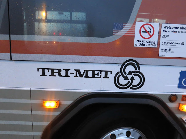
Back in those days, the buses were pretty plain. You, can, if you're lucky, get a look at what it was like, because one of the buses is wrapped in the livery of those days: a utilitarian orange, white, and silver, with the original logo design on.

I spotted the anniversary bus one morning recently at the Parkrose Sumner TC, running on line 71-60th Avenue:


The paint job looks pretty solid, and the trick of the windows is like those graphic screens that restaurants like Denny's use to put an ad on the window and still allow you to see out. It's really obvious when it runs past you and the interior lights are on when it's dark out.

As memories go, also ... it's a pretty pleasant one.