Showing posts with label Silverton. Show all posts

11 April 2024

Silverton's Crows' Nest

4127

Even if you're in a town as modestly-sized as My Little Town of Silverton, you might miss something if you don't look up when you would otherwise be looking down, or sideways, or whatever.

Now, I will cop to a bit of disingenuity here. As we are finding out about one of The Most Oregon Places That Ever Existed, Silverton has enough architectural quirkitude and charm for a town many times its size; that's what happens when you let the old buildings stay and don't break your neck trying to remake the place in a fashionable mode (yes, Eugene Field School is no longer there, but that was a sad necessity). Indeed, Silverton's architectural vicissitudes are east to spot ... but sometimes, you do have to trouble yourself to take a moment and look up

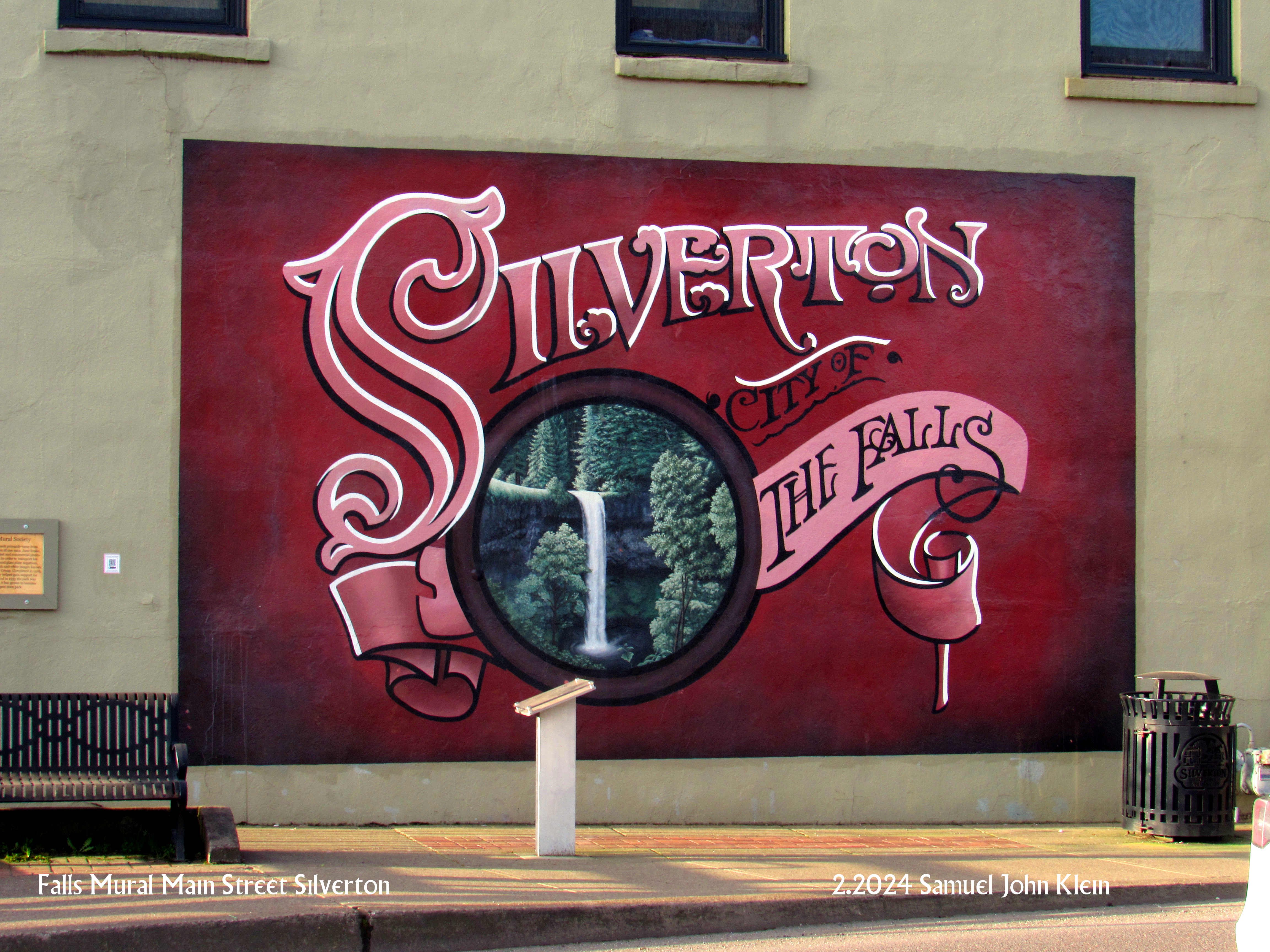
The facade of the Palace Theatre, with its Art Deco detail comes immediately to mind, but a half-block south of that, on the same side of North Water Street, there's, this:


Stand in front of Mac's Place, turn south, and look up, and there is this enigmatic cupola perched on the northwest corner of the Wolf Building, which I've mentioned before, just a few articles ago.

Now, I was born in Silverton, and lived there until my early teens. And I knew the Wolf Building, remembered Hande Hardware and its wood floors. I was borne of ancestors who had lived in the area since the 19th Century. I guess I knew Silverton about well as any kid would, but it wasn't until I was an adult that I knew that crows' nest even existed. 

And now I'm hungry for a look out those windows. And I know of no other town that can claim a weather vane on the peak of the tallest building in town, but there it is. Silverton, you never stop surprising even this jaded former resident. 

It's true; Silverton contains enough architectural wonder of more than one Silverton, but the Wolf Building contains enough design interest for one Silverton, one Molalla, a Gervais and about half a Scotts Mills.


06 April 2024

The Wolf Building, The Antique Heart of Silverton

4121

I've picted this building before, but it was a Creative-Commons pict. This one is copyright mine, mine, ALL MINE. 

Adolf Wolf is another one of Silverton's small gods. Silverton's city center is loaded with historic architecture and the more I think about it, the more this building must be considered one of Silverton's crown jewels that way. It has immaculate cast iron detail (which I enthused about here). It was erected in 1891 which, I think, makes it the oldest extant building in Silverton:

I remember it as a boy for Carl Hande Hardware, continuing the mercantile tradition Wolf started and marketing implements to the little farming metropolis Silverton was at the time. Of course, just like every charming old building in Oregon currently, there's a bisro there, so there's that.

The biggest charm in this image is the lovingly-preserved painted ad on the Water Street side there. 

And I might be a little sarcastic about it all, but if I wanted to open some creative concern and brand it with Silverton's charm and quirk, I'd certainly consider the second floor of that building. 

The Covered Pedestrian Bridge, Silverton

4120

In the last missive (and maybe one or two previous) I made mention of the pedestrian bridge that connects Town Square Park, next to downtown Silverton and across the creek, to Water Street at Lewis. 

Illustrated here is the bridge if you aren't on it taking pictures:


The covered bridge is something personal to Silverton; one of the most historic covered bridges in the state, the Gallonhouse Bridge, is located about two miles north of here, just outside of town (follow First Street to Hobart Road, left on Hobart to Gallonhouse Road, and right on Gallonhouse to the Bridge itself, as we will do sometime soon). So this charming little bridge, which makes it all of a piece.

The Gallonhouse Bridge was named for what people would trade at that point, during Prohibition years. The nature of the substance traded in gallons is an exercise left to the reader, but I'm sure I've left enough clues that the reader can intuit it.

The trade may have involved an ancestor; my mother liked to tell me one of the things my grandfather, the first Samuel John Klein, did, was hide 'shine on his dairy farm, which was located northeast of town about halfway between Silverton and Scotts Mills.

It's a family legend which will have to stay that way, because of reasons. But it's a fun story to hint at.

04 April 2024

Town Square Park, Silverton, and My History Thereupon

4119

As mentioned in the last posting, there is a park in the middle of Silverton now, along West Main, between the bridge and Fiske Street, which is terribly charming and comfortable, and they call it Town Square Park.

It's roughly square in shape and goes back some 100-150 feet from West Main. If one goes to the south side of it, and looks north from the ramp to the covered footbridge, just past the war memorial, the view one gets approximates the picture, thenceforth and herewith.


This is a patch of ground I have intimate history with. I'll explain.

In the middle background, in front of that brick building (which at one time was the local phone company building and probably still is telco propertry, though not in the way it was when I was young), is a length of West Main Street that runs about 160 feet in length, give or take fifteen feet or so. And along that brief bit of road, if you drove west from the bridge, there were the following three buildings on that side of the street in this order:

  1. A building that looked as though it once provided services to cars which, even in my youth, looked dusty and disused for decades
  2. Hoyt's Grocery
  3. A gas station on the corner of Fiske that started out as Hancock and later was a Fina station.
Hoyt's Grocery remains a treasured, if attenuating, memory. My mother worked there for a few months while I was a toddler and we were rooming with my Grandma Klein on South Second in the months before we moved up to, and I commenced my formative years on, Steelhammer Road. And many times during that childhood we stopped in for this and than at Hoyt's.

It was the old-school kind of small market, unlike today's quick-shops, c-stores, and roadside markets: it was stocked with dry goods, a small selection of produce and meat, and essentials that you could stop for on the way home if you didn't feel like going over to Roth's or the Safeway. I mean, we knew the owners. They were sweet people. I remember old Lillian Hoyt, how she was just this sweet old lady who ran the grocery store with the assistance of her family, how she lived in the apartment in the small triplex that was tucked in behind that gas station on the corner. I remember how the sign over the front of the store had HOYT'S GROCERY in big, chunky, curvily voluptuous letters, the way that sign was bracketed by two big 7UP (I think it was 7UP, anyway) signs, and the way the front wall was actually set on a track and could be opened like a closet door if they had to. I remember the wooden floor of the place.

And now here am I, wandering through this park and there's no trace of those places. I hope pictures of the old grocery store exist somewhere. I'd like to see them again. 

And now here am I, wandering through this park and in spaces that I couldn't have walked to when I was small, and thinking about how we think as we grow aged the world moves on without us and we can think that way if we want, but we can also think that things change and the world does move on but it moves on with us as passengers and the views from the ride are actually quite lovely, if we accept what we see. 

Getting too philosophical means I've maundered a bit too prolix, and I should leave this here. 

And that I shall. 

The Back Stairs To Silver Creek

4118

We return to Silverton to get to know Silver Creek a little better. It's changed and gotten incredibly charming, and deserves the tarry.


Along West Main Street, just the other side of the creek from the center of town and Water and Main, is a park, Town Square Park. Quite a lovely place and with it I'm rather smitten. It is roughly square in shape, fronting West Main between the end of the bridge and Fiske Street, with a small parking lot at the corner and a charming public toilet (Portland has its Loos, but leave it to Silverton to make a public convenience charming), and at the south side of the park, the pedestrian path winds past a war memorial to cross a covered footbridge over Silver Creek that'll connect you back to Water Street a block south of Main.

If you stand on the bridge ... which has ample room for those who want to take it slow and absorb the charm ... and look upstream, in the general southward direction, you see this, a property on Fiske Street backing up to the creek itself and this stairway from that property going right down to the creek bank which is all so adorable I say, without trace of irony, that I can't even here.

It has occurred to me that the owner of that property is quite the fortunate person. 

It, and the presence of Riverfront Park in Salem, speak of a quantum leap in how Valley communities relate to the streams that flow through them. In Salem, as I said earlier, downtown ended for most of us at Commercial Street, Front Street was a railway-laced nightmare for your car's chassis, and riverfront access for downtown Salem was the veriest of oxymoronic things to say. Silverton's relationship with Silver Creek was similar though not as brutal; an unbroken line of buildings along the west side of Water Street made the creek a thing you glanced in passing over the bridge.

No longer. Silver Creek is still screened from downtown Silverton by the buildings but there are more and more personal ways to get closer, and Town Square Park, a lovely thing, which allows one to come right down to the side of the stream that inspired Silverton's name. 

27 March 2024

The Church at Second and A

4109

The subtraction of the century-old Eugene Field School building from the landscape of city-center Silverton has opened up sight lines that young me never even comprehended existed.

If you look grid-east and a s'kosh north from the corner of Park and Water Streets, the lack of a rather substantial building opens a line of sight two city blocks long.


The big white historic-looking building, which is the Trinity Lutheran Church, is at the corner of N. 2nd and A Streets. Google Maps says this is at a range of about six-hundred and thirty feet from Yours Truly, the photographer. N. 1st Street crosses the middleground at where that chain link fence is. The red brick building wit the multi-colored windows is the First Christian Church. The green space in the foreground is the lawn on the south end of the new Civic Center block.

When it comes to church in Silverton, if you want it, you got it. More church than you can shake a steeple at.

In looking around the town of my youth, I'm amazed at how wide my perception of the world has become. These places are mere minutes away in a walk, but since I couldn't directly see them when I was young, they may as well have been halfway around the world. Perspective widens with the altitude of age; it opens the world at the same time drawing it closer in.

Escher would approve of that, I think.

The Hitching Post at Water and Park

4108

This is a thing that exists in Silverton that refuses to explain itself.


Located at the northeast corner of Water and Park streets, on the north edge of downtown, it keeps its own counsel. It saw Eugene Field School come and go; it's watching Silverton's new fancy Civic Center sprout from the former schoolyard. 

It appears to be of the same vintage, if one can read such a thing on a small concrete obelisk with a hitching ring embedded, as the Stark Street Milestones here in Portland, possibly a minimum of a century old.

It's the only one like it in Silverton. 

And it will not explain itself to you. It owes you no justifications or apologies.

It does kind of miss the school building, though, as do I.

25 March 2024

Water Looking North From Main

4106

A look at Water Street, downtown Silverton, looking north from Main.

History still lives in small Oregon towns and, maybe I'm biased, but more so in Silverton than other Valley cities.

All these buildings were aging before anyone of us looking at it were even born. 

I had a pathetic childhood in Silverton that made me want to go elsewhere (eventually I got my wish). Well, time does heal wounds. Who wouldn't love this scene, or at least feel warmed to it? 

At the moment I can remain cozily in the midst of my beloved Portland and see Silverton when I can find the time. Best of both worlds, really.


24 March 2024

Curly's Legacy Cooler

4105

On the west side of South Water Street there's a charming little coffee dive (and I mean that in the most affectionate way) called the Silverton Coffee Station. 

It occupies what was once a filling station and auto garage, but if you know what to look for, that shouldn't be a surprise. The gas pull-through and the garage are separate buildings on the west side and south side, respectively, of a cement platform which is one way these properties were situate on the right bank of Silver Creek, which runs behind all the buildings on the west side of Water Street downtown.

The current service area is inside of what was once the garage, and this is where I spotted a certain historical gem.

The wordmark on the front, Curly's Dairy, represents a bit of greater Salem history that, in Portland, is approximated by the not-late but still lamented Alpenrose, though Curly's never got as big as that, but as a local staple, it was every bit of present. 

The main office was along Mission Street SE, on the south side, around about 23rd St SE. I just visited the approximate place where it was on Google Street View just now, and there is no trace of the dairy; that whole corner of town has been redeveloped beyond of the recognition of anyone who grew up in that area between 1978 and 1982. 

One suspects Curly's no longer exists or, if it exists at all, as IP owned and marketed by some out of state company nobody's ever heard of an whose name you'd forget in an instate if you did hear of it. But this gem remains, and keeps ice creams cool in a coffee spot where you can also find Allan's Coffee, which also makes it a location of notable worth. 


Silverton's Small God

4104

This was seen on the property of the Silverton Coffee Company, on South Water at Lewis:

And this, on the doorstep of the Palace Theatre, which I have just rhapsodized about:


Know ye of Bobbie the Wonder Dog? 

In August of 1923, a Silverton family visited Indiana with their Scotch Collie/English Shepherd mix in tow. During that visit, the dog, as the legend has it, was attacked by other dogs and ran off. The family, not able to locate their pooch by the time they had to return, did so, undoubtedly with hearts heavy with the knowledge that they'd never see their dog again.

Except he turned up again in Silverton n February of 1924, showing every sign of having physically endured a trek of at least 2,500 miles just to get back home to Oregon.

I've always said Oregon has this pull on natives. But then, if I found myself in Indiana, the first thing I'd probably do is try to leave, so there's me for you.

Well, in the way that things went viral in the 1920s this did, and not only was Bobbie a local hero but became a national celebrity for a short time, and in doing so cemented his fuzzy visage indelibly into local history.

And, as one can see, not only is he celebrated in one of Silvertons many murals, but also in at least two figurines, one about two blocks away from the other in Downtown, and making himself an excellent candidate for the patron spirit of the area: Silverton's own charming and relatable small god.

Silverton: dog is their co-pilot.

The Palace Theatre, Silverton, At Dusk

4103

The gem of town shines out as it once did, brilliantly at dusk, at Oak and Water Streets in downtown Silverton, Oregon, the kind of theater that's still the kind of place were you can walk in and imagine kids streaming in to get imagination fuel, for adults to come for entertainment. 

This is the Palace Theatre, Silverton, Oregon, year 2024.

There has been some sort of entertainment venue on this corner for more than 100 years. Before the Palace, it was the Opera House, which was destroyed by fire in 1936. 

The past few years for this old cinematic matron have been, if the news reports I've seen are an indication, a bit rocky. In 2012, fire seriously damaged the lobby. The venue got back on its feet, then the owners, one of them the inimitable Stu Rasmussen, had to give the business up. The succeeding owners were not able to keep the place alive and she closed again, and then the current owners came in and really pulled out the stops to get the place back into the swim.

The Palace re-opened for good this last winter with a run of the Timothee Chalamet Wonka film and has returned to stay.

The facade is a warm and cherished memory and, paint scheme tastefully highlighting its Art Deco design notwithstanding looks quite like it did when I was a lad, including the marquee ... although they do get bonus points from YT for that splendid sign centered in that facade. 

We much approve.

23 March 2024

Falls Mural On Main St, Silverton

4102

Another Silverton mural, of which I'll have a few in the next several articles, which is found on the north side of East Main Street between the end of the bridge over Silver Creek and the intersection with Water Street:

Silver Falls State Park is the gem of the state parks system, the crown jewel, the largest single state park ... it's to Oregon State Parks what Yellowstone is to the National Park system as far as a star player goes, and if you're in Silverton, it's not just in your back yard, it is your back yard.

If it weren't for photographer June Drake getting the ball rolling back in 1902, it might never have been, but then ... Silverton was always a town for photographers.


20 January 2024

Details of Silverton's Wolf Building Are Cast In Iron

4099

At the corner of East Main and North Water in downtown Silverton stands the Wolf Building. It was built in 1891, making it 133 years old at the time I'm writing these words. 

There's a district of Portland that this reminds me of, and it's the Skidmore/Old Town district. Decades before Portland began to grow into a Real Big Town, that area had architecture accented with wrought iron that was of exquisite detail; few examples still remain. The most prominent example is the New Market Theatre building. 

The Wolf Bulding looks this way:

The Wolf Building, 201-205 East Main St, Silverton Oregon.
Photo by Ian Poellet. Source.

The photo was taken by another photographer; I am surprised that I do not have one of the facade ... yet.

Adolf Wolf commissioned the building and set up a hardware and dry-goods concern. During my lifetime, it was the friendly, wooden-floored hardware store of one Carl Hande. Concordant with the general upscaling of Silverton over the years, it is now a stylish bistro. The upper floor currently has office space, if I understand correctly. 

Just as with many things of this nature, the eye is rewarded by closer inspection: at the bottom of those sunny yellow verticals in the facade are these fittings:


... all the way from St Louis, yet. Fancy.

The loving care with the facade continues over the sidewalk, too:


One thing about the local Kiwanis chapter; I think it's always met there.

That can be something out of Silverton Gothic: The Kiwanis Club meets Thursdays at 7:00 AM at the Wmlf Building. It has always met there.  

30 March 2021

A Street-Address Map Of Silverton, Oregon

3798

This is a major signpost in a process that's been developing all my life, really. I don't say this just to be dramatic although I do like to write as though I'm saying things to be dramatic.

City street maps have always been my jam, and, in a life full of plans that went nowhere, I'd say #1 of those was to become a mapmaker. No matter how you get those skills, and I'm self-taught there, there isn't exactly a place that accepts applications to be a mapmaker, and I am beyond shabby in my skills at making connections and networking.

I remember one time, many years ago, applying for a job with surveyors with the City o'Portland. I knew enough of surveying and mapmaking to get an interview, but I must have seemed like the most egregious poser because an interview is as far as it got. C'est la guerre, mon frere. But, during all those years, but not so much latterly (which the Brown Eyed Girl will tell you is one of my biggest problems) I dashed off a prodigious number of make-believe city maps, played with street grids, and all that.

The results are lost to time except in my memory, and I am incredible for map memory (as the Brown Eyed Girl will also tell you).

Early in life, I was born. This was a great relief to my mother who may now point out that if we did things according to my schedule, I'd have waited until I was, at a minimum, twelve. And that occurred in the Willamette Valley backcountry metropolis of Silverton. This was a peculiar place for someone obsessed with street layouts and address grids to be; McEachern's Silverton: the Morphology of an Oregon town hints at the amazing textual variety contained within Silverton's snowflake-like street plan - nothing regular about it,  a combination of little bits and parts that don't really mesh with each other.

The street grid of Silverton can be inscrutable even to the native-born. This is a point I plan on exploring going forward. It's been a curious trip. Anyway, my exploring this has resulted in the map you see embedded here: the first map I think anyone's ever made that sets out, nearly block-by-block the street addresses you can expect to find in Silverton, Oregon.

It's about a 2.3 Mb PNG and here it is:


To make it I hacked apart a PDF copy of the Oregon Dept of Transportation map of Silverton, which I was able to load into the Inkscape application and editing all the street names into a mixed-case font I liked more than was provided, then, with the aid the public GIS at the City of Silverton's website, figured out where the blocks should go, and plopped an obliqued set of red digits there (this was a common them in the maps of California cities that the AAA's California branch produced and I've always rather liked it).

This is a product which is useful even though it's not a finished thing, there's some detail there outside of town I want to add in and I can do it on a 2nd pass.

It also got me of thinking of ways to renumber and quadrant the town so as to make the address layout a little less inscrutable. But Silverton's street address plan is, as it is, quirky and interesting without being too confusing (that's the beauty of smaller-area towns like Silverton). And this too is something I'll be exploring as a thought experiment roping in a few insights from planning documents I've traipsed across in my intellectual travels.

But for now, here, a most unique map. I enjoy this. And even though I was never able to become a professional map maker, I can at least now say I've put something out there. 

08 September 2020

Beachie Creek: The Smoke From A Not-So-Distant Fire

3751

This fire will go down in the same historic terms as the Eagle Creek Fire of 2017.

Marion County looks like a big pork chop. It's wide on the west and narrows to a sort of a rough panhandle on the east, where it delves into the mountains. And, just as everywhere right now, its tinder-dry.

Now, history will also indicate that northwestern Oregon had a remarkably potent wind event over the last 12+ hours (it's 1:54 PM on the 8th as I write this). A great deal of collateral damage has already occurred; multiple power outages, over 100,000 still out of power in the Portland Metro area in PGE's service area alone (we, fortunately are not one of those. The massive demand indicates waits for reconnection of service of possibly 1-2 days hence in some cases). Also, PGE decided to take a page out of the California playbook and pre-emptively cut power to the area along US 26 going up to Mount Hood, to prevent a possibly downed and shorting out power line from causing a wildfire up Rhododendron or Zigzag way. 

And that has largely worked. In Portland the worst of it continues to be the power outages, and last night there was considerable wildfire smoke from numerous conflagrations east of the Cascades not only in Oregon but also Washington. At the time of this writing the skies over Portland are back to that dreary clear blue we see so much of at the height of summer.

The issues in Oregon include two fires on the panhandle end of the Marion County pork chop, called Beachie Creek and Lionshead. Beachie Creek is in the Opal Creek Wilderness north of Detroit, and the Lionshead fire is somewhat to the east of that nearer Mount Jefferson. Before this weekend the Beachie Creek fire was a small fire but then the wind came though and it does what wind does to fires, and in this particular case, it's expanded it to historic proportion.

This morning, while on Silverton Road about two miles west of the eponymous town, our correspondent Gus Frederick showed the smoke from that not-all-that distant fire moving in:

The viewpoint in this photo is cardinal east. the smoke plume seems to indicate a source off to the east-southeast, which matches up with the general bearing of where that fire is. 

Checking with the Oregon Dept of Forestry, who embeds the Active Major Fires map from the National Interagency Fire Center, yields this salient information:


The map takes fire information from satellite overflights and compiles them. This big red and yellow patch is the area around the Beachie Creek fire where fire sign has been detected by satellite. The small detached area just  to the left of that region's left edge obscures the town of Lyons. Moving east along the lower edge of that patch are the towns of Mehama, Mill City, Gates. The small blue patch below the Hwy 22 shield is Detroit. The light green area around the highway shield form Hwy 214 is  Silver Falls state park. The edge of this zone is less than 10 miles east of Stayton and about 15 miles southeast of Silverton

And that's why the Santiam Canyon was evacuated earlier today and why the towns along the Cascade Highway are on Level 2 evac alerts.

That's the state of play of things right now.

24 August 2020

Silverton, Oregon, Within Her Borders Of 1922

3746

Today has been productive when it comes to serendipitously finding things I've been looking for. There are so many things on the 'web, and so many ways to find them, that sometimes it takes years to put just the right terms together. So it is thus.

On thing I've always been curious about is the annexation history of Silverton, my birthplace. Silverton's geography and street layout have always been one of the most intriguing things to me, and one of my insatiable curiosities has been 'why', or if not that, at least, 'how'. Under the aegis of the esteemable Gus Frederick, I have acquired the knowledge of Silverton history that I always should have had but nobody bothered to ever present to me. He also connected me with McEachern's Silverton: The Morphology Of An Oregon Town which answered a great deal of questions about how My Little Town grew, and if it didn't give me any clues of the town's annexation history, I did get a certain idea of what Silverton's boundary looked like at incorporation confirmed, to a degree.

I'm considering a little thought experiment that'll require a map of Silverton to play on. I know where to go at the ODOT website to get one, but I did a bit of Googling just to see what I could find. And boy, did I stumble on something pleasantly unexpected. It would seem that the Library Of Congress would have something that would enlighten, namely, 17 scans of the 1922 Sanborn Fire Insurance map of Silverton.

What I include hence is the sheet showing the entire town. This is a city map containing all the streets in town at the time, and the city limits as of 1922. They are identical to the city limits at incorporation McEachern detailed in one of his excellent diagrams. 

When I was a kid in Silverton and got familiar with the map, I did find that I enjoyed the shape that the city limits in that time enclosed: a big ol' wing sweeping back from the north side of town; a leg reaching down Silver Creek ending at Ike Mooney Road; but what really intrigued was the visual suggestion that all these additions attached to an original town that was shaped rather as a square. McEachern's diagram confirmed that but gave the footprint a small tail on the southeastern corner of that square, as does this Sanborn map.

Something that really jumped out was the geographical dominance of Silverton's two lumber mills. Before I was alive Silverton was a big timber town, and in the north part of town the yellow area marked 17 and the blue area marked 13 were all lumber mill. As Homsar might say, I'm not gonna lie to ya, that's a healthy piece of real estate.

I note also that most of the streets in Silverton have always been called what they were called when I was a kid and what they're called today. There are very notable exceptions, perforce, in no particular order:

  1. What we call today East Main St going east from the center of town ("Danger Hill") was noted as Broadway.
  2. Maple Street, which is a short street connecting the ends of Grand and Sherman Streets just south of North Water and just north of a meander in Silver Creek, was called N. Front St. 
  3. The section of B Street east of Mill Street and West of Hill Street was then called Madison Alley, which is a whole lot cooler of a name than "B Street" but then, they didn't hire me to figure out street names for 'em
  4. On the western edge of town there's a street called Lower. Today's Silverton has that as Westfield Street. 
  5. In the north, in the area today called "Milltown" the north-south streets are labelled with what must be the names the original developers gave it: 1st, 2nd, 3rd. Today those streets are known, respectively as North 2nd, Elm, and Fir Streets. 
  6. In the northeast part of town, between Church Street and Norway Avenue and north of Chadwick Street there's a connecting street called Plamateer Avenue. Today that's known as Bartlett Street; the short T street capping that at the east end of Bartlett, on our Sanborn map known as Wolford, is today known as Wall Street. And, north of that, a short street comes off the north end of Norway and is called Solum; today's more prosaic name is Liberty Street. One can't help but wonder about the reasons behind those changes.
  7. The east side of town has also seen intriguing changes. The street known as Rook Street is, comparing modern maps, Rock Street; what was then marked as W. Park Street is now called Ames Street; the next street to the west is not marked nor does it exist on the ground however E. Park Street does (it didn't when I lived off Steelhammer Road, back in the day). 
  8. And, speaking of Steelhammer Road; it's that street that is marked as simply East. Practically named, anyway.
  9. There is now, as there was then, a W. Center Street, coming off West Main about halfway up West Hill. What is now S. Center Street (coming off W. Main going south from that intersection) was known then as E. Center St, presumably to differentiate it from that street coming off S. Water known then as S. Center St and today called Central Street. 
  10. And, last but not least (for now), what we today call Cowing Street was known then as S. Mill St, to draw the difference between it and the Mill Street serving the two lumber mills on the north side of town. This mill street was named for an altogether different mill, the old Fisher Flouring Mill, which was along Silver Creek just north of there. 
  11. Also, in the south part of town, between South Water and Silver Creek and running parallel to both there is a street that is modernly called Madison Street. In the Silverton of 1922 it was called W. Water Street.

Those, to me, are some fiercely interesting changes, just as interesting as the 1922 city boundary, and the seal in the upper right hand corner which duly reports that in 1922, Silverton's population was 2,251, and the prevailing wind was from the southwest.

The entire run of the 17 sheets can be found at the Library of Congress at https://www.loc.gov/maps/?all=true&fa=segmentof:g4294sm.g4294sm_g074631922/&sb=shelf-id&st=gallery

20 August 2020

Silverton, Mac's Place, January 2008

3741

Third and last old pic for the night, and old is appropriate here, is this photo of downtown landmark Mac's Place. This tavern has existed in downtown Silverton since before then, no, even before that, recently revealed research suggests that it was founded either in the late Corduroy or the early Cretinous period (Ramblin' Rod, 1972), though a recent monograph published by Keeko the Clown in 1969 and found in a bootlegged edition of MAD magazine from August 1976 has garnered support for the founding actually being in the mid-Cantankerous period, after the impact of the great shaving cream bolide but before the first Republicans arrived in Oregon.

At any rate, enjoy.

Camera was, again, the ViviCam 3705.

Silverton Back Street, January 2008

3740

While Silverton isn't a large place, it does have back streets of its own that have a roguish charm.

This is North 3rd Street at Park Street, one block north of Oak. North 3rd is unpaved north of Oak and seems more an alley than a street from here on north the short remaining distance until it ends at B Street. 

The camera, as before, is the ViviCam 3705.

Downtown Silverton, January 2008

3739

Had the urge to post, but not much valuable or useful to say, so here's one of three old photos I have that caught my eye. The camera used in this one was a ViviCam 3705, not much by today's standards but when I got it it was more than $100 of income and 3.5 Mpx and digital zoom and boy was it liberating at the time ... a camera that just shot the picture in whatever light level I had? I've always had my misgivings about our headlong rush into the future but digital photography was certainly not one.

This is downtown Silverton, Oregon, the town of my birth, looking north on North Water Street from between East Main and Oak, taken during the afternoon of 1 January 2008. 


13 February 2020

The 1994 Map Of Silverton, Oregon

3607
I've been on a deep dive through more than 20 years of collected paper ... maps, many of which I've collected, a great deal of which I've drawn myself, because city maps were always a passion for me.

I'm proud to call myself a Portlander, but my birthplace, along with several greats and other near-greats, was (and still is) a place called Silverton.

When I was a kid, life was not always kind. I was the bullied one, that one in every class, the one that kids let new kids know about so they have a head start on it.

That was then. I lived. One of the things I did to make me feel good was to deep dive into maps. I soon discovered I was transfixed by the patterns of streets, the way they ordered themselves amongst each other, the shapes and patterns of blocks, the shapes created by the city limits and the way the pattern of streets lived withing them. And, perhaps in what I should have seen as a presage of blunted ambitions, just as I got to the grade in Mark Twain Junior High (as it was then) and was in the middle of a class on how to draw a map of Silverton ... that's when we moved to Salem.

It's okay. It is what it is, or what it was. I wanted out into the wider world anyway; Silverton, as it was, was a small, stifling place. Had I been born there and grew up in the Sliverton that exists today, I may well have stayed. It's certainly not the same place.

But as you can take the boy out of Silverton, you cannot fully take Silverton out of the boy, and there is a corner of my mind that remains posessed of the place, the rearview seasoned to a large degree by the sepia tones of nostalgia. The parts of my childhood in Silverton that were kind? They were quite nice. We lived in a house on the edge of town a road that still has an awesome name (Steelhammer) and I had a bedroom that had a dormer window that looked east across the fields north and east of town. My mom worked her tail off; we never felt poor. On clear days, Mount Hood/Wy'east  could be easily seen, starting a visual love affair that continues unabated to the present day.

In 1994, still nurturing dreams of becoming a drafter or somehow working my way into drawing city maps for a living, I took an ODOT map of Silverton dated 1986 and created my own. Here's what it looks like:


This is Silverton very close to the way it was when I was in elementary school. Things changed very slowly in Silverton, if and when they changed at all: comparing this map to a modern map shows the city boundary flung out considerably in just about every direction, encompassing a couple of wholly new neighborhoods on the east and south edges of town; especially on the south and west to rope in the Oregon Garden (if you had told me as a kid that Silverton would eventually become a tourist destination, I'd have thought you un-sane). Silverton as I knew it scarcely had more 4,500 people; now there are more than 10,000, and it has become a hub of art and culture.

You know how you feel when your ex goes off and finishes themselves and become magnificent and your still struggling to get your stuff together? I know what that's like, only it's with my old hometown. Anyhow.

Here's a detail of the city center:


Starting from a primly-gridded downtown and city center, Silverton just grew any old way it pleased. The leg-shaped extension of the city going south was constrained by the narrowing valley that Silver Creek flowed out of. The grid tried to right itself on the east, but just kind of straggled up the hill on the west; the northwest corner of the city seemed to have its own ideas. North Water street became an east-west street. And up near a mill on the north edge of town which had become a manufactured-home plant by the time I existed, a tidy 3-by-4 block grid became its own neighborhood: Milltown (which, as it happens, was what Silverton was called before it was called Silverton).

And this is a detail of my side of town:


If you follow East Main Street to where it ends there at Steelhammer Road, and follow it south past where Reserve Street ends, there's a segment between Reserve and the bend where it becomes Evans Valley Road which is where my childhood home was, about dead center in that segment. The house I was a child in still exists, but there is what looks like an upscale cabinet maker there now. in the area south of Reserve and between the city limits then and Steelhammer/East View Lane that was an absolute blank and as I knew it then was a bramble-filled gully is now a capacious subdivision full of what I can only assume are fairly-expensive homes, all of which have been annexed into the city ...

... except for my old home. The city limits dance around it. Still just outside of town. I find this too cosmically funny to put into any effective words. Never mind the glandular subdivision that's sprung up at the south end of town, around the intersection of Hwy 214 (South Water Street) and Ike Mooney Road.

The area I lived in there was called by adults East Hill (West Hill being the opposite side of Silver Creek, where West Main Street ascended the heights) and was called by us kids Danger Hill: at the foot of it, just east of Third Street, where East Main ascended in about a 5% grade, a red diamond sign proclaimed DANGER and a rectangular sign below it explained HILL. Danger Hill. I don't know how they deal with it these days; those houses on East Main between Fifth and Rock, which are perched on that slope, must have some pretty nervy days when its icy or when the snow that seems to visit us more often comes to pay another visit.

Sic transit gloria iuventae, and all that. So it goes.