Showing posts with label PDX Geography. Show all posts

21 June 2020

The Ziggurats From Four Miles Out: NE 57th And Sandy

3698Portland is a city which, to the Oregon mind, sprawls, but is still personal-sized. Herewith another example.

Portland's got an angle. It's not an insider's angle though, and it's easily findable by anyone on any map; it's called Sandy Boulevard. Starting at SE 7th and Washington and through the Parkrose district, where it more aligns with the Columbia River, Sandy Boulevard is a great diagonal. Rising from the east side center of town to what was once merely the northeast corner at about 30 degrees, it cuts through all walks of Portland life; from the affluent to the merely prosperous, it connects all.

It's more than five miles worth of fork intersections and small flat-iron shaped buildings, has one television studio, it's main-street Hollywood District, its a small clutch of Asian restaurants up near 72nd, the Pirate's Cove with the huge jug-shaped building, it's the good, the bad, the ugly, it's as iconic as any Portland arterial.

Portland's Wilshire Blvd, really, in a way.

It also surmounts the comparatively flat eastside's actually-rather-undulating geography. As one moves east from the Hollywood District's business center, you go up a very long climb, which levels out at NE 57th Avenue. Here, at the crest of the Alameda ridge, you look back the way you came, and you have an extraordinarily interesting POV on Portland's City Center. Thus:


This is just about four miles away from that red rocketship-shaped building. Iconic Portland landmarks you can see from here is that rocketship (the KOIN Center), and the stalwart Wells Fargo Tower on the right. Visible in front of the KOIN Center is the new Multnomah County Courthouse. Just to the right of that, recognizable by its tilted chapeau, is the Edith Green/Wendell Wyatt Federal Building. Right and alongside that is the bland striped buffness of One Main Place. That's the south side of downtown.

To my right here, out of shot, is a lawn and within that lawn is a plinth in front of the German-American Society, and at one time upon that plinth was a statue of George Washington, but then the protests came and began serious iconoclasm. The statue, pulled down, has been pulled off the field of play. We wish it well.

13 August 2014

[PDX] Love Sellwood? Then There's a Bridge I'd Like To Sell You.

3126.
Seriously …
After nearly 90 years of public service, the Sellwood Bridge could have a new owner and a new home. The bridge has been designated a historic resource which requires it to be made available for historic reuse before it is removed to make way for the new Sellwood Bridge. Multnomah County is accepting proposals to buy the bridge until September 12, 2014.
This chapter of the Sellwood Bridge follies isn't facetious, though, it be for real. The old bridge has to go, and since it's (as the excerpt says) a 'historic resource', they have to put the ol' girl up for grabs. You want it, you can maybe get it.

It is a continuous steel truss, over 1,000 feet in length, and you have to take it away. So, it's like a spiffy piece of furniture in someone's front yard, with a sign saying 'best offer', and you have to move it.

Only muuuuuuuuch bigger.

So get your proposals together and get your financing in line by the 24th of next month.

One very historic bridge … such a deal!

Full details at http://www.sellwoodbridge.org/?e=554

Good luck. 

26 January 2012

[pdx] Like A Troubled Bridge Over Water: The Sellwood Bridge Construction Cam

2773.Your tax dollars at work, Multnomah County (but not yours, Clackamas … just sayin') Just announced via email: the Sellwood Bridge project's webcam.


Clicking on that excerpted piccy should get you to the page at http://www.sellwoodbridge.org/?p=construction-camera; if it don't, just click that link I put there.

The camera is, as you can see, on the east bank just about a block north of the bridge and pointing more or less WSW. On the right on the west bank is the old Staff Jennings marina; the hills beyond are swathed in the necropolis known as Riverview Cemetery. It's a beautiful place along the river there, one we much enjoy.

What's apparently happening now is that the crane in the river is doing preliminaries for the temporary supports the old bridge is going to be moved over on, where it will be a stand-in for the new span.


01 September 2011

[pdx] The Martians Have Landed At SE 32nd And Taylor

2681.The big castle-shaped church at 32nd and SE Taylor has a new and well-known tenant.

I first assayed it in this post, in which we found that the church - which had appeared inactive - was apparently claimed by Pastor Melissa Scott, the successor to the mantle of her late husband, the inimitable, amusing, bemusing Pastor Dr Gene Scott, perhaps the most unique televangelist the US has brought up in the last fifty years. Many were louder than him, but none more entertaining. I don't care who your pastor is, when it comes to sheer entertainment, they still labor in his shadow.

Anyway, after a comment on the older post the news broke … the colossal (and growing) Mars Hill Church, from Seattle, is coming to town, and prayer (and, no doubt, some savvy real-estate buying) got them what was the Portland branch of the comparatively moribund Scott empire.

It's very near the corner of SE Hawthorne and César E Chávez Boulevards, near a area full of, well, liberal stuff. An international youth hostel that has a bio-roof; several "world crafts" stores that sell smoking paraphernalia; a New Seasons supermarket; a New-Age apothecary where tarot readings are available; a major street recently-renamed after a left-wing political figure; and, on Friday and Saturday nights, about eight hundred thousand drunk hipsters, clubbers, and type-A personalities.

I still didn't understand why God would direct the Martians to this part of the Sunnyside neighborhood, but then I realized … the Bagdad must have played Avatar once. That must have been the last straw.

I was reviewing what the Pastor, Mark Driscoll, appears to believe. With any due respect, I shan't be joining the Martians anytime soon. I certainly wish them no ill will, and would like to remind them that their about-to-be-new neighbors are, typically, very tolerant of lifestyle choices. 

21 October 2009

[pdx] PDX Street Sign Shop, Ca. 1916

2240.Fellow street sign blogger Eric Fischer, whose San Francisco work I've praised, has done me a definite solid and dropped a very beautiful thing my way.

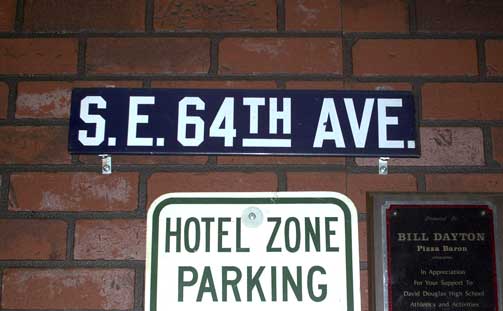
As I may have alluded to in another post somewhere, Portland's street  blades have looked different. From, I'd estmate, around 1900 through the middle third of the 20th Century, PDX Street blades where these indesctructable iron things, with white and enamel paint, which looked like this:


As you can see, it's very utilitarian. Blocky, almost-military letterforms – not graceful, but very very readable.

In a recent comment to the Cyclotram's P13 Stark Street Milestone, fellow street sign blogger from San Francisco (whose work I enjoy) Eric Fischer pointed me to a most amazing publication, in the public domain and available in its entirety on Google Books. It was in this book, Municpal Engineering Practice, by A. Prescott Folwell and published in 1916 by Wiley and Sons (a book generally about designing and laying out cities), that I found the following view – the inside of Portland's sign shop, ca. 1915 or so:


You have to embiggen this to see it in its full glory, to do this, go to Posterous here and click on the photo (which you can also download) or click on the photo above.

Lined up along the bottom there are signs for E. 70th ST. N (today's NE 70th Avenue), E. 72nd ST. N., 50th AVE. SE (today's SE Raymond Street), and 41st AVE SE (today's SE Gladstone Street). I also see a rather big blade, reading (on two lines) PATTON ROAD/COUNTY ROAD, and there are signs for CRYSTAL SPRINGS BLVD, WISTARIA AVE, and possibly a deprecated style for WASHINGTON ST.

To go over it real quick again, before the Great Renaming of 1933, numbered streets east of the Willamette and north of Burnside not only carried the East prefix because of that but also the North suffix to extend west-side naming practice east in a uniform way; therefore 11th Street east of the Willamette and north of Burnside would be EAST 11TH STREET NORTH. The avenues suffixed SE were in the area south of Powell and east of E. 39th Avenue which, for reasons even not yet clear, had number congruent to today's street blocks going out in both directions, though avenues ran east-west and streets north-south: therefore, 1916's 50th Avenue SE would be today's SE Raymond Street, which is the 5000 block (50th standard street name south of East Burnside) and 41st Avenue SE would be SE Gladstone Street – today's 4100 block (41st standard street name south of East Burnside).

The viewer can no doubt find some things that I've missed, and it's all interesting and good.

Thanks Eric … you definitely da man!

To view the page directly and download your own PDF of this book, surf to the following:

http://books.google.com/books?id=7AJLAAAAMAAJ&dq=%22street%20name%20signs%22&pg=PA295#v=onepage&q=%22street%20name%20signs%22&f=false

Technorati Tags: , , , , , ,

17 October 2009

[pdx] Stark Street Milepost P13 …

2237.… atul666 can haz it, in Gresham:


… it's that little obelisk by the sign post. Probably knocked down by a road crew; lovingly replaced by the Gresham Historical Society.

The picture above is small and hotlinked (with apology to atul) to make you go and read his entry, which is highly skookum.

Cleveland Avenue (historically SE 235th Avenue) and Stark Street.

Check it.

Technorati Tags: , , ,

11 October 2009

[address_nerd] Zero Hundreds Go Viral A Little Bit

2229.Long-time blog readers (I think I might have a few of you) may recall that I expounded at-length about the curiosity of addresses in Portland with leading zeroes in the house number – what I called the zero-hundreds, in that area of Southwest that's not east of the river (so it can't be Southeast) but it's east of the zero baseline (so you've got to be able to tell that somehow).

The abstract: as you clear the Naito Parkway line going east but approach the river, the addresses increase block-by-block, but have a zero prepended to the house number; where an address three blocks west of Naito on, for instance, SW Porter Street might read 200 SW Porter Street the same street three blocks east of Naito would read 0200 SW Porter Street.

The entire system is described in this entry I made on 20 July 2005: http://zehnkatzen.blogspot.com/2005/07/geography-address-nerd-on-zero-hundred.html. Go there for a more complete description. Break out any map of Portland for a good look at the layout of the area (you can use Google Maps, but they leave off the leading zero (just remember it's there, okay?).

I figured out eariler today that, via my SiteMeter report (I'm poor, so I just look back at the last hundred) the posessor of the LiveJournal here (at least, this is the earliest one I can find within that hundred-post limit) posted a very succinct yet very cool link to that original Address Nerdery.

One thing I love about blogging is that, in my obsessions I sometimes answer a question for myself that becomes an answer for a question someone will have sometime down the road, at any time that may or may not happen. I love the ordering of a well-formed address grid, but without randomness, order is meaningless, so viva la Chaos!

And you know what else? It's spread out just a little bit on other LJs and on this LJ-esque service called Dreamwidth, which is an artistic sort of LJ, which is even more thrilling.

It makes me feel all unicorny and antic inside. And I'm flattered, too.

Technorati Tags: , , ,

07 October 2009

[pdx] More Portland Milestones

2220.As pointed out by Cyclotram's Atul666 in the previous post's comments, there are more milestones around Portland than just the ones on Stark Street.

The reading I did on Stark Street Mile Markers blog suggests that there could well have been a system of mile markers on all four major routes into and out of the city. Not just east (Stark Street) but West (Canyon Road), North (Saint Helens Road) and South (Capitol Hwy) as well.

Stark Street's markers seem better preserved than the rest. The claim gains a measure of credibility when we find that there's another P7 milestone – but which is preserved today, perhaps not exactly in its precise position, at the corner of the property on which the Multnomah County Library's Capitol Hill Branch now stands:


See the tagged Flickr stream containing the above photo, taken by Chris_G_OR, hereabouts. It's got bits of history in it that make for intriguing reading (such as, e.g., the name "Taylors Ferry Road" used to go down what we now consider Capitol Highway).

Technorati Tags: , , , ,

05 October 2009

[pdx] The Stark Street Milestones

2219.Some time ago I fancied going out and finding milestones along SE Stark Street. The one I found looked like this:


This is on the northwest corner of SE 117th Avenue and Stark Street, at the corner of Ventura Park. As it turned out, there was a whole system of these small obelisks along Stark, going from the Willamette River at the east slip to the Stark Street Ferry (how you got across the river there before there was a Morrison Bridge) all the way out to what was to become Troutdale. Each small obelisk contained the letter P with a number representing the mile; P7 is 7 miles out. Stark Street – then, Base Line Road to signify its alignment along the Willamette Base Line – was one of the main routes into and out of Portland, connecting as it did to the old Columbia River Highway through Corbett and thence east to The Dalles, Hood River, and points east.

My plan was to find each one that the explanatory sign at 117th and Stark said were still extant and photograph them. As it turns out, some others are already doing this (hey, no foul; I can still go out and do it – and now I have a guide).

Atul666 at the blog Cyclotram had the same idea, and he'd been having just a little more luck than I did. He found milestone P5 in Montavilla, at the corner of SE 78th and Stark, tucked behind a dumpster (I've hotlinked this image):


Atul has also found P2, embedded within the wall of the Lone Fir Cemetery, near 23rd and SE Stark. You can read his words about it at http://cyclotram.blogspot.com/2009/10/milestone-p5.html.

But someone who's done the yeoman's job about this was someone identifying himself simply as Jeff at the blog http://starkstreetmarkers.blogspot.com/. In only two witty posts, he explores the idea of the Willamette Meridian and Base Line, and the idea of milestones along not just East but North, South, and West roads into and out of Portland.

Thanks to Jeff, I have pictures to go take and prattling to do. What Jeff did is, no more and no less, a public service.

Technorati Tags: , , , , ,