1779.
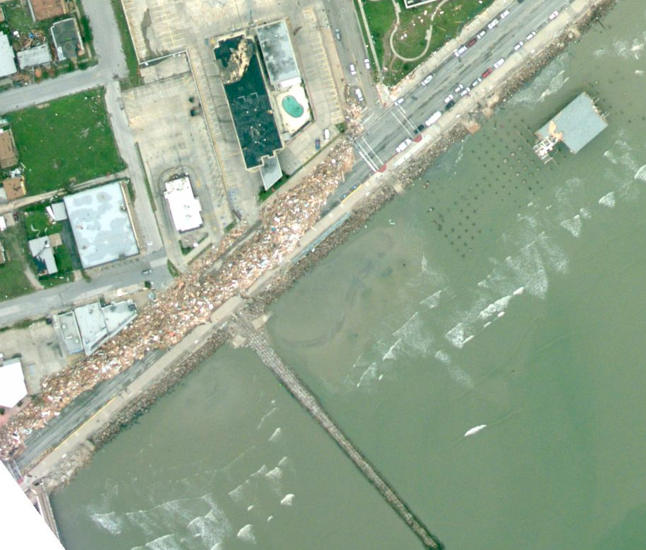
(via) Those wanting a birds-eye view of the damage Galveston and the surrounding areas of Texas and Louisiana due to the impact of Hurricane Ike are in luck.
NOAA, the National Oceanic and Atmospheric Administration, just after Ike's landfall, did a series of rapid  reconnaissance flights for the express purpose of documenting the damage. Go to this page, and click on one of the squares on the base map. You will then go to a page displaying a satellite view of that base mape with yellow squares. Clicking on any yellow square will allow you to drill down to see the individual tract.
A complete rundown on the process can be seen at the other end of the via link at the top of this article (or just click on the via word there). As anyone can see, it didn't take long to find a rather remarkable example of damage off the Galveston seawall (clicky here to embiggen). There are also apparently files available for Google Earth (see the via article)
That'll be a tough job of cleanup.
Tags: galveston, hurricane ike, atlantic hurricanes 2008, hurricane ike 2008, NOAA
Powered by Qumana

No comments:
Post a Comment